Malish
Well-Known Member
weathering blurring the paint edges so it appears green at range
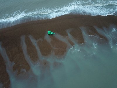
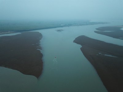
Fantastic images - Thank you @Johnah . I'm traversing in to the Deben in a few weeks for the first time and was looking for guidance. These pics are a massive help.Photos taken of the Deben entrance at LW 0.5m Harwich on 15th February 2024.
The buoys are in the 2023 positions and the Trinity House survey hasn't taken place yet, so it will be a few weeks before the buoys are moved.
You will see that the old channel running parallel to the golf course has nearly closed up.
John White the Harbourmaster says he is concerned as there is now a dogleg in the channel and John Barber (assistant Harbourmaster) reports that there isn't much depth at either end.
John
View attachment 172724
View attachment 172725
View attachment 172726
Wikipedia does - HMS Beckford - WikipediaIf you look at the very top of the very informative picture by tillergirl you will see the 3 mastered training yacht, that was falling to pieces. It sat in Harwich harbour for many years and I always thought how sad. Does any one know where it is now or was it scrapped.


I'm curious about one thing. Why does Trinity House survey and maintain the buoys at the entrance to the Deben when it doesn't for Hamford Water and the Walton channel? Not complaining; just wondering how they decide! Commercial interest can't be the reason - Hamford Water has a more active commercial operation (the explosives factory at Oakley Creek, with several freighters a year) than anything on the Deben. Historic activity is also the same for both; barges went up to Walton.The Trinity House survey has not yet taken place, so it is likely to be a few days before the buoys are repositioned.
Yes, I was also wondering similarly. Plus Antares Charts seems to manage to survey places in Scotland to at least as high standard - and massively more detail - than UKHO ever does, and creates very detailed electronic charts.I'm curious about one thing. Why does Trinity House survey and maintain the buoys at the entrance to the Deben when it doesn't for Hamford Water and the Walton channel? Not complaining; just wondering how they decide! Commercial interest can't be the reason - Hamford Water has a more active commercial operation (the explosives factory at Oakley Creek, with several freighters a year) than anything on the Deben. Historic activity is also the same for both; barges went up to Walton.
As a former professional in the map-making business (Geographic Information Systems Manager at British Antarctic Survey),Yes, I was also wondering similarly. Plus Antares Charts seems to manage to survey places in Scotland to at least as high standard - and massively more detail - than UKHO ever does, and creates very detailed electronic charts.
Could a group of locals / clubs not ask for some coaching and do similar Antares style surveys. Could do 3 or 4 times each sailing season and solve the issue entirely. Only has to save one grounding to make worthwhile.