Savvy Navvy

Sandy

Well-known member
Joined
31 Aug 2011
Messages
20,938
Location
On the Celtic Fringe
duckduckgo.com
I've been getting quite a few ads for this app. It look quite good, well, at least from perusing their website. Has anyone any experience of it?
There was a thread on here a few weeks back.

In my view a complete waste of cash as all they are doing is 'bringing all the data together'. I had a pleasant dialog on Facebook with them asking what was so unique about them that I would want to part with beer tokens when I can get everything for free. Sounds like a solution in search of a problem.
 

sgr143

Active member
Joined
26 Jul 2016
Messages
494
Location
Oxford & WicorMarine
Visit site
There was a thread on here a few weeks back.

In my view a complete waste of cash as all they are doing is 'bringing all the data together'. I had a pleasant dialog on Facebook with them asking what was so unique about them that I would want to part with beer tokens when I can get everything for free. Sounds like a solution in search of a problem.
Ah - must have missed that thread. I'll go and have a look. Thanks!
 

MM5AHO

Well-known member
Joined
1 Oct 2007
Messages
2,517
Location
Central Scotland
Visit site
Is it right that it requires internet connection?
If so, then there are many places in Scottish waters where I sail, that miss this requirement. And that would mean an additional connection via mobile phone network?
 

Ningaloo

Well-known member
Joined
19 Aug 2001
Messages
913
Location
Northern summers on Primal otherwise Perth WA
yacht-primal.com
I took a Black Friday reduced price trial offer.
It only works a couple of days ahead as it requires a weather forecast (from internet).
It won't plot a passage just based on tidal streams.
It also does not have the facility to automatically find the best departure time in a 24 hour window, something I feel is a basic feature of a plotting tool.
The graphics are great and I have found the time predictions to be reasonably accurate but on longer passages (Biscay) it appears to calculate legs in stages rather than looking at the passage as a whole.
I don't think I will be renewing the subscription.
 

Blue Sunray

Well-known member
Joined
20 Jul 2015
Messages
2,424
Visit site
I took a Black Friday reduced price trial offer.
It only works a couple of days ahead as it requires a weather forecast (from internet).
It won't plot a passage just based on tidal streams.
It also does not have the facility to automatically find the best departure time in a 24 hour window, something I feel is a basic feature of a plotting tool.
The graphics are great and I have found the time predictions to be reasonably accurate but on longer passages (Biscay) it appears to calculate legs in stages rather than looking at the passage as a whole.
I don't think I will be renewing the subscription.

That is disappointing and rather shocking since Neptune Nav has been able to do that for some time but that does have poor graphics and a terrible user interface.
 

Ningaloo

Well-known member
Joined
19 Aug 2001
Messages
913
Location
Northern summers on Primal otherwise Perth WA
yacht-primal.com
Just came across this post again and after another season thought I woul provide an update.
Departure time planning has been added in a rather elegant way, so you can see how long planned passage might take are various departure times. SN continue to develop the product.
I have also used the planning on several longer 36hour) passages and these are proving to be very accurate. On two occasions the SN prediction gave me confidence to stay on a tack that was not taking me directly to my destination until later wind shifts allowed me to tack and get pushed back on course.
I renewed my subscription for another season.
Next year I will choose between SN or, depending on the progress they make with their wind/weather planning (currently in beta testing), I may switch to Orca.
 

Parabordi

Active member
Joined
22 Apr 2011
Messages
833
Visit site
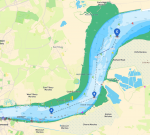
Still has major bugs in it. I have reported this many times, in the example below if proceeding down the Thames and out to sea, it takes you directly across the channel and then back over the right side again. This is one of SEVERAL such issues I have reported. Its a shame because the rest of the product is really good although Orca looks good too. 1669824518926.png
 

Plum

Well-known member
Joined
6 Jun 2001
Messages
4,263
Location
UK East Coast
Visit site
Still has major bugs in it. I have reported this many times, in the example below if proceeding down the Thames and out to sea, it takes you directly across the channel and then back over the right side again. This is one of SEVERAL such issues I have reported. Its a shame because the rest of the product is really good although Orca looks good too.
Agree, when I tried Savvy Navvy it took account of draft and depth below CD but not tidal height so it would route you around shallow areas even a HW when there was enough depth. This made it of little value on the East Coast/Thames Estuary.

www.solocoastalsailing.co.uk
 

Ningaloo

Well-known member
Joined
19 Aug 2001
Messages
913
Location
Northern summers on Primal otherwise Perth WA
yacht-primal.com
I wonder how many of their customers require a passage planner to navigate a river?
It is useful for cross channel to take tide into account or longer passages when wind changes are predicted.
Not sure about the concept of a plan taking you over shallow water that might put you aground at low water. Remember the plan might be saved to your plotter and used at other states of tide.
All said and done this is a useful tool to aid planning but you still need to apply common sense and navigation skills!
I have renewed my Elite subscription for a third year. Orca are some way from being able to match SN but when they do I will probably switch.
 

Sgeir

Well-known member
Joined
22 Nov 2004
Messages
14,786
Location
Stirling
s14.photobucket.com
I am presently having a look at the free trial version of Savvy Navvy. It certainly has some useful features, although I suspect that it may be best suited to longish overnight+ passages with tricky tides, say, from Cornwall to Brittany.

On shorter inshore passages that I am familiar with, the suggested routes have thrown up some slightly odd dog-legs, some which were of very short duration.

I can see that having inbuilt wind and tide calculations makes for easy routing on long passages and that is probably its strength. However, some important information is very difficult to read, eg oil and gas installations in the North Sea, information that is easy to find on Navionics (and, although only for the British sector, Memory-Map). I also suspect that many wells are simply not shown on Savvy Navvy.

Perhaps the full paid version is better, but the trial version does seem very slow and a bit tempramental on an Android tablet. I shall persevere....
 

AntarcticPilot

Well-known member
Joined
4 May 2007
Messages
10,095
Location
Cambridge, UK
www.cooperandyau.co.uk
Agree, when I tried Savvy Navvy it took account of draft and depth below CD but not tidal height so it would route you around shallow areas even a HW when there was enough depth. This made it of little value on the East Coast/Thames Estuary.

www.solocoastalsailing.co.uk
I write a little hesitantly because my experience is not recent and the package could have improved. However, I'd endorse this comment about it being of little use in waters where there is insufficient depth at CD, but plenty at most states of the tide other than dead low water.
 
Top