Which Weather App

Which weather App do you use?

  • Predict Wind Pro £600 or £1100/yr

    Votes: 0 0.0%
  • Squib Mobile

    Votes: 0 0.0%
  • Squib Mobile €33.20/yr

    Votes: 0 0.0%

  • Total voters
    30
  • Poll closed .

onesea

Well-known member
Joined
28 Oct 2011
Messages
3,828
Location
Solent based..
Visit site
I know this question has been asked many times before and recently here:
Which weather app?
But it all got into a technical debated a simple poll might give what people are using.

Your welcome to state why.

After not paying for years and dabbling with all of them, I am considering a subscription to PredictWind. I like the comparison graphs between the models, however there weather routing is not cheap.

I am curious about the weather routing have tried SavyNavvy but found it lumpy and difficult. When it did work I appreciated it as a guide.

At the end of the day I am old fashioned and the shipping forecast still rules. It’s just the finer points are good to have and can give options you hadn’t thought of.
 

GHA

Well-known member
Joined
26 Jun 2013
Messages
12,444
Location
Hopefully somewhere warm
Visit site
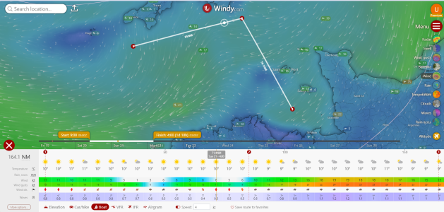
Windy - windy.com. Use it for weather routing, quick & easy, it will be wrong pretty much straight away anyway, they all are..🙂
& Predictwind basic but not a huge fan, but some bits are handy & costs little . Their own 2 models are a complete waste of time imho.
Also have own basic webpage just to view various synoptics & upper level chart images in one place .
 
Last edited:

NormanS

Well-known member
Joined
10 Nov 2008
Messages
9,714
Visit site
I just look at one or two, mainly to see if they agree. If so, they're probably close to reality. I don't see any point in paying money for something which other suppliers provide for free.
The shipping forecast areas are far too large where I am, to give any useful weather predictions.
I like XC Weather, but often the predicted wind strengths are too vague to be useful. What use do you make of a prediction of 15 to 32 knots? Where we sail on the West Coast of Scotland, the weather, and particularly the wind both in strength and direction is very often tempered by the topography.
 

Boathook

Well-known member
Joined
5 Oct 2001
Messages
8,822
Location
Surrey & boat in Dorset.
Visit site
Windy red free plus met office app, bbc app and inshore forecasts. Sometimes view the met office video forecast.
Sometimes wonder about windy premium but not sure whether it is worth it going on comments here.
 

franksingleton

Well-known member
Joined
27 Oct 2002
Messages
3,630
Location
UK when not sailing
weather.mailasail.com
I know this question has been asked many times before and recently here:
Which weather app?
But it all got into a technical debated a simple poll might give what people are using.

Your welcome to state why.

After not paying for years and dabbling with all of them, I am considering a subscription to PredictWind. I like the comparison graphs between the models, however there weather routing is not cheap.

I am curious about the weather routing have tried SavyNavvy but found it lumpy and difficult. When it did work I appreciated it as a guide.

At the end of the day I am old fashioned and the shipping forecast still rules. It’s just the finer points are good to have and can give options you hadn’t thought of.
I have said many times, and will repeat, that you will not get any better forecasts by paying. You will get extras, such as routing - about which I am always sceptical. You can get a wider choice of models in one place, you may get presentations that you prefer.
I repeat, you will not get any better forecasts.
 
Last edited:

franksingleton

Well-known member
Joined
27 Oct 2002
Messages
3,630
Location
UK when not sailing
weather.mailasail.com
Windy - windy.com. Use it for weather routing, quick & easy, it will be wrong pretty much straight away anyway, they all are..🙂
& Predictwind basic but not a huge fan, but some bits are handy & costs little . Their own 2 models are a complete waste of time imho.
Also have own basic webpage just to view various synoptics & upper level chart images in one place .[/B]

I am glad that somebody has said this. Although PW have stopped saying so, this uses a grid of 50km. Such gridlengths were used around 2000. Global models now use 0.1 degree (ECMWF, UK UM) and 0.125 degree for most other models. The big laugh is that they interpolate to an 8km grid to run “regional” models and then to 1 or 2 km to run national scale models. All with no extra data. At least, that is what they used to do. I have seen nothing to suggest otherwise.
 
Last edited:

franksingleton

Well-known member
Joined
27 Oct 2002
Messages
3,630
Location
UK when not sailing
weather.mailasail.com
I just look at one or two, mainly to see if they agree. If so, they're probably close to reality. I don't see any point in paying money for something which other suppliers provide for free.
Comparing a small number of models tells you very little. It is like picking two members at random from a large ensemble. I look at it the other way round. If you have a few, say 5 models and one is an outlier, the trust none. If they are all similar, treat it as encouraging. Mo more. Better, IMHO, for outlook purposes, is to look for consistency of one model from one day to the next. On the day, if models are saying the same thing in general terms, it is largely a matter of luck which is nearest to actuality. Generally, each model’s results will be within the uncertainty factor of the others.
The shipping forecast areas are far too large where I am, to give any useful weather predictions.
I like XC Weather, but often the predicted wind strengths are too vague to be useful. What use do you make of a prediction of 15 to 32 knots?
XCWeather uses the GFS. It can be no better and no worse than any other supplier of GFS output. If you look at ensemble output, I give an example in Reeds Weather Handbook, the ensemble from one model can easily indicate the possibility of such a range in speed. Look at the Meteocirl Ensemnle page.
Where we sail on the West Coast of Scotland, the weather, and particularly the wind both in strength and direction is very often tempered by the topography.
Detailed models might get nearer to prediction in such geographically complex areas. Always remember that the effective resolution of any model is about 5 grid lengths. So, even for ECMWF and UK UM the smallest feature that they can represent is about 50km size.
 
Last edited:

franksingleton

Well-known member
Joined
27 Oct 2002
Messages
3,630
Location
UK when not sailing
weather.mailasail.com
What’s Windy blue?
Windy blue, Windy.app, is US based. As far as I can see, they provide GFS only for global models. They dress up the output and charge for it. It looks a big con to me, especially as they put the WMO logo on their pages. Whether or not they have permission to do so, I do not know.
Windy.com is Eastern European based.
 
Last edited:

GHA

Well-known member
Joined
26 Jun 2013
Messages
12,444
Location
Hopefully somewhere warm
Visit site
I am glad that somebody has said this. Although PW have stopped saying do, this uses a grid of 50km. Such gridlengtys were used around 2000. Global models now use 0.1 degree (ECMWF, UK UM) and 0.125 degree for most other models. The big laugh is that they interpolate to an 8km grid to run “regional” models and then to 1 or 2 km to run national scale models. All with no extra data. At least, that is what they used to do. I have seen nothing to suggest otherwise.
And what's very annoying is you can't turn them off in the tables or graphs, they just clutter the place up & are useless 🙄
Though predict wind does seem to have more reliable location reports, some missing in windy recently, can be really handy to see local effects.

BTW, it's possible to create your very own basic website for free with your favourite synoptics, links etc all in one place. Bit geeky but shouldn't take long to do a step by step if anyone is actually interested. Doubt many are though, people seem to like their own favourite app 👍😎
 
Last edited:

franksingleton

Well-known member
Joined
27 Oct 2002
Messages
3,630
Location
UK when not sailing
weather.mailasail.com
There are many more apps that could be included in the survey. All have pros and cons. Discussion about which is better than others is meaningless. It is all about personal like and dislikes. You could add Passageweather, Ventusky, XyGrib, , SailGrib, Weather4D, OpenSkiron, WeatherTrack, meteoblue, Windfinder, LuckGrib, Saildocs, MeteoConsult, Theyr.com, Weatheronline, Windguru.
There are more that could be included. It is a growth industry as it dawns on people that much GRIB data is freely available for unscrupulous people to use as a cash cow. Don’t pay unless you really like or really want some add-on or cosmetic feature. Remember that the only real experts in numerical weather prediction are national weather services, ECMWF and those working for them. Nobody else can produce the data analyses used to start forecasts. In fact, the data handling is a bigger problem than running the forecast. There is no definitive best analysis.
 

AntarcticPilot

Well-known member
Joined
4 May 2007
Messages
10,534
Location
Cambridge, UK
www.cooperandyau.co.uk
There are many more apps that could be included in the survey. All have pros and cons. Discussion about which is better than others is meaningless. It is all about personal like and dislikes. You could add Passageweather, Ventusky, XyGrib, , SailGrib, Weather4D, OpenSkiron, WeatherTrack, meteoblue, Windfinder, LuckGrib, Saildocs, MeteoConsult, Theyr.com, Weatheronline, Windguru.
There are more that could be included. It is a growth industry as it dawns on people that much GRIB data is freely available for unscrupulous people to use as a cash cow. Don’t pay unless you really like or really want some add-on or cosmetic feature. Remember that the only real experts in numerical weather prediction are national weather services, ECMWF and those working for them. Nobody else can produce the data analyses used to start forecasts. In fact, the data handling is a bigger problem than running the forecast. There is no definitive best analysis.
Frank understates the difficulty of ingesting data into the system. Observations are often at point locations, and although these are carefully chosen, may not always sample the overall field effectively. The time of observations doesn't always correspond to the time-steps of the model. Interpolation is fraught with its own problems; choosing the best interpolation scheme for a particular dataset is not intuitive. Satellite data, while requiring less interpolation may not measure the desired parameters directly, and may have a non-linear relationship with the desired parameters.

All these are handled routinely by the Met Office and other similar agencies, but that step is vital to modelling. I understand that the whole process is dynamic; the previous model is adjusted to match the latest data values.

I also understand that hind-casting is used to validate the modelling process, using data that were not available in time for forecasting.

As Frank says, the real issue is the ACTUAL resolution of the models used. Of course they can be resampled to provide a nicer looking display - but the real resolution is unchanged.
 

geem

Well-known member
Joined
27 Apr 2006
Messages
8,043
Location
Caribbean
Visit site
We have been watching the models for the Atlantic crossing coming up. Antigua to Azores. Weather really isn't stable yet and GFS and ECMWF have variations.
We generally use the ECMWF here locally. We pay for the Windy simply because we kitesurf and wingfoil here. We get a 1 hour forecast rather than a 3 hour. It helps especially when there is a weather system moving through to see a trend that the 3 hour predictions don't show. They don't always get the timing right though
 
Top