Lows

phanakapan

Well-known member
Joined
26 Mar 2002
Messages
1,262
Location
Cruising
Visit site
Yup- we’ve got as far as Povoa da Varzim but looks like we’ll have to stay there for the foreseeable. Who knows when we’ll get further south.
 

Wansworth

Well-known member
Joined
8 May 2003
Messages
33,087
Location
SPAIN,Galicia
Visit site
Local news gives wave height on Galician coast at nearly Severn metres with continuing wind and rain…….used to be normal in my time here now the gale gets a name?….new low on its way
 

Daydream believer

Well-known member
Joined
6 Oct 2012
Messages
20,977
Location
Southminster, essex
Visit site
Would some of those heading south be going for the ARC?
Or would they have already left & passed south before now thus getting better weather?
I ask because friends of mine have paid for the 2023/4 ARC & intend to leave Bradwell mid august & coast hop the first part, We will be cruising in company from Cherbourg, CIs& on to Brest as a fairwell club cruise.
So far they have never done a night trip, or anything over 90 miles (ostend) so want to break into it gently.
 

GHA

Well-known member
Joined
26 Jun 2013
Messages
12,458
Location
Hopefully somewhere warm
Visit site
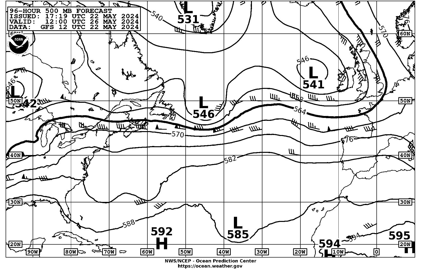
500mB charts can be handy for a quick glance at where the lows are likely to track in the next little while & hint at how viscous they will be >>
Mariners Weather Log Vol. 52, No. 3, December 2008

For any sailor interested in the weather beyond "my favourite weather app says".. ??

Lows look like tracking southish for a few more days ..
PPAM50.gif
 
Last edited:

GHA

Well-known member
Joined
26 Jun 2013
Messages
12,458
Location
Hopefully somewhere warm
Visit site
Why not use GRIBs, or the new Met Office App?
Or both!
I like a quick morning glance at upper level charts as imho it's easier to get feel for the movement rather than flicking through the surface charts to see where the lows are going. That's further south though. if the 500mB 5640m line is pointing at Galicia & not Scotland then time to look more carefully.
Plus helps a little to visualize a bit the 3d meanderings between the polar & Ferrel cells. As does looking at higher level temperatures on windy.
So both!- much more interesting ?
 

franksingleton

Well-known member
Joined
27 Oct 2002
Messages
3,642
Location
UK when not sailing
weather.mailasail.com
Or both!
I like a quick morning glance at upper level charts as imho it's easier to get feel for the movement rather than flicking through the surface charts to see where the lows are going. That's further south though. if the 500mB 5640m line is pointing at Galicia & not Scotland then time to look more carefully.
Plus helps a little to visualize a bit the 3d meanderings between the polar & Ferrel cells. As does looking at higher level temperatures on windy.
So both!- much more interesting ?
I suppose that my point, really, was that the human brain cannot beat the computer models as regards such matters as movement of a low, its development etc. I have seen some ridiculous claims with people trying to apply ideas that date back to the late 40s/early 50s. It ,at be interesting from an academic viewpoint but not useful.
 

GHA

Well-known member
Joined
26 Jun 2013
Messages
12,458
Location
Hopefully somewhere warm
Visit site
I suppose that my point, really, was that the human brain cannot beat the computer models as regards such matters as movement of a low, its development etc. I have seen some ridiculous claims with people trying to apply ideas that date back to the late 40s/early 50s. It ,at be interesting from an academic viewpoint but not useful.
Well I find it very useful ? , and interesting.
One occasional useful feature in 500mB is they will occasionally hint at a cut off low forming down of Morocco before it shows up on the gribs/surface synoptics which can be handy to get ready if you want to head north up the Portuguese coast.
 

franksingleton

Well-known member
Joined
27 Oct 2002
Messages
3,642
Location
UK when not sailing
weather.mailasail.com
Well I find it very useful ? , and interesting.
One occasional useful feature in 500mB is they will occasionally hint at a cut off low forming down of Morocco before it shows up on the gribs/surface synoptics which can be handy to get ready if you want to head north up the Portuguese coast.

Well, I guess that I am more interested in what the models are saying than a hint that may or may not be well founded based on the 500nPa level. Models use data globally from the surface up to 80km, not just one level. They apply the best science available. They give the best forecast possible but not the best possible forecast.
 
Top