What is the minimum amount of charts and books that I need for going around Scotland?

Bodach na mara

Well-known member
Joined
21 Aug 2002
Messages
2,694
Location
Western Scotland
Visit site
It has been interesting reading this thread and remembering with horror my own first cruise. I was 19, a student and cruised from Gourock to Malaig and back via the Crinan canal in a chartered Folkboat. None of us had any qualifications or experience, the Skipper was a few years older than me but was an oarsman rather than a sailor and the other two were friends who were even less knowledgeable. Our navigation equipment consisted of a copy of the "Blue Book " of the CCC Sailing Instructions, an ex-RAF 1942 flying map and a hand-bearing compass. Oh, and a postcard of Ardnamurchan lighthouse so that we could recognize it if we got there. Which we did. One highlight of the cruise was trying to enter the anchorage at Arinagour on Coll in the dark and wisely opting to abandon the attempt and sail out again to spend the night at sea, entering Tobermory in the morning.

We are all still alive which goes to show two things.
1. You can get by with very little equipment if you are lucky but you will need to miss out on the best areas.
2. There is a providence that looks after fools, drunk men and little children which works overtime for drunken students.

All this happened in the 1960s,when electronic navigation was almost unheard of, but there is a post from Dylan Winter in 2011 which has a link to a YouTube video of a TV presenter running aground in the Arisaig channel which shows that you still need luck navigating the West coast of Scotland.
 

Bodach na mara

Well-known member
Joined
21 Aug 2002
Messages
2,694
Location
Western Scotland
Visit site
Found that link but can't find how to paste it in on my phone. The search facility in YouTube is useless and the one in the forum not much better. I'll try again using the laptop.

Found Dylan's post at last by searching "TV sailor hits rock and calls lifeboat film" as the title and copied the link


I hope it works.
 
Last edited:

Minchsailor

Well-known member
Joined
2 Dec 2014
Messages
1,276
Location
N of Ardnamurchan, winter South of Oban
Visit site
Knowing exactly where you are, or where the plotter thinks you are, is over-rated.
On the way in to Soay harbour, SWMBO held us bang on the leading line as directed in the pilot book. Meanwhile I kept glancing at the plotter and was having kittens because it placed us about 50m to the west, on solid ground. That's the biggest charting/GPS error we've encountered but there have been others where we've been glad to have the pilot book to follow, and not just believe what the plotter told us.

That does not surprise me in the least. The HO is really only now interested in surveying parts of the coast which are of commercial interest, and any electronic charts will be based on their very old surveys, where the datum is now unreliable. Soay is definitely not one of these!.

As @AntarticPilot states, situational awareness and navigating by Mk1 eyeball is sometimes more wise.

When the CCC was working on updating the North Coast and Northern Isle pilot to bring it up to uniform standards (this was after Imrays took-over the printing) there were some major problems in standardising the sketch chartlets. We looked at the old charts in the NLS as they contained more information for inshore areas than the current HO charts.

(BTW - there are major portions of 'interesting' places on the west coast of the Shetlands where information is very sketchy, in some places marked as 'unsurveyed'. Any information will be gratefully received to fill in these gaps.)
 

Alicatt

Well-known member
Joined
6 Nov 2017
Messages
4,970
Location
Eating in Eksel or Ice Cold in Alex
Visit site
It has been interesting reading this thread and remembering with horror my own first cruise. I was 19, a student and cruised from Gourock to Malaig and back via the Crinan canal in a chartered Folkboat. None of us had any qualifications or experience, the Skipper was a few years older than me but was an oarsman rather than a sailor and the other two were friends who were even less knowledgeable. Our navigation equipment consisted of a copy of the "Blue Book " of the CCC Sailing Instructions, an ex-RAF 1942 flying map and a hand-bearing compass. Oh, and a postcard of Ardnamurchan lighthouse so that we could recognize it if we got there. Which we did. One highlight of the cruise was trying to enter the anchorage at Arinagour on Coll in the dark and wisely opting to abandon the attempt and sail out again to spend the night at sea, entering Tobermory in the morning.

We are all still alive which goes to show two things.
1. You can get by with very little equipment if you are lucky but you will need to miss out on the best areas.
2. There is a providence that looks after fools, drunk men and little children which works overtime for drunken students.

All this happened in the 1960s,when electronic navigation was almost unheard of, but there is a post from Dylan Winter in 2011 which has a link to a YouTube video of a TV presenter running aground in the Arisaig channel which shows that you still need luck navigating the West coast of Scotland.
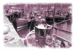
Aye Mallaig was a little different in the 1960s
JDPaul_01_135sm.jpg
 

Bodach na mara

Well-known member
Joined
21 Aug 2002
Messages
2,694
Location
Western Scotland
Visit site
Thanks for that picture Alicatt.

Actually Quandry, I have no idea what Mallaig looks like now. I last visited in 1966 on a different boat, with a skipper who was experienced both as a sailor and on the west coast. And we managed to have a brief encounter with a brick off Arinagour. And again I spent the night sailing about till it got light and we could anchor in Tobermory. That is one harbour where I do not regret the appearance of pontoons and moorings for visitors. Anchoring in 15 fathoms is hard enough. It took the entire length of chain carried by the Folkboat. Getting it all back up again without a windlass is something I tried never to repeat.
 

SimonFa

Well-known member
Joined
25 Feb 2013
Messages
6,434
Location
Me North Dorset. Venezia in Portland.
Visit site
I was wondering about putting it my bucket list and bought Sailing Around UK and Ireland by Roger Oliver.

Its not quite the same but he bought 120 second-hand Admiralty charts (they're listed) and then updated them. He also lists 17 pilots and almanacs.

I've also got Sam Steele's guide as well, but it isn't as concise as Roger's and doesn't list them all in the same place.
 

Kelpie

Well-known member
Joined
15 May 2005
Messages
7,767
Location
Afloat
Visit site
As @AntarticPilot states, situational awareness and navigating by Mk1 eyeball is sometimes more wise.

Indeed. When I first got Antares charts, I managed to get it all working correctly on my phone with my GPS position overlaid.
When I changed phone, I never managed to get it working again, and to be honest haven't missed it. I still buy the charts but I use them as pilotage sketches.
Blindly believing that the dot on the screen represents exactly where you are in the real world is not always a good idea.
 

JumbleDuck

Well-known member
Joined
8 Aug 2013
Messages
24,167
Location
SW Scotland
Visit site
... a link to a YouTube video of a TV presenter running aground in the Arisaig channel which shows that you still need luck navigating the West coast of Scotland.
I've only been into (edited - thanks, Kelpie) Arisaig a few times, but it seemed dead easy to me - I just followed the marks. I can see it would be a tad awkward without them, even with my 1.2m draft.
 
Last edited:

Quandary

Well-known member
Joined
20 Mar 2008
Messages
8,210
Location
Argyll
Visit site
Indeed. When I first got Antares charts, I managed to get it all working correctly on my phone with my GPS position overlaid.
When I changed phone, I never managed to get it working again, and to be honest haven't missed it. I still buy the charts but I use them as pilotage sketches.
Blindly believing that the dot on the screen represents exactly where you are in the real world is not always a good idea.

My understanding is that as well as being accurate in themselves, Antares charts have been corrected to ensure that the GPS location is right, certainly in Loch Aline if you switch from 'Admiralty' which can show you at the top of a cliff to Antares the latter position looks correct. This year, among the Borrodale Islands it was the same.
Perhaps Dunedin or Wully might want to comment on this
 

dunedin

Well-known member
Joined
3 Feb 2004
Messages
14,082
Location
Boat (over winters in) the Clyde
Visit site
My understanding is that as well as being accurate in themselves, Antares charts have been corrected to ensure that the GPS location is right, certainly in Loch Aline if you switch from 'Admiralty' which can show you at the top of a cliff to Antares the latter position looks correct. This year, among the Borrodale Islands it was the same.
Perhaps Dunedin or Wully might want to comment on this

Clearly Bob B would advise that Antares Charts are made by an enthusiastic amateur, and recommend navigating with caution.

But I believe he has some pretty seriously accurate kit, and takes a lot of trouble to try to ensure his detailed charts are as accurate as possible. You may have to make your own manual adjustment for Continental Drift, from the date of survey ;-)

One thing Antares website does warn about, is that some phone / tablet GPS can assume you are in a fixed location if the speed of motion is too slow - so worth being aware of this if threading carefully through a tricky passage at 1 knot - though I have never noticed this on my iPad, and not an argument to whizz past granite rocks at 6 knots! Granite tends to win.

But certainly Kelpie is choosing to lose a lot of functionality, and I am sure the Antares Charts could be made to work normally with almost any modern phone / tablet with an inbuilt GPS. For most of us it is extremely easy to set up with an App like MemoryMap.
 

AngusMcDoon

Well-known member
Joined
20 Oct 2004
Messages
8,833
Location
Up some Hebridean loch
Visit site
Clearly Bob B would advise that Antares Charts are made by an enthusiastic amateur, and recommend navigating with caution.

But I believe he has some pretty seriously accurate kit, and takes a lot of trouble to try to ensure his detailed charts are as accurate as possible. You may have to make your own manual adjustment for Continental Drift, from the date of survey ;-)

One thing Antares website does warn about, is that some phone / tablet GPS can assume you are in a fixed location if the speed of motion is too slow - so worth being aware of this if threading carefully through a tricky passage at 1 knot - though I have never noticed this on my iPad, and not an argument to whizz past granite rocks at 6 knots! Granite tends to win.

But certainly Kelpie is choosing to lose a lot of functionality, and I am sure the Antares Charts could be made to work normally with almost any modern phone / tablet with an inbuilt GPS. For most of us it is extremely easy to set up with an App like MemoryMap.

I've found Antares charts superbly accurate. I'm always right on the GPS spot, even in some very tight spots like Caol Scotnish, Loch Shark & Culkein Drumbeg. I've found 4 inaccuracies - 1 where a beacon had been washed away, 2 places where new hardware had appeared & only 1 case of a charting error showing an island as a peninsular. I always report them with photo evidence, Bob mentions them in his next NTM, & the chart is updated the following year.
 

Kelpie

Well-known member
Joined
15 May 2005
Messages
7,767
Location
Afloat
Visit site
Apologies if I made it sound as though I was doubting the accuracy of Antares charts- not what I meant. I was simply commenting that when I messed up the install on my new phone, I found I didn't really miss the functionality of having it linked to GPS. Probably just the way I've got used to using them- as a supplement to the pilot book rather than the plotter.
 

JumbleDuck

Well-known member
Joined
8 Aug 2013
Messages
24,167
Location
SW Scotland
Visit site
I've found Antares charts superbly accurate. I'm always right on the GPS spot, even in some very tight spots like Caol Scotnish, Loch Shark & Culkein Drumbeg. I've found 4 inaccuracies - 1 where a beacon had been washed away, 2 places where new hardware had appeared & only 1 case of a charting error showing an island as a peninsular. I always report them with photo evidence, Bob mentions them in his next NTM, & the chart is updated the following year.
I think his locations are fine. I am not as convinced about his depth contours, which I think are sometimes rather misleading. I don't blame him for that, though. I have spent some of my life plotting contours from irregular data grids - it's a very tricky business which in essence is no more than mathematical guesswork. Since a single shallow bit can be a pinnacle, a reef or a flat plane of rock, errors are inevitable. Moral: measured depths are probably OK but contours are general guidance only and should never be relied on. That goes for UKHO too.
 

wully1

Well-known member
Joined
27 Aug 2002
Messages
2,840
Location
west coast of Scotland
Visit site
My understanding is that as well as being accurate in themselves, Antares charts have been corrected to ensure that the GPS location is right, certainly in Loch Aline if you switch from 'Admiralty' which can show you at the top of a cliff to Antares the latter position looks correct. This year, among the Borrodale Islands it was the same.
Perhaps Dunedin or Wully might want to comment on this

I‘d trust Antaries over Admiralty or Navionics etc any day... Antaries are made with current technology very recently and very diligently for our needs and not by Lead line for bigger vessels than ours.
 
Top