You are using an out of date browser. It may not display this or other websites correctly.
You should upgrade or use an alternative browser.
You should upgrade or use an alternative browser.
Suez blocked.
- Thread starter burgundyben
- Start date
BurnitBlue
Well-Known Member
I thought that also but i considered the big picture and the politics of the mid-east. Keep digging to extend the ditch for a few more miles to drain the Indian ocean into Israel.View attachment 112065
I think the plan is to allow the current to flow round the bow so as to scour the sand away.
Easticks28
Well-Known Member
Kukri
Well-Known Member
Stork_III
Well-Known Member
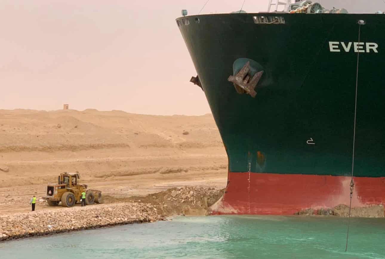
Next refloating attempt will be at this evening’s high water. I’ve seen some pictures of the bow from Evergreen but I don’t have permission to post them. She is about two metres out of her draft forward so a good salvage man will already have calculated the ground effect. The SCA seem to be working on clearing the sand under the bow bulb and in way of the thrusters (which obviously she can’t use). I’m sure they know what to do.
edited to add - from photos taken from the bank on the north (port) side one can see these she made quite a spirited attempt to invade Sinai and her bow bulb is actually ashore by about a metre. Seeing this, the use of the digger is not silly, the SCA have been cutting a channel round the bow bulb so the current can flow round it and scour away the sand.

Stemar
Well-Known Member
So it woz the wind wot dunnit. I know those things have a fair bit of windage, but really? Enough to embed both ends? I get that the wind can be a problem coming alongside or leaving port, but under way? Is there a reason why they might not want to admit to a steering failure?
Anyone who knows what they're talking about (which I certainly don't) got an opinion on that?
Anyone who knows what they're talking about (which I certainly don't) got an opinion on that?
Kukri
Well-Known Member
I think we have to wait and see. It suits Bernard Schulte to say that she was, in the words of Michael Greene, “seized by a giant hand” (?) and it suits the SCA to say that she had a black out.
Both seem improbable to me. I am guessing that she sheered off the south bank, due to bank effect.
This may not be relevant, but she does look to be almost down to her marks, as most boxboats have been since November, she is a very big ship and she may not have been handling as she did when at normal container ship draft.
Hermit
Well-Known Member
Stemar
Well-Known Member
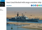
It must have been a serious power failure to take the stealth systems down too. Glad to see they're back on line in the later pics.I like the picture that the editor chose to go with an early report of the story...
WoodyP
Well-Known Member
I recall a much smaller vessel being caught across the River Nene at the port of Sutton Bridge. When the tide retreated she broke her back. The cargo and ship became the problem of the owners of the Port, Fenland Council. It took a couple of weeks and about £3million to clear it up.
Easticks28
Well-Known Member
Stock Photo - The cargo ship Lagik wrecked in the River Nene at Sutton Bridge, December 2000I recall a much smaller vessel being caught across the River Nene at the port of Sutton Bridge. When the tide retreated she broke her back. The cargo and ship became the problem of the owners of the Port, Fenland Council. It took a couple of weeks and about £3million to clear it up.
Kukri
Well-Known Member
I recall a much smaller vessel being caught across the River Nene at the port of Sutton Bridge. When the tide retreated she broke her back. The cargo and ship became the problem of the owners of the Port, Fenland Council. It took a couple of weeks and about £3million to clear it up.
Very definitely a risk. If you wanted to make a model. one metre long, of the “Ever Given”, exactly to scale, you would need to use kitchen foil for the hull.
WoodyP
Well-Known Member
Thanks for posting the pic. I was working for the E A at the time, and the fear was that erosion of the flood banks would lead to flooding.
Kukri
Well-Known Member
Work suspended until tomorrow.
This is interesting. It’s a speeded up AIS based animation:
See what happens at 14 seconds in. She closes the port bank then swings across the channel.
This is interesting. It’s a speeded up AIS based animation:
See what happens at 14 seconds in. She closes the port bank then swings across the channel.
Frank Holden
Well-Known Member
Hmmm.... took a bit of a sheer.... oh well ...nothing new under the sun....
Canal Zoners - Incidents -El Firdan Bridge Crash
Canal Zoners - Incidents -El Firdan Bridge Crash
JumbleDuck
Well-Known Member
Coo. Quarter inch plating?Very definitely a risk. If you wanted to make a model. one metre long, of the “Ever Given”, exactly to scale, you would need to use kitchen foil for the hull.
Slowboat35
Well-Known Member
Interesting video, that.
I was wondering what would happen to following traffic in such a situation and that partly explained it- the one right behind also lost control and hit the bank at an angle and the next one either rammed it or very nearly did so.
But how does a similar ship stop in a hurry in a canal without running aground too, or doesn't it? Anchoring isn't likely to be an option (except as an emergency brake if necessary) as there is no room to swing and as soon as you stop the wind's presumably going to pin the ship on the leeward bank. How then do you get off? Tugs? Does going aground like that cause any damage? Are water intakes and outlets affected if they're stuffed into the mud?
Any big ship drivers here to explain the situation?
Kukri
Well-Known Member
Interesting video, that.
I was wondering what would happen to following traffic in such a situation and that partly explained it- the one right behind also lost control and hit the bank at an angle and the next one either rammed it or very nearly did so.
But how does a similar ship stop in a hurry in a canal without running aground too, or doesn't it? Anchoring isn't likely to be an option (except as an emergency brake if necessary) as there is no room to swing and as soon as you stop the wind's presumably going to pin the ship on the leeward bank. How then do you get off? Tugs? Does going aground like that cause any damage? Are water intakes and outlets affected if they're stuffed into the mud?
Any big ship drivers here to explain the situation?
Captain Holden, post 74 above
penfold
Well-Known Member
The suez canal is run as an employment scheme, so there are lots of tugsHow do they get the tugboats to the other side of the ship? Cape of Good Hope?
They can anchor in the Bitter Lakes like the poor barstewards caught there after the 6 Day War; hopefully it won't be 7 years to unplug it this time.The camels have been mobilised and on the way along with an army of tug boats. Interesting times for all the other ships stopped north of the blockage. Wonder if they have giant sized clips and pins for mooring to the sand embankments.
Gary Fox
N/A
No way 1/4" , more like 3/4" hull plating. With all sorts of lesser thicknesses for the superstructure etc. It would be interesting to know exactly.Coo. Quarter inch plating?
Other threads that may be of interest
- Replies
- 65
- Views
- 2K


