capnsensible
Well-Known Member
Why pay?
Mebbe I'm just lucky but marine traffic and vessel finder work fine for me.
Mebbe I'm just lucky but marine traffic and vessel finder work fine for me.
What I'm getting now is worse than uselessWhy pay?
Mebbe I'm just lucky but marine traffic and vessel finder work fine for me.

I am paying for the Mobile Pro Plan and I get the same as you !!! Even more frustrated by the recent changes to Marine Traffic app. There does not appear to be a benefit for paying.The free version is just crap, now. This is what I get when I click current position for a target
View attachment 207377
If I try to leave a review of Marine Traffic in the google app store it says "server error" so can't even complain. I have yet to find another AIS app that is as good as the version 4 Marine Traffic was before they messed up on version 5.I’ve been a subscriber for a good few years, but just cancelled my subscription. The new version is very poor.
Interesting...I usually just use my onboard tablet for mirroring Raymarine, and for Bluetooth apps, so I don’t connect to the Internet. Today I needed to connect to a hotspot to install an app. By chance I opened Marine Traffic and I could see it in the original format with a nautical chart. What's different? I'm not logged in! Grand, I said, I'll just log out on the phone, but it doesn't let me log out. I guess I'll just delete the app later, and reinstall, and see what happens.
Yeah, same for me now on my phone. I did manage to log out but its just the same. I'll check the tablet on the boat tomorrow and see if it's still on the free nautical chart.Interesting...
I'm using gthe free version (no real need for the paid features) and to get nautical charts, it says I have to 'upgrade'.
That whether I'm logged in or not.
Still getting nautical charts on my tabletInteresting...
I'm using gthe free version (no real need for the paid features) and to get nautical charts, it says I have to 'upgrade'.
That whether I'm logged in or not.

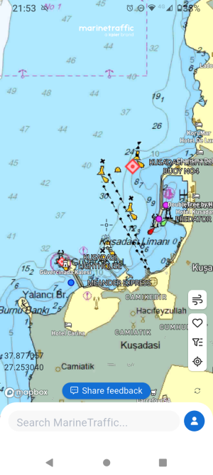
Is that what they call a nautical chart?Still getting nautical charts on my tablet
View attachment 208644
Actually I'm not sure what they mean by nautical chart. This is what I've always had on the free version. I'd never have considered using marine traffic charts for navigation. Maybe someone paying for nautical charts will enlighten us.Is that what they call a nautical chart?
Looks more like Google Maps. Where's the depths, buoys, nav lights, etc?
I think the map you're seeing is the standard one from the previous version, no longer available to me since the upgrade.Actually I'm not sure what they mean by nautical chart. This is what I've always had on the free version. I'd never have considered using marine traffic charts for navigation. Maybe someone paying for nautical charts will enlighten us.