Why do boats use nautical miles and why are they different than normal miles? Couldn't you just convert it to normal miles or km?

PaulRainbow

Well-known member
Joined
16 May 2016
Messages
17,143
Location
Suffolk
Visit site
a sea or nautical mile is one-sixtieth of a degree of latitude, and varies from 6046 feet on the Equator, to 6092 feet at a latitude of 60°

In post #11 you said it was a fixed length. Historically, it's not fixed, as your quote above demonstrates. It only became a standard distance because we made it so.
 
Last edited:

AntarcticPilot

Well-known member
Joined
4 May 2007
Messages
10,556
Location
Cambridge, UK
www.cooperandyau.co.uk
The first definition of the metre was a ten millionth of the distance between the equator and the pole. This was abandoned when it became apparent that the length of a degree of latitude changed with latitude (they're longer near the poles). But theoretically the metric system in conjunction with grads rather than degrees would work just as well as 1nm = 1' of latitude.

But grads (100 to a right angle) are one bit of the revolutionary units that didn't catch on. There's a reason - because 60 has far more factors than 10 or 100, it's easier to divide a circle in degrees.
 

chriscallender

Active member
Joined
30 May 2001
Messages
612
Visit site
1 metre was originally defined as 1 ten millionth of the distance from the north pole to the equator on a line of longitude through Paris. So we could very well use metres or km and relate that pretty closely to lattitude changes on the chart (neglecting the fussy detail that the earth isn't a perfect sphere). Except that we don't divide up circles in nice decimal units to measure angles. If there were 400 degrees all the way around a circle, and 100 "sub degrees" in one degree then it would be pretty convenient to use km. According to google, the use of 360 degrees for circles goes back to about 300-200BC and we have the Babylonians and Greek astronomer Hipparchos of Rhodes to thank for that, so it predates (earth scale long distance) navigation, and the first navigators just used the angle units that were already available (which are nothing special).
 

DanTribe

Well-known member
Joined
8 Jan 2002
Messages
5,440
Location
Essex
Visit site
Why can't we stick to the standard TV measurements.
Height= Nelson columns
length = London busses
area = football pitches or Isle of Wight
volume= olympic swimming pools
weight= elephants or jumbo jets.
 

Daydream believer

Well-known member
Joined
6 Oct 2012
Messages
21,073
Location
Southminster, essex
Visit site
When I took the family sailing to Ostend, in the new boat, for the first time we had no nav gear such as dividers etc. Neither did we have GPS. So I let them measures progress on the chart with a coke bottle top. I seem to recall that we crossed at something like 2 tops per hour with maxm tidal drift of half a top.
 
Last edited:

Buck Turgidson

Well-known member
Joined
10 Apr 2012
Messages
3,441
Location
Zürich
Visit site
The answer is because counting started on fingers and the Sumerians formalised writing in cuneiform on clay tablets so it caught on.
Left hand thumb points to the sections on each finger, 3 per finger, 4 fingers on left hand max number is 12 then one finger is raised on right hand and you start again. When 4 fingers and 1 thumb are raised on right hand you have reached 60.
 

RunAgroundHard

Well-known member
Joined
20 Aug 2022
Messages
2,282
Visit site
The answer is because counting started on fingers and the Sumerians formalised writing in cuneiform on clay tablets so it caught on.
Left hand thumb points to the sections on each finger, 3 per finger, 4 fingers on left hand max number is 12 then one finger is raised on right hand and you start again. When 4 fingers and 1 thumb are raised on right hand you have reached 60.

Fascinating! Thanks for sharing that explanation.

How 10 Fingers Became 12 Hours | EarthDate.
 

AntarcticPilot

Well-known member
Joined
4 May 2007
Messages
10,556
Location
Cambridge, UK
www.cooperandyau.co.uk
Coming from a scientific background, I would prefer to use Radians. I’m sure we could all cope with a circumnavigation covering 2 pi Radians ie 3.683183…..Rad
But unfortunately, "easy" points of the compass are irrational numbers when expressed in radians, being fractions of Pi! I don't think that saying "Steer 0.785398163397.. Radians" works as well as "Steer NorthEast" or "Steer 45° E"

Any internal calculation of trigonometric functions works in radians - indeed, you often have to convert to radians before using the trig functions in a computer language. That's why I know Pi to 8 significant figures without having to look it up!
 

doug748

Well-known member
Joined
1 Oct 2002
Messages
13,319
Location
UK. South West.
Visit site
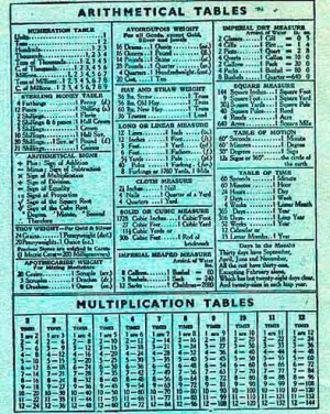
Members of an advanced age will remember the back of old school exercise books:

1730901819448.png


Not a good image but nice to recall that 36lbs of Old Hay = 1 Truss. 36 Trusses = 1 Load

.
 
Top