prologica
Member
Thanks gentlemen.
David
David
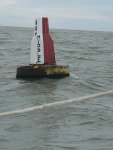
I've crossed twice this year, and many times over the years, with a 1.7m fin keel. An hour before HW no problem.Tillergirl and I have corresponded previously about the wisdom, or otherwise, of crossing the Rays’n in a 1.8 fin keeler but this thread has sparked my interest afresh. Looking at Tillergirl’s 2019 chartlet, and fully aware that depths may have changed, I see a maximum drying height of 1.6m on the 01 degree line. Assuming Whitaker Beacon is the best tide table to use, the tidal height at HW-1 today is 4.5m and 4.8m at HW. The crossing at 01 degrees due south between the 2m contour lines is approx 1.4 miles so say 20 minutes at 4 plus knots, or a bit longer if you were to cross slower just in case. Does that not suggest that in benign conditions without a ‘negative surge’ or lower tide caused by wind or high pressure, a depth of 2.9m with a rise of another 0.3m at high water would make this a realistic proposition with due care? I stand by to be contradicted!
Regards
David
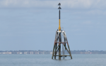
I remember going through The Ray once and Charles Stock was abreast of me. He was well inshore and inside of the wreck beacons the whole time. He took a great chunk off Hollin Point too. Did he know something that we didn't or was it because he drew 12" with the keel up .

I remember going through The Ray once and Charles Stock was abreast of me. He was well inshore and inside of the wreck beacons the whole time. He took a great chunk off Hollin Point too. Did he know something that we didn't or was it because he drew 12" with the keel up .


Hi. I crossed in early July 2021. I draw 1 meter. I tried to gently get across a little early very slowly but had to turn back and wait as I touched bottom and crunched a bit as I think its hard sand and shells. It was on a rising tide so I got off quite easily. I waited a couple of hours and then crossed with plenty of water to spare . Don't risk it on a falling tide or if there is any type of chop. By the time I set off there were three other boats waiting.I was wondering if anyone has used the Raysand this year?
With a 1m draft you should be able to cross at half-tide. The best water is shown on Tillergirl's chart here http://www.crossingthethamesestuary.com/Ray Sand 2020 Upload.pdf so best to follow the 1-degree longitude lineHi. I crossed in early July 2021. I draw 1 meter. I tried to gently get across a little early very slowly but had to turn back and wait as I touched bottom and crunched a bit as I think its hard sand and shells. It was on a rising tide so I got off quite easily. I waited a couple of hours and then crossed with plenty of water to spare . Don't risk it on a falling tide or if there is any type of chop. By the time I set off there were three other boats waiting.
We came through from Brightlingsea to Burnham at 12 noon today, 2 hrs before Hw. Shallowest bit on our track was between Ray Middle and Raysn buoy in the Crouch. Showed 1m below our 1.8m keel.