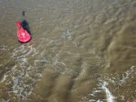
Deben Entrance, buoys now re-positioned for 2022.

PeterR

Member
Joined
12 Dec 2009
Messages
418
Visit site

I have just published my video of crossing the Deben Bar after launching at Larkmans on 17 May. They launched me early and it was a big tide. I was crossing the bar only one hour twenty minutes after HW on the bar so I was not anticipating any problems and expected to find the shallowest water between Knoll Spit and West Knoll in view of the Trinity House chartlet and what others have found.

However; to my surprise, I found the shallowest water in the stretch from the southern most Martello Tower to Mid Knoll where my echosounder recorded 2.4 metres for quite some distance as opposed to the 3.1 metres I found by West Knoll. Given that tidal predictions, my measurements at West Knoll and the Harwich Tidal gauge all indicated that the height of tide was around 3 metres, where I recorded 2.4 metres (perhaps 2.5 metres allowing for a slight under recording) there must have been a drying patch on my track.

I have no idea whether I was simply not in the deepest part of the channel or whether the entrance has silted up very recently but others are bound to find themselves in the same place. It was not a problem for me as the water was calm but half an hour later and I might well have grounded. If others with the same draft pass the same way later on the tide they will find themselves in trouble.

You will see where I was on the video. Has anyone else found the same shallow patch?
 

Johnah

Well-known member
Joined
28 Apr 2019
Messages
105
Visit site
Hi Peter,

A great video with useful information. Coincidentally I took this photo on the next morning the 18th May at LW. The Harwich tide gauge was reading 0.3m above CD.

We went out over the bar on Friday 19th at 3 1/2 hours before HW and the shallowest part was over the bar, where I had 0.5m minimum under the keel (plus 1.6m draught), about 30m SE of the West Knoll.

You are right in saying that there is a shallower section nearer to the Martello Tower, but my echo sounder read about 1m depth there (+1.6m).

My shallow alarm goes off at less than 1 metre below the keel and it did not sound on that shallow section by the Martello Tower.


DJI_0621 (1936 x 1177).jpg

What I did notice was that the West Knoll PH Buoy has been sited right on the bar and if you look on the photo below and to the right you will see the chain link of the Buoy sinker.

So beware if anyone is scraping over the bar that you don't get to close and hit the concrete block!

I think there is slightly deeper water to to the South East of the West Knoll buoy. Note the broken water around the West Knoll buoy on the top photo.

Hopefully I will go out with John White and check this in the near future.

DJI_0640 (2000 x 1500).jpg

John
 

PeterR

Member
Joined
12 Dec 2009
Messages
418
Visit site
John

Thank you for your comments. I hope you did not mind my incorporating some of your video into mine. It adds a lot to the context of the whole thing and I did ask permission in 2019 when I last used some of your work.

I do find it perplexing that I got that low reading near the Martello tower. It was not a transient, it lasted for about 30 metres. The sounder was accurate when I ran aground at Melton and gave exactly the readings I would expect following the channel from Melton to the Marina, although I do think it under reads by 0.1m. A situation I live with as a small safety factor. Going through Loders Cut it indicated slightly more depth than I would normally expect. I have only ever experienced errors before in thick weed or in the turbulance behind large vessels. Neither condition applied here although I suppose one could get some turbulance from water being squeezed out of the deepwater gully that shallows abruptly parallel to the Martello tower.

As neither your drone footage or your sounder showed any sign of a drying patch I have to assume there was something wrong with my readings – although you can see from the video I was not imagining it. I will go back again at high water when I get the chance and see what I get then.
 

Cantata

Well-known member
Joined
1 Aug 2003
Messages
4,888
Location
Swale/Medway
Visit site
I confess to not know much about how these things happen but I wonder if the increasing flow through the northern 'entrance' is starting to result in shallowing to the south of it, i.e. a new 'bar' where you noticed the shallow section.
 

AntarcticPilot

Well-known member
Joined
4 May 2007
Messages
10,126
Location
Cambridge, UK
www.cooperandyau.co.uk
I confess to not know much about how these things happen but I wonder if the increasing flow through the northern 'entrance' is starting to result in shallowing to the south of it, i.e. a new 'bar' where you noticed the shallow section.
Certainly, the photo in #102 shows substantial flow through the northern channel. And if there is less flow through the present channel, then more sediment will be deposited on the present bar as the flow slackens there. It's a feedback loop - more sediment building up at the southern bar will mean that the outflow is diverted through the northern channel, resulting in less flow at the southern entrance and more sediment building up and so on. I think that there is a case for frequent survey and monitoring of the situation (perhaps after every spring tide), as I suspect that the "switch" could happen quite quickly, especially if there is increased run-off into the Deben, or a storm. Usually, such things happen in winter but all bets are off at the moment! Unfortunately, the Debven is not a commercially active river, so I don't know whether the resources for more frequent survey are available.
 

Johnah

Well-known member
Joined
28 Apr 2019
Messages
105
Visit site
You are very welcome to use the videos Peter, I find the yearly changes really interesting and the more information the better.

John White pointed out to me last year that shallow section near the Martello Tower. This year it has moved a bit to the West. Indeed the flow through the usual channel by the golf course does seem to be decreasing, but this channel does have the advantage of not roughing up so much in an Easterly.

The assistant harbour master John Barber says with transits he has noted that the North channel is moving throughout the year, so that might mean that if the buoys were sited in April, they might need moving as the channel position changes. Last year I found more depth in the North channel than at the usual bar.

As Cantana has pointed out, Trinity House decide which channel should be used and they are in discussion with John White and John Barber at Felixstowe.
 

LONG_KEELER

Well-known member
Joined
21 Jul 2009
Messages
3,721
Location
East Coast
Visit site
You are very welcome to use the videos Peter, I find the yearly changes really interesting and the more information the better.

John White pointed out to me last year that shallow section near the Martello Tower. This year it has moved a bit to the West. Indeed the flow through the usual channel by the golf course does seem to be decreasing, but this channel does have the advantage of not roughing up so much in an Easterly.

The assistant harbour master John Barber says with transits he has noted that the North channel is moving throughout the year, so that might mean that if the buoys were sited in April, they might need moving as the channel position changes. Last year I found more depth in the North channel than at the usual bar.

As Cantana has pointed out, Trinity House decide which channel should be used and they are in discussion with John White and John Barber at Felixstowe.
Many thanks for your efforts.
I'm wondering if you have any natural leading marks or /Lat Long's for the North Channel .
 
Last edited:

Johnah

Well-known member
Joined
28 Apr 2019
Messages
105
Visit site
Hi LK, Sorry but I don't. As yet I haven't used the North channel at all and was only taken through there by John White. It would be just my luck to get stuck there if I gave it a go!

John White was only saying today that the swell on this channel could be pretty uncomfortable if it becomes the preferred channel one day.

I am sure many of us can remember what it was like several years ago coming in from that direction in an Easterly when it was often a bit of a sleigh ride in the standing waves.
 

Aquaboy

Well-known member
Joined
12 Jun 2019
Messages
548
Visit site
I use the north channel, its often easier as I prefer to sail. Leading marks ---WERE-- the corner of the sailing club and I cant remember but one of the groins with the red canes on top.. Maybe the upriver end one. I haven't ventured that way yet this year
but hopefully soon. I saw a load of Shrimpers leave that way last year couple of hours before low water.
 

shanemax

Active member
Joined
10 Jan 2008
Messages
288
Visit site
You are not alone and I am in no hurry to become a pioneer.
There has never been enough buoys at this well known dangerous entrance. I think its fair to say a boat runs aground here at least every 3-4 weeks and sits on its side until the tide returns. There have been fatalities in the past. I have never understood why there are not a couple more. Its ok for those with a bit of local knowledge, who know where the deep water is but no good at all for a first time entrance. There are warnings on the charts and pilot books but I suppose nothing will happen until someone drowns.
 

RivalRedwing

Well-known member
Joined
9 Nov 2004
Messages
3,513
Location
Rochester, UK, boat in SYH
Visit site
There has never been enough buoys at this well known dangerous entrance. I think its fair to say a boat runs aground here at least every 3-4 weeks and sits on its side until the tide returns. There have been fatalities in the past. I have never understood why there are not a couple more. Its ok for those with a bit of local knowledge, who know where the deep water is but no good at all for a first time entrance. There are warnings on the charts and pilot books but I suppose nothing will happen until someone drowns.
Where are you getting your data from? I've never seen such information published... Good seamanship and (in extremes) a call to the harbour master prior to entry should suffice.
 

Marmalade

Well-known member
Joined
15 Feb 2005
Messages
2,352
Location
Essex
Visit site
For those of us who only go into the Deben occasionally, and always do so at high water - when the channel is less obvious - a extra buoy on that bend to show where the channel is wouldn't hurt. Having said that, we made it in and out two weekends ago...
 

PeterWright

Well-known member
Joined
23 Aug 2006
Messages
1,096
Location
Burnham-on-Crouch, UK
Visit site
I've been in and out of the Deben for more than 60 years now, and for the past 12 years with 6 foot draft. You would think I know my way well enough, but this year i chose to put a waypoint in the plotter where the unmarked bend is as well as having wayloints for each buoy. However, we don't domit at high water - tthat's reserved for the Tide Mill cill. The Deben always used to be one of my half tide ports, but this year demoted to HW +/- 2hrs. HW +2 to get out, having got out of the Tide Mill at HW- 10 mins, was a bit worrying - we really didn't want to find a shallow patch when roaring out on the ebb.

I am wondering whether that extra waypoint may have helped Peter R find more water S of the last Martello tower.

Peter.
 
Joined
26 Dec 2001
Messages
64,141
Location
Saou
Visit site
I too am a 'near HW' sailor when I visit the Deben. It was much easier in ancient times when we had metes to guide us.

In my short time on the east coast I admit that it was my practice also, certainly the first time each year for the Deben and Ore thereafter the chart plotter earned its keep following the previous successful track. The north channel always beckoned but I never had the nerve to try it.
 

LittleSister

Well-known member
Joined
12 Nov 2007
Messages
17,824
Location
Me Norfolk/Suffolk border - Boat Deben & Southwold
Visit site
Isn't the first tale in Maurice Griffiths' 'Magic of the Swatchways' about him and his mate going aground exiting the Deben, and that would have been about the 1920s?

I am grateful for the current level of buoyage, together with the info from the East Coast Pilot and this great forum (and the availability of advice from John White if need be). It doesn't seem to me to be wildly inadequate. An appreciation of the dangers, the application of a bit of nous to mitigate the risks, and a feeling of accomplishment in successfully doing so is surely part of what sailing is all about?
 

Plum

Well-known member
Joined
6 Jun 2001
Messages
4,303
Location
UK East Coast
Visit site
There has never been enough buoys at this well known dangerous entrance. I think its fair to say a boat runs aground here at least every 3-4 weeks and sits on its side until the tide returns. There have been fatalities in the past. I have never understood why there are not a couple more. Its ok for those with a bit of local knowledge, who know where the deep water is but no good at all for a first time entrance. There are warnings on the charts and pilot books but I suppose nothing will happen until someone drowns.
When were those fatalities? I don't recall hearing of any in the Deben entrance.
 

Leighb

Well-known member
Joined
8 Aug 2007
Messages
6,777
Location
Suffolk
Visit site
The only time the Deben entrance is dangerous, as opposed to tricky requiring careful attention to your pilotage, is if you are foolish enough to leave/enter in a strong Easterly, especially when the tide is ebbing.
There is certainly a risk of running aground and embarrassment if you are careless in any situation.
I have also not heard of any fatalities, but there may have been some in the past.
 
Top