You are using an out of date browser. It may not display this or other websites correctly.
You should upgrade or use an alternative browser.
You should upgrade or use an alternative browser.
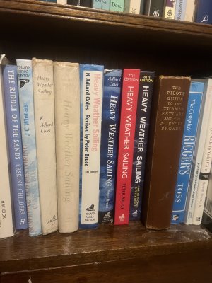
“Heavy Weather Sailing”, Martin Thomas and Peter Bruce, Adlard Coles Nautical, 8th edition, published 2022.
- Thread starter 14K478
- Start date
14K478
Well-known member
Scomber
Active member
H W Dick ?? Traders and Tramps?
14K478
Well-known member
Well spotted, next to “Beancaker to Boxboat”.H W Dick ?? Traders and Tramps?

This of course is two cockroaches fighting over a beancake, and I claim half the credit, with my old pal David Ewings, for bringing the old crest back into use, in 1990, in what is now, by a country mile, and much to its own surprise, Britain’s largest shipowning concern.
Last edited:
davidaprice
Active member
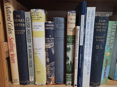
I've a few of his books myself, though being based in Finland I've focused on his (and others') books set in the northern Baltic. (Coincidentally, my copy of Heavy Weather Sailing is the missing 6th edition). I've retraced some of his steps in my own boat, it was he who inspired my to follow the south-east approach to Kökar in the Åland Islands
14K478
Well-known member
davidaprice
Active member
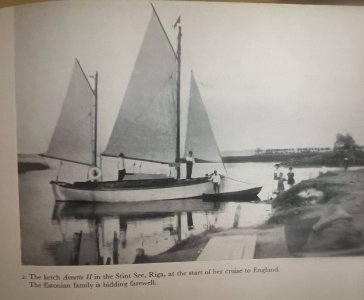
His book "Close-Hauled" on my bookshelf tells of the trip returning the newly-bought Racundra / Annette II from Riga to England. He tells the same story in "Sailing Years".
14K478
Well-known member
She survived to be rediscovered by the “Yachting Monthly” when I was first a reader (1970 onwards) but subsequently was broken up; had she stayed around just a little longer she would have been as carefully looked after as his other boats are!
Last edited:
Frank Holden
Well-known member
14K478
Well-known member
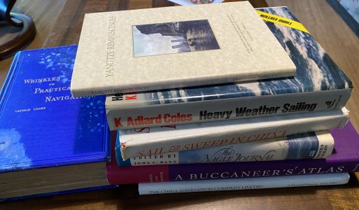
Very fine book at the top there. Should anyone need to know how to navigate a high powered coal burning steamship up a rapid, here’s how! Also a memorable last sentence, when he has escaped to Thailand and the waiter comes up to his table and says “Ikky Soad?”3rd Edition?
Just leafed through it.
I'm rather glad I hadn't opened it in 30 odd years.
Terrifying!
View attachment 183468 I would have sold my boat and gone cowherding in Mongolia.
“He had recognised an Empire Builder”!
I met the author a couple of times.
There is, according to a Bristol Channel pilot cutter owning friend who has been there, a lake in Mongolia, containing trout, a tug and a lighter. He asked the tug skipper if there was a chart of the lake and the skipper replied that he had once had one, but the Government had taken it away on the grounds of national security!
STS Lecky would have known what to do about that!
Last edited:
mattonthesea
Well-known member
Eek! Uncharted water even now. Although it turned out to be fine, I was prepared for some squeakiness from the west. Or have I got the wrong island? The Baron?, it was he who inspired my to follow the south-east approach to Kökar in the Åland Islands
Frank Holden
Well-known member
Mongolia? The cook doesn't like sailing and preferred central Asia . With a team of retired lady friends went to Mongolia a few times, two of the stans - Uzbekistan and Kurgistan. About ten years ago with same team of ladies (only) went to Iran for a few weeks. Reckoned it was great but they didn't get to Abadan or Bandar Mashur. Also went for a day sail on Lake Baikal. EDIT just advised she had been to the shore of Khuvsgul Lake (sp) SW of Baikal in Mongolia but has not been afloat on it.Very fine book at the top there. Should anyone need to know how to navigate a high powered coal burning steamship up a rapid, here’s how! Also a memorable last sentence, when he has escaped to Thailand and the waiter comes up to his table and says “Ikky Soad?”
“He had recognised an Empire Builder”!
I met the author a couple of times.
There is, according to a Bristol Channel pilot cutter owning friend who has been there, a lake in Mongolia, containing trout, a tug and a lighter. He asked the tug skipper if there was a chart of the lake and the skipper replied that he had once had one, but the Government had taken it away on the grounds of national security!
STS Lecky would have known what to do about that!
Re other books in that stack.
'A Buccaner's Atlas' - wonderful if you are interested in the west coast of South America.
'The Nagle Journal' - just brilliant. Not only did Jacob Nagle know how to write, he also kept a journal from 1775 to 1841. And the journal survived!
Fought with Washington at Brandywine, sailed in the First Fleet to New Holland, and served under Nelson in the Med. Interesting bloke.
Last edited:
davidaprice
Active member
I'm referring to the route on chart 742 of the Ahvenanmaa portfolio, the approach to Karlby from the southeast (direction of Utö). The route is shown on modern charts with a dashed line but no assertion about its depth. In practice we have followed it twice and from memory not seen less than about 4 metres until the final approach to Karlby, which seems to be dredged to about 2 metres. It's worth it for the well-equipped, sheltered harbour at Hotel Brudhäll. There's also a diesel jetty and a grocery shop, and you can take a day trip by boat to the Baron's island Källskär, if you'd rather not risk the uncharted waters around the island.Eek! Uncharted water even now. Although it turned out to be fine, I was prepared for some squeakiness from the west. Or have I got the wrong island? The Baron?
Here's the chart from "Mary Anne Among 10,000 Islands"; Källskär can be seen near top left. He was braver than me to sail this route with that chart and no GPS, we drop sails near Gåsharu and do the rest by motor. His book describes more sea-marks than I remember, but on the other hand post-glacial rebound means the route is now about 40cm shallower than in his time!

14K478
Well-known member
This is a contender for the title of “The thread that got off the subject faster than any other and has continued to get further away!”
Great fun!
Anyway, I just wanted to repeat Adlard Coles’ joke about the book being like seasickness pills - best taken before the weather arrives - and to say how impressed I am with this edition.
Great fun!
Anyway, I just wanted to repeat Adlard Coles’ joke about the book being like seasickness pills - best taken before the weather arrives - and to say how impressed I am with this edition.
Last edited:
Frank Holden
Well-known member
I always thought the best seasickness preventative was to go sit under a tree.This is a contender for the title of “The thread that got off the subject faster than any other and has continued to get further away!”
Great fun!
Anyway, I just wanted to repeat Adlard Coles’ joke about the book being like seasickness pills - best taken before the weather arrives - and to say how impressed I am with this edition.
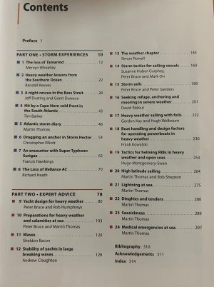
I've just looked at the contents page - when did you say you were coming down to Chile?

14K478
Well-known member
Have 1 x competent son whom you once took round the Cutty Sark available if wanted…I always thought the best seasickness preventative was to go sit under a tree.
I've just looked at the contents page - when did you say you were coming down to Chile?View attachment 183533
Frank Holden
Well-known member
I'm afraid my days of adventurising are nearly done and don't think I will be going south of Golfo de Penas again. That heady mix of pisco sour, carmenere, and lomo liso have just about done for me.Have 1 x competent son whom you once took round the Cutty Sark available if wanted…
What is wrong with your boat? Stuck in that east coast mud or something?
Come on down, you know you want to.
14K478
Well-known member
“What - and leave all this?”I'm afraid my days of adventurising are nearly done and don't think I will be going south of Golfo de Penas again. That heady mix of pisco sour, carmenere, and lomo liso have just about done for me.
What is wrong with your boat? Stuck in that east coast mud or something?
Come on down, you know you want to.
mattonthesea
Well-known member
Thanks, that's just made up our minds to go back.I'm referring to the route on chart 742 of the Ahvenanmaa portfolio, the approach to Karlby from the southeast (direction of Utö). The route is shown on modern charts with a dashed line but no assertion about its depth. In practice we have followed it twice and from memory not seen less than about 4 metres until the final approach to Karlby, which seems to be dredged to about 2 metres. It's worth it for the well-equipped, sheltered harbour at Hotel Brudhäll. There's also a diesel jetty and a grocery shop, and you can take a day trip by boat to the Baron's island Källskär, if you'd rather not risk the uncharted waters around the island.
Here's the chart from "Mary Anne Among 10,000 Islands"; Källskär can be seen near top left. He was braver than me to sail this route with that chart and no GPS, we drop sails near Gåsharu and do the rest by motor. His book describes more sea-marks than I remember, but on the other hand post-glacial rebound means the route is now about 40cm shallower than in his time!
View attachment 183499
And to go further off thread: Gruff Rees Jones' biography of Ransome is still available on iPlayer. Gives some extra context to Racundra FC
penberth3
Well-known member
I may be obsessive. A glance at my bookcase suggests so:
View attachment 183449
(Why did I miss the third and the sixth editions?)
Anyway, it’s always been a jolly good book, and it has certainly changed over time!
You need a trip to the charity shop or the re-cycling bin!
Members online
- Stingo
- wombat88
- harvey38
- Boathook
- geepee
- SC35
- BarrytheViking
- Ferring
- Momac
- Sailing steve
- Clash
- Hoolie
- Peggy M
- Wandering Star
- iamtjc
- Greg2
- NorthUp
- Timeless 2
- Beneteau381
- cat ketch
- Alicatt
- Iliade
- Geoff A
- John_P
- veshengro
- oldgit
- Allergy
- Grubble
- trialframe
- CJU
- garymalmgren
- Hot Property
- durza
- bedouin
- 38mess
- CrossedThreads
- LoneHort
- fredrussell
- nevis768
- ashtead
- princess_V40_1998
- RobbieW
- Cuan
- crewman
- DanTribe
Total: 1,273 (members: 56, guests: 1,217)

