Which weather app?

franksingleton

Well-known member
Joined
27 Oct 2002
Messages
3,462
Location
UK when not sailing
weather.mailasail.com
Back to the original question, but not so relevant to the UK, I use ascat sometimes to see what really happened compared to the models..
https://manati.star.nesdis.noaa.gov/datasets/ASCATBData.php
WMBas123.png


& DeepZoom Trip to get an idea of what wind might be expected for longer passages. Cool site but takes a moment to get the hang of.
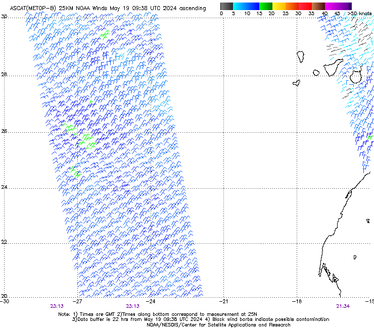
A former colleague referred to these wind data being the “gold standard”. Amazingly, to me at least, the data are derive from the molecular scattering of a radar beam.
 

GHA

Well-known member
Joined
26 Jun 2013
Messages
12,211
Location
Hopefully somewhere warm
Visit site
Nothing to do with which app is best but what an odd bit of weather it was today!
Forecast was gusty overnight & today, night was calm then today wind just appeared and temperature shot up, like in a minute. Thermometer is in the cv7 wind sensor which seems to take a little while to display changes, might take a little while for the whole unit to warm up, but the change was much faster that the graph. Then sailing along the SW coast of Gran Canaria in like a boat length the wind stopped & it was like walking through a door into an air conditioned hotel in Dubai, instantly 12degC cooler & wind did a 180. Very hazy & dusty sand everywhere so warm wind prob straight from the Sahara. Assuming most likely the wind splitting around the mountains & I sailed across where they met, but extraordinary such a large temperature drop in an instant! 🥵🥶

1712865056920.png


Looks like it took about 5 minutes to go through the boundary between the 2 blobs of air but the spike just before 2pm shows how instant it was when the temperature changed>
1712865610858.png
 
Last edited:

franksingleton

Well-known member
Joined
27 Oct 2002
Messages
3,462
Location
UK when not sailing
weather.mailasail.com
I will start with what you may think an insult. Are your temperature readings correct? The SST in the area is about 20degC. What sea temp are you measuring`? 20deg is about the seasonal norm.Your air temp started off at 28deg. And rose to 38deg. That seems extraordinary.
Having said that, the temperature increase occurred when the wind went to the WNW. That looks like a katabatic effect. The cooling late on was, presumably, as you move out of the katabatically warmed air.
You could contact AEMeT and ask for an opinion. They might want a little more info, wind speed and pressure, for example. You might, also contact the R Met Soc with a description. Whichever, I suggest thst you calibrate your temperature sensor against a mercury in glass thermometer.
 

GHA

Well-known member
Joined
26 Jun 2013
Messages
12,211
Location
Hopefully somewhere warm
Visit site
I will start with what you may think an insult. Are your temperature readings correct? The SST in the area is about 20degC. What sea temp are you measuring`? 20deg is about the seasonal norm.Your air temp started off at 28deg. And rose to 38deg. That seems extraordinary.
Having said that, the temperature increase occurred when the wind went to the WNW. That looks like a katabatic effect. The cooling late on was, presumably, as you move out of the katabatically warmed air.
You could contact AEMeT and ask for an opinion. They might want a little more info, wind speed and pressure, for example. You might, also contact the R Met Soc with a description. Whichever, I suggest thst you calibrate your temperature sensor against a mercury in glass thermometer.
Pretty sure the thermometer in the cv7 is accurate to within a degree or so, usually tallies up well with any nearby airport reports though not instant. Sea temperature is around 21DegC. And it really did happen, the first temperature rise was not instant but sailing along the coast the change was instant, it was a blast of what felt like cold air from hot very much like walking from a hot tropical day to standing in front of an air conditioner. And stayed cool. Yes, extraordinary, never experienced anything like that before!
Nearest windy recording station is round the east coast but show that it was indeed hot round there, pity the one to the west is offline at the moment. >
1712939005714.png

Windy shows it forecast as 28Deg at 3am this morning 2000 feet up.

1712939576456.png

Weather does some weird stuff sometimes 🙂
 

franksingleton

Well-known member
Joined
27 Oct 2002
Messages
3,462
Location
UK when not sailing
weather.mailasail.com
Pretty sure the thermometer in the cv7 is accurate to within a degree or so, usually tallies up well with any nearby airport reports though not instant. Sea temperature is around 21DegC. And it really did happen, the first temperature rise was not instant but sailing along the coast the change was instant, it was a blast of what felt like cold air from hot very much like walking from a hot tropical day to standing in front of an air conditioner. And stayed cool. Yes, extraordinary, never experienced anything like that before!
Nearest windy recording station is round the east coast but show that it was indeed hot round there, pity the one to the west is offline at the moment. >
View attachment 175399

Windy shows it forecast as 28Deg at 3am this morning 2000 feet up.

View attachment 175400

Weather does some weird stuff sometimes 🙂
I am not doubting that it happened. I am saying that any meteorologist would query the calibration. Your values recorded locally do support the value. Katabatic effect would seem the most likely. A good MSc dissertation topic.
 

GHA

Well-known member
Joined
26 Jun 2013
Messages
12,211
Location
Hopefully somewhere warm
Visit site
Keep forgetting that the little barometer chip does relative humidity as well, surprised it went down, could that be because the temperature went up so much? Certainly felt humid & sticky when the heat hit. Sensor is inside the chart table which might explain the lag in readings from what it felt like which was very quick.

1712992808201.png

No big change in pressure >
1712993038834.png
 

franksingleton

Well-known member
Joined
27 Oct 2002
Messages
3,462
Location
UK when not sailing
weather.mailasail.com
Keep forgetting that the little barometer chip does relative humidity as well, surprised it went down, could that be because the temperature went up so much? Certainly felt humid & sticky when the heat hit. Sensor is inside the chart table which might explain the lag in readings from what it felt like which was very quick.

View attachment 175419

No big change in pressure >
View attachment 175420
Yes. In the Foehn effect the rising air, once it has reached the condensation level, cools at the wet adiabatic rate. When the air descends, it warms but when water drops have evaporated, it warms st the dry adiabatic rate. The RH decreases a the warming is marked Aberdeen gets abnormally warm days in these situations. N Wales does in southerlies.
I still do not understand by the temperature was so high at sunrise but see that the whole area was warm.
 
  • Like
Reactions: GHA

GHA

Well-known member
Joined
26 Jun 2013
Messages
12,211
Location
Hopefully somewhere warm
Visit site
Yes. In the Foehn effect the rising air, once it has reached the condensation level, cools at the wet adiabatic rate. When the air descends, it warms but when water drops have evaporated, it warms st the dry adiabatic rate. The RH decreases a the warming is marked Aberdeen gets abnormally warm days in these situations. N Wales does in southerlies.
I still do not understand by the temperature was so high at sunrise but see that the whole area was warm.
Carrying this on a bit, similar today & question is - where does the air go? Must go up? No wind at the boundary- anyway, sailing today enjoying a nice downwind breeze then it died & within about 50m it reversed! Pretty much exactly 180Deg >


1714158013108.png


Tiny little spike in pressure >
1714158086327.png
Temperature dipped just 1 degc for a few minutes.

No idea how this works but fascinating!! 😎
 

franksingleton

Well-known member
Joined
27 Oct 2002
Messages
3,462
Location
UK when not sailing
weather.mailasail.com
Carrying this on a bit, similar today & question is - where does the air go? Must go up? No wind at the boundary- anyway, sailing today enjoying a nice downwind breeze then it died & within about 50m it reversed! Pretty much exactly 180Deg >


View attachment 176040


Tiny little spike in pressure >
View attachment 176041
Temperature dipped just 1 degc for a few minutes.

No idea how this works but fascinating!! 😎
Where were you relative to the island and how near your previous track?
 

GHA

Well-known member
Joined
26 Jun 2013
Messages
12,211
Location
Hopefully somewhere warm
Visit site
Where were you relative to the island and how near your previous track?
Slightly to the east of previous & a mile or so off >
1714204601646.png

As you no doubt know the Canaries are famous for the wind acceleration zones, so far I'm visualizing a high pressure being created north of the island when the wind hits the mountains and a low pressure downwind, then the wind is accelerated down each side of the island and what I went through was where it meets again? Guessing though, if so the air must go up when it meets? Dunno, but would be nice to have a better feel for what goes on 😎
Todays ecnwf which looks pretty similar >
1714204873117.png
 

franksingleton

Well-known member
Joined
27 Oct 2002
Messages
3,462
Location
UK when not sailing
weather.mailasail.com
Slightly to the east of previous & a mile or so off >
View attachment 176050

As you no doubt know the Canaries are famous for the wind acceleration zones, so far I'm visualizing a high pressure being created north of the island when the wind hits the mountains and a low pressure downwind, then the wind is accelerated down each side of the island and what I went through was where it meets again? Guessing though, if so the air must go up when it meets? Dunno, but would be nice to have a better feel for what goes on 😎
Todays ecnwf which looks pretty similar >
View attachment 176051
Certainly an interesting effect. Where the sir comes round the island and you get convergence, the sir must go up. But, do you see any cloud? It might be interesting to show to a university. Is there one in the Canary is? It wold be a nice MSc project.
 

geem

Well-known member
Joined
27 Apr 2006
Messages
7,399
Location
Caribbean
Visit site
All this talk of weather. We are stuck in Antigua waiting for a weather window to cross to the Azores. Blocking High pressure seems to be the theme. Head winds on the get away from Antigua followed by a huge patch of no wind meand we won't be going anywhere soon. We need normal service to resume. Lots of chatter on the groups over here wondering when we are all going to be getting away
 

The Q

Well-known member
Joined
5 Jan 2022
Messages
1,581
Visit site
Need normal service here in Norfolk, it's Sunday racing day and yet again it's high winds and soggy. Worst weather start to a season in many years...
 

AntarcticPilot

Well-known member
Joined
4 May 2007
Messages
10,073
Location
Cambridge, UK
www.cooperandyau.co.uk
Are there any manifestations sr sea level? You would think thst there should be. It probably needs some good fine scale modelling. UKV is transportable. As I have said, a good student research project.
I'm afraid I don't know. The seas in that part of the world are not much frequented! I'd imagine there would be, though, because there are not only the strong westerly winds but also the Antarctic Circumpolar current, which flows in the same direction. Intuitively one would imagine that oceanographic and meteorological phenomena would reinforce each other. But I am neither oceanographer not meteorologist!

It might be interesting to look at ocean vortices imaged by SAR or satellite altimetry, but as you say, it's an MSc or even PhD project.
 
Last edited:

franksingleton

Well-known member
Joined
27 Oct 2002
Messages
3,462
Location
UK when not sailing
weather.mailasail.com
I'm afraid I don't know. The seas in that part of the world are not much frequented! I'd imagine there would be, though, because there are not only the strong westerly winds but also the Antarctic Circumpolar current, which flows in the same direction. Intuitively one would imagine that oceanographic and meteorological phenomena would reinforce each other. But I am neither oceanographer not meteorologist!

It might be interesting to look at ocean vortices imaged by SAR or satellite altimetry, but as you say, it's an MSc or even PhD project.
I was hoping that GHA might see his way to contacting a local university. I am too far removed to have any contacts. It might be worthwhile for him to send his two examples plus the link Roberto provided and ask if they could suggest an explanation.
 
Top