Yngmar
Well-Known Member
http://o-charts.org/shop/index.php?id_category=8&controller=category&id_lang=4
Charts available growing constantly.
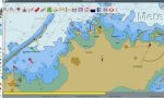
We bought the Spanish o-charts this year, primarily to try them out. The price was fair, but the charts were disappointing. They were much the same as the 2011 CM-93 everyone has as "base map", only of course up to date. That means they're very good, accurate shipping charts, but completely lacking for cruising. They're the same as the official Spanish charts though, which are also completely lacking in detail for most anchorages and even some marinas. They're not aimed at the leisure market at all, they're for shipping.
We also have Navionics on the phone, which had extremely accurate soundings for every anchorage and marina on it, along with all the other stuff. Not sure where they get that from if the official charts don't have it, perhaps it's all crowdsourced data from their "Sonarchart" feature, or perhaps they do their own hydrographic surveys, but it works. Sadly not in OpenCPN.
So for now we use them together, OpenCPN for passage planning/offshore and steering to track with the autopilot and Navionics when we are close to shore or anchoring. We didn't bother buying the Italian o-charts, as we expect they're much the same as the Spanish. Not sure if there is a good source of leisure charts for OpenCPN for these areas.