Difference between coordinates

Sailfree

Well-known member
Joined
18 Jan 2003
Messages
21,472
Location
Nazare Portugal
Visit site
Problem in Portugal (involves a neighbour - not me) regarding boundary co-ordinates.

Can anyone advise roughly what the difference would be between ED50 and WGD 84 CO-ORDS?
 

mjcoon

Well-known member
Joined
18 Jun 2011
Messages
4,462
Location
Berkshire, UK
www.mjcoon.plus.com
Problem in Portugal (involves a neighbour - not me) regarding boundary co-ordinates.

Can anyone advise roughly what the difference would be between ED50 and WGD 84 CO-ORDS?
I have no idea, except that I would expect the difference to depend on the location. Once upon a time your, or at least my, basic hand-held GPS could be set to a location and then the datum altered (e.g. ED50 to WGD 84 or v.v.) to see how much difference it made...
 

Eygthene

Member
Joined
11 Aug 2007
Messages
417
Location
Falmouth
Visit site
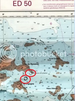
If you can find an oldish chart of the relevant region of Portugal using the ED50 datum there may be a note with the adjustment from ED50 to WGS84.
On my south Brittany charts the adjustment from ED50 to WGS84 datum is -.06minutes N and +.09minutes W. Depending where you are in Portugal, you are about 40°N. I don't know if the same adjustment ED50 to WGS84 would apply in Portugal as in Brittany but I guess it would be somewhat similar.
At 40° N, 1 minute E or W is 0.766nm (about 1550yards) and 1 minute of latitude is always 1nm (about 2026yards). So the difference of -0.06minutes N would be about 120 yards in a southerly direction and the difference +0.09minutes W would be about 140yards in a westerly direction.
Antarctic pilot has come up with a figure in the same ball park.
 

AntarcticPilot

Well-known member
Joined
4 May 2007
Messages
10,108
Location
Cambridge, UK
www.cooperandyau.co.uk
I should note that there are issues to do with the map projection being used and that the OP hasn't given enough information to define the problem fully. However, the main point is that in Portugal, which is the westernmost country that used ED50, the differences will be between 100 and 200 metres. This far exceeds any difference in position that is likely in a domestic dispute, where it is usually matters of metres that are in dispute! It is also likely that a map on the ED50 datum predates GPS, and positioning may well be less accurate.

If I were in such a position, I would identify common points between the maps (ones not in dispute) and use them to align the two maps. Datum calculations in a case like this may well be unable to resolve the issue. However, the calculator I linked to above will certainly provide a good starting point. It will require further information about map projection, though.
 
Top