Brittany tides?

nburrell

New member
Joined
1 Jan 2007
Messages
12
Visit site
What do people recommend for referencing tidal heights in Brittany? Has anyone found an app that is reliable?

I tried using Imray tide planner in North Brittany last year and found that it matched other sources in most areas, but was out by as much as an hour in others including Treguier, Lezardrieux and Iles de Chausey. Imray acknowledged the discrepancy, but didn't confirm the cause.

I guess the lesson is to check multiple sources in cases when tidal height/time are critical - but interested to know what others rely on?
 

ashtead

Well-known member
Joined
17 Jun 2008
Messages
6,378
Location
Surrey and Gosport UK
Visit site
There used to be booklets in each marina for each Brittany port -clearly for some like st cast it’s not really an issue but you could pick up booklet there for say st Malo if heading across the bay . I guess a chart plotter programme might be a source of tidal height info however appreciate the concern might be a range of values. Does Navily help in France ?
 

LittleSister

Well-known member
Joined
12 Nov 2007
Messages
18,650
Location
Me Norfolk/Suffolk border - Boat Deben & Southwold
Visit site
Remember that they're all predictions, based on simplified models in an area where the speed of the tidal streams and complications of the coast can render variations from those predictions significant.

A few years back I was somewhere off Paimpol doing 14 knots over the ground in a 23 footer with a max speed of 5 knots! At the time both the chart plotter and Reeds Nautical Almanac (paper version) were insisting it was slack water!
 

rotrax

Well-known member
Joined
17 Dec 2010
Messages
15,851
Location
South Oxon and Littlehampton.
Visit site
Tides are not always regular to the minute, whatever the tables say.

Here in Wellington NZ the Cook Strait varies big time. Sometimes the flood or ebb runs the wrong way.

A 1 metre- ish rise is normal, so not much. Get low pressure in the Pacific and high pressure in the Tasman and all tables go out of the window, you have to deal with what you find out on the water.

They don't believe me when I tell them a six metre rise of tide is nothing exceptional in our waters.........................................
 

Roberto

Well-known member
Joined
20 Jul 2001
Messages
5,377
Location
Lorient/Paris
sybrancaleone.blogspot.com
What do people recommend for referencing tidal heights in Brittany? Has anyone found an app that is reliable?
If you are looking for electronic format, this is the gold standard (for some ports they have computed >140 harmonic components), if actual value vary it will be due to specific factors
Horaires de marées gratuits du SHOM
Imray say they have a licence from Shom, so data should be identical.
The same Shom data is available here (they have an Android app as well)
maree.info - Annuaire des marées - horaire, hauteur, coefficient de marée en Atlantique Manche Mer du Nord
A very nice PC software (for all the rest of the world as well)
Marées dans le Monde
I also look at WXtide32 output, generally within a couple of tens of minutes/centimeter difference WRT Shom data.

Next step to correct forecast tidal heights is using "surcote" forecasts, surge forecasts.
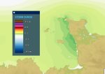
Web site data.shom.fr --> Layers --> Oceanographic forecasts --> Water level --> Storm surge
You get this type of images
surge.jpg

Data in tabular form is available from Almanach du Marin Breton (sorry, I cannot come to terms with Bloc Marine, main advantage seems to be it is in English language too, fair enough), or from the various booklets available here and there for free or at a nominal price. In the last page they usually have a table of corrections for nearby secondary ports.
 

LittleSister

Well-known member
Joined
12 Nov 2007
Messages
18,650
Location
Me Norfolk/Suffolk border - Boat Deben & Southwold
Visit site
"A walled French town on the coast of Brittany, Saint-Malo has the highest tides in Europe, with water that can rise 13m over the course of six hours. When the water goes out, it reveals several kilometres of ocean floor."

I thought parts of the Severn & Bristol Channel claimed the greatest tidal range in Europe (and second the World, after the Bay of Fundy), at around 14m?

Of course what extent of seabed is revealed when the tide goes out is generally more closely related to the slope of the seabed than the tidal range. I'm sure there must be drying parts of the East Coast that extend for several kilometres at low tide, despite a much smaller range, while there must be rocky parts of coasts with huge tide ranges that have negligible drying areas..

I might generously let pass as poetic licence the reference to the drying coast around St. Malo being 'ocean floor'.
 

doug748

Well-known member
Joined
1 Oct 2002
Messages
13,300
Location
UK. South West.
Visit site
"A walled French town on the coast of Brittany, Saint-Malo has the highest tides in Europe, with water that can rise 13m over the course of six hours. When the water goes out, it reveals several kilometres of ocean floor."

Danger: Saint-Malo and the highest tides in Europe

Which is why I carry 65m of anchor chain.


I love this snap:

1679047433566.jpeg


The ole missus took it off the beach in St Malo. Camera phones are great, she just picked it up and took it, such a shock - she never mastered a viewfinder, with a camera I had only ever seen photos of her feet.

Back to the subject, I also just use a tide table from a local marina. Always available FOC and usually marked heure légale which, has I translate it, is BST for France.

.
 

Roberto

Well-known member
Joined
20 Jul 2001
Messages
5,377
Location
Lorient/Paris
sybrancaleone.blogspot.com
with a camera I had only ever seen photos of her feet.
My wife specialized in inverting ON/OFF buttons in video cameras: we often have no video of what she pointed the camera to during 10-15 minutes, the video begins after the camera is left on one corner of the cockpit, one sees a bit of rope just in front of it for about a couple of hours until either the battery goes down or the memory card is full.
 

nburrell

New member
Joined
1 Jan 2007
Messages
12
Visit site
Thanks very much - the SHOM data is exactly what I was looking for.

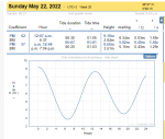
fyi - I first noticed the problem with the Imray app on 22nd May last year when I realised that the app gave different timings to the leaflet provided by the harbour office in Lezardrieux.
I've just done a spot check and happily/unsurprisingly the SHOM website matches the Lezardrieux leaflet for 22/5/22.

When I cross-referenced the Imray app with the leaflets from other ports, some were OK (Granville, St Cast, Saint Quay) but Treguier & Iles de Chausey were also problematic for the dates I checked.

I look forward to using the SHOM and maree.info websites this year!

1679054272873.png1679054981632.png
 
Top