Alderney Race + Seine to Paris

Nessy

Active Member
Joined
13 Feb 2024
Messages
57
Visit site
Greetings All!

First of all, please excuse my bad „school english“!

I hope you can understand my questions.

We, Stefan + Regine, are a German couple with a Beneteau Antares 9,80 lying in Barneville-Carteret during winter.

Since 2019 we cruised several times Brittany, the French Atlantic Coast, Northspain until Santander and South England from Portsmouth to the Isles of Scilly.

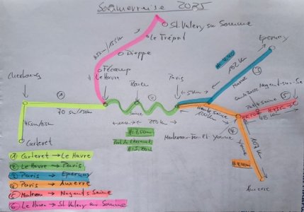
This year our plan is to visit Paris and North- and Southnormandie.

Our time slot ist from 24.04. to 09.10, therefore afterwards perhaps we will again make a hop to Southengland.

Some days in London is another wish on our list, but at the moment we are afraid to get in contact with a refugee boat when crossing the channel.

But this is another item.

Now I want kindly ask for some advice for two items.

1. How can I calculate slack water in the Alerney Race. The Navionics-App shows some active current arrows and a time and heightstabel.

Is this reliable?

The Reeds offers some current charts, but no real time HW Dover +/- ? for slack water in the Alderney Race.

Also I‘m not really sure about the infos in the Channel Pilot.

Is there perhaps a thumb rule for this?

I presume it‘s not really important to hit slack water exactly to the minute. It‘s more a question of interest.

We plan start in St. Peter Port and head to Cherbourg.


2. Seine from Le Havre to Rouen, maximum speed?

The other item is how fast we can go up the Seine to Rouen, without trouble about the maximum speed.

Our Antares normally feels good between 16-20 kn, but in the documents to find in the www. they write 12-18 km/h, in another place there is mentioned a special regulation for the time between 15. Mai to 15 Juni, due too protect the fish fry.

Does perhapbs anyone of you have some special information about this two points?

I would also be grateful for any other tips on our planned trip!

Many thanks in advance and a nice day in office, at home or aboard!

Cordially Stefan

MY Nautic
 

Attachments

  • IMG_8105.jpeg
    IMG_8105.jpeg
    119.1 KB · Views: 15
My old tidal stream atlas from the 1970's shows the Alderney Race slack water at around HW Dover and then again around HW Dover +5.

At both times though, it shows that the current does alter quickly.
 
I’m not local to the Race but I’ve been through and past several times. I think that providing you avoid the worst of it at the worst time and in the worst conditions, ie wind against spring tide, it shouldn’t be a problem. My impression was that it was hard to sail through the actual race as the motion tended to knock the wind out of the sails, but 5 knots of current helps a bit. We have usually aimed to arrive at the change of tide and skirted the actual race.
 
You need to get to Cherbourg before the tide turns at Cherbourg or it can be very slow battling the current. We time it based on that and doing 5.5kn stw. We went through the race peaking at 13kn sog. Wind with tide and springs so a bit lumpy but ok. Went 2 miles out round cap de la Hague to avoid the i shore countercurrent. Worst bit is at the end of the little Russell where currents merge.
 
I found the navionics tide arrows way off there. The tide atlas is better. Done it several times now - once got one hell of a shaking using the last 90 minutes of fair tide, but cut too close to cap de la Hague I think. Last week, we rode an even stronger fair tide, but routed through the deepest areas and it was barely perceptible, despite a force 6 against tide. So it seems fine if the shallower race areas marked on the chart are given a wide berth.
 
As linked to in #4 the tide stream charts will allow you to work out your timings, the flow in the race ties in nicely with Dover tide tables, in fact the current flow direction in the center section of the English Channel is inline with HW/LW Dover. Dover tables are under the tide tables tab on my site, as are Cherbourg and links to St Vaast, St Peterport and St Helier.
A good source of information for the French Waterways is https://www.french-waterways.com/waterways/seine/lower-seine/
I don't know of any speed limits on the lower Seine, only time restrictions - Navigation is restricted to between Sun rise and set for pleasure craft.
The marina at Rouen is very good with nearby Bus and Cycle routes into town.
PS in my Download tab there is a page of 'Traffic Signs' for the French Waterways.
 
Last edited:
Many thanks to all my friendly helpers!

Have a nice evening!

We‘ ll get guests in some minutes, I will have a the next look later in the evening.

Cordially! Stefan
 
There is a well-known counter-current that runs for a couple of hours between Cherbourg and Cap de la Hague that can be used to your advantage. It is very many years since I went that way but there was one occasion when we did the usual thing and stopped off in Omonville to wait for the tide. My only memory of it is that the only option was to tie to a great rusty cylinder of a buoy with no easy means of holding off, though this must surely have changed.
 
As linked to in #4 the tide stream charts will allow you to work out your timings, the flow in the race ties in nicely with Dover tide tables, in fact the current flow direction in the center section of the English Channel is inline with HW/LW Dover. Dover tables are under the tide tables tab on my site, as are Cherbourg and links to St Vaast, St Peterport and St Helier.
A good source of information for the French Waterways is https://www.french-waterways.com/waterways/seine/lower-seine/
I don't know of any speed limits on the lower Seine, only time restrictions - Navigation is restricted to between Sun rise and set for pleasure craft.
The marina at Rouen is very good with nearby Bus and Cycle routes into town.
PS in my Download tab there is a page of 'Traffic Signs' for the French Waterways.
Good Morning Sir!

Many thanks for the information and your great blog!

Cordially! Stefan
 
Some days in London is another wish on our list, but at the moment we are afraid to get in contact with a refugee boat when crossing the channel.

Please don't be deterred from crossing to England because of refugee boats!

They are actually very rare - you are very, very unlikely to ever see one. Even less likely to see one that isn't already accompanied by the authorities.

You can reduce the chances even more, if you set off in a Northerly wind, or do so at one of the wider parts of the channel, or the southern North Sea.
 
I can’t believe that a refugee boat would be interested in a passing yacht. If it were in trouble it would probably be unable to make sufficient progress to close with it anyway and the yacht would be too small to be of much help.
 
As soon as the refugee boats are spotted by French Authorities, they stand on. Checking on anyone who wants to come off or needs medical aid. The French stop them entering the TSS and wait for a UK support boat to arrive, who then take charge. Some are not spotted by the French and come straight into UK care. In three Dover Calais trips last year we only saw the one incident referred to above. Otherwise, they are just a vessel to navigate by.
 
Many thanks for your reports about the refugee boats!

If I can convince the „Admirality“, perhaps we can combine Paris and London this year.

Cordially! Stefan
 
Hello to all my consultants!

Meanwhile we solved both, the Alderney Race as the tidal Seine.

Many thanks for all information you offered!

We left St. Peter Port with 1,50m over the sill with the normal harbour opening and went with round 16-20 GPS-Knots through the Race, and as all was running well we decided to skip Cherbourg and to go to St. Vaast la Hogue.
A perfect trip!

Unfortunately 4 Weeks ago a north-west weather situation emerged for several days and we sat in a trap in St. Vaast.

One day the wind in the harbour seems to have died down and we started to go to Ouistreham.

This was a big mistake, and we were happy to reach Port-en-Bessin after 25 nm and 3 h after a very rough ride.

The same from Port-en-Bessin to Ouistreham two days later.

Ouistreham was very nice, Caen also, but not the marina. Dirty and unorganised!

After some days in Deauville/Trouville we reached Honfleur. Very nice village, not to busy in the foreseason.

Until now the big question was how far we can go along the 110 km on the Seine to Rouen.

By chance I found an info in the yellow Normandy book of Neville Feathersrone.

He wrote 15 kn!

The young harbour master in Honfleur said also 15-20 kn are no Problem, and we did so without any problems.

20 kn through the water=16 GPS-kn.

Where ferries crossed and where boats/ships are lying we slowed down.

Due to the daylight we decided to go against the tide and reached Rouen, Basin St. Gervais after 5h.

No comparison to any marina in South England or the Frexh side of the Channel! 🙈

This experience accompanis us the Seine upward until now in Cergy/Oise where the situation is really „ok“.

So far some experiences of the last weeks on our trip to Paris.

If there is interest in further experiences on his, I will be happy to continue my report.

Many thanks and warm greetings from German MY Nautic and her Crew,

Stefan+Regine
 
Top