How to feed AIS data via WiFi to garmin UHD unit ?

Refueler

Well-known member
Joined
13 Sep 2008
Messages
20,414
Location
Far away from hooray henrys
Visit site
OK ... Garmin Echomap UHD 70 unit ...

I enabled WiFi as per book ... but cannot get it to receive AIS data ... it wants to be HOST only.

I have tablet / PC / Phone all reading and showing AIS targets via the WiFi ... but the Garmin unit does not.

Any info how to do it ??

I am not a N2000 network so thats a non starter ... I could connect it via 0183 but why if WiFi can do it ??
 

Refueler

Well-known member
Joined
13 Sep 2008
Messages
20,414
Location
Far away from hooray henrys
Visit site
Yep ... lost opportunity .....

Manual says WiFi is available on this unit .. and then you spend next hour loading up your mobile phone ... changing SD Card, creating active capt card so you don't corrupt your Chart Card .... get all done and what do you find ?

Its only one way ... except for updates which again - out comes the mobile phone.

What a sheer waste of opportunity.

My hope was that my WiFi on board which has various fed into the plexor ... GPS / AIS etc. would be able to feed the UHD 92v .... Ha Ha - forget it ... it only wants to play 'Host' ....

Ended up having to run an NMEA lead to it to get AIS displayed ...

Everthing else I have - Phone .. Tablet ... PC etc. ALL accept the data via WiFi ... will even feed Data back ... making it 2 way ... but Garmin ???

Luckily - I managed to identify an unused lead in a multi core cable running behind the panelling ... used that to feed AIS to the Garmin.

I am now considering whether to add another WiFi plexor ... to remove cables.

My ONWA GPS / AIS unit feeds into NMEA2WiFi plexor .... all data is then available as 0183 and WiFi simultaneously. Intention is top replace the 2 version with the latest 4 version. This will then send out same all combined 0183 and WiFi simultaneously. My existing NMEA2WiFi can then be moved to serve the Garmin converting the WiFi back to 0183 ... as well as both units serving other if needed.
 

Refueler

Well-known member
Joined
13 Sep 2008
Messages
20,414
Location
Far away from hooray henrys
Visit site
Why did you think it would? Nothing in the manual.

Manual in fact has section about creating WiFi ...

It also explains Active Captain etc. - which to complete the AC duties must be a two way WiFi ... but it does not make clear that its only AC that is two way ...

Why create a WiFi capability in a unit - then cripple it ?

Garmin has created a WiFi that means ... a) connect phone to Plotter to check status ... then b) disconnect and connect phone to internet to get data via Active Captain ... then c) disconnect from internet, change SD card in plotter to Active Captain Card ... then d) connect phone to plotter to transfer data ...

What a BS exercise !!
 

PaulRainbow

Well-known member
Joined
16 May 2016
Messages
17,045
Location
Suffolk
Visit site
Manual in fact has section about creating WiFi ...

It also explains Active Captain etc. - which to complete the AC duties must be a two way WiFi ... but it does not make clear that its only AC that is two way ...

Why create a WiFi capability in a unit - then cripple it ?

Garmin has created a WiFi that means ... a) connect phone to Plotter to check status ... then b) disconnect and connect phone to internet to get data via Active Captain ... then c) disconnect from internet, change SD card in plotter to Active Captain Card ... then d) connect phone to plotter to transfer data ...

What a BS exercise !!
No need to swap SD cards, just create an AC card and leave it in the plotter.
 

Refueler

Well-known member
Joined
13 Sep 2008
Messages
20,414
Location
Far away from hooray henrys
Visit site
No need to swap SD cards, just create an AC card and leave it in the plotter.

I did that but charts on the Garmin card have not transferred to plotter .. still trying to figure out why not. So to get charts up again - had to put Garmin SD back in again ...

Manual is not too clear on it ... but its early days and I'm not a Garmin user - so its learning curve ...
 

fredrussell

Well-known member
Joined
24 Mar 2015
Messages
3,471
Visit site
I have a Garmin Echomap plotter. The way I see it, it’s an N2k enabled device, and everything I’ve plugged into it via N2k has ‘showed up’ and worked seamlessly with the plotter. It would indeed be nice if all boat tech could talk to each other wirelessly but when I raised this issue a while back the general consensus seemed to be that wireless connections drop out occasionally, wired connections don’t, and with something as safety critical as AIS, you really don’t want it dropping out, ever.
 

Refueler

Well-known member
Joined
13 Sep 2008
Messages
20,414
Location
Far away from hooray henrys
Visit site
I have a Garmin Echomap plotter. The way I see it, it’s an N2k enabled device, and everything I’ve plugged into it via N2k has ‘showed up’ and worked seamlessly with the plotter. It would indeed be nice if all boat tech could talk to each other wirelessly but when I raised this issue a while back the general consensus seemed to be that wireless connections drop out occasionally, wired connections don’t, and with something as safety critical as AIS, you really don’t want it dropping out, ever.

Fine ... but not everyone is a devotee to N2K ....

The Depth sensor is via N2K ... that I know ... my AIS is now via 0183 lead ...

I have on board WiFi that has proved excellent and never dropped out since day it was installed on other boat ... I have now moved the unit to the new boat ... same performance.
That WiFi feeds PC .. Tablet .. Phones ... but not the Garmin ... seems a lost opportunity to me. Life would be so much easier to setup gear to play to the Echomap
 

PaulRainbow

Well-known member
Joined
16 May 2016
Messages
17,045
Location
Suffolk
Visit site
I did that but charts on the Garmin card have not transferred to plotter .. still trying to figure out why not. So to get charts up again - had to put Garmin SD back in again ...

Manual is not too clear on it ... but its early days and I'm not a Garmin user - so its learning curve ...
The Echomap series have pre-installed charts, they are not on a card.

Any updates will go on an SD card, they do not get transferred to the internal memory.

The card with the updates can safely be used as an AC card too.

If you register the plotter to yourself and install the AC app' on your phone or tablet (max 2 devices) you can download "your" charts to the phone. You can then use the phone as a stand alone backup plotter. If your Echomap supports "Helm" from the AC app' you can mirror the plotter to a phone or tablet.

Garmin wifi works exactly as Garmin intended, but the AC app' can be clunky. It's pretty good in everyday use and it is free. I have it on two 10.4" Android tablets at my lower helm, either can be used stand alone or mirror the main plotter on the flybridge, 10.4" plotter for £150 isn't bad :)

Best way, usually, is use the app' on your phone, with an internet connection, which should download all of the updates, charts etc, then when you connect to the plotter it will all get transferred over. Make sure the plotter and phone are set to sync.
 

Refueler

Well-known member
Joined
13 Sep 2008
Messages
20,414
Location
Far away from hooray henrys
Visit site
This is where the confusion comes in ...

The Plotter reverted to the base World Map when Garmin SD card was not in ... Swedish Navionics did not load.

Garmin Card back in - restart plotter ... Swedish Navionics loaded ...

If AC card was in - plotter was only Base World Map ...

As I said - its early days so still working through ... even to watching mind numbing YT videos on it !!
 

PaulRainbow

Well-known member
Joined
16 May 2016
Messages
17,045
Location
Suffolk
Visit site
This is where the confusion comes in ...

The Plotter reverted to the base World Map when Garmin SD card was not in ... Swedish Navionics did not load.

Garmin Card back in - restart plotter ... Swedish Navionics loaded ...

If AC card was in - plotter was only Base World Map ...

As I said - its early days so still working through ... even to watching mind numbing YT videos on it !!
That's odd, the charts should be pre-installed, unless Sweden is somehow different. Might be worth contacting Garmin, they are pretty good with support.
 

Refueler

Well-known member
Joined
13 Sep 2008
Messages
20,414
Location
Far away from hooray henrys
Visit site
OK ... did a few photos to illustrate :

Here's plotter screen ... to right is the base relief map where I need to upgrade to a map set ... to left is the Swedish map set showing ..

5YCUkxnl.jpg


Now card removed - Swedish map set lost - and base relief map instead :

kB88LIil.jpg


Ok - lets pan to Gotland (Farosund channel) with SD card in place - this is part of Swedish Navionics set :

g6at1iZl.jpg


Card removed :

JBsRMu9l.jpg


Card back in again :

and this pops up :

vN72BQcl.jpg


If I put Active Captains card in :

78OUvGal.jpg


Somethings not right !

All the while - my Onwa is providing full coverage and AIS ...
 

Refueler

Well-known member
Joined
13 Sep 2008
Messages
20,414
Location
Far away from hooray henrys
Visit site
OK ... I think I know why ... just logged into Active Captain to see My Charts ... and whether Swedish is there.

No its not - but if if I go to 'Add Subscription' and scroll down ... I have updates for G3 version Swedish charting ... so my card is not Navionics+ ... its G3 ...

I didn't think that G3 was compatible ...
 

PaulRainbow

Well-known member
Joined
16 May 2016
Messages
17,045
Location
Suffolk
Visit site
OK ... I think I know why ... just logged into Active Captain to see My Charts ... and whether Swedish is there.

No its not - but if if I go to 'Add Subscription' and scroll down ... I have updates for G3 version Swedish charting ... so my card is not Navionics+ ... its G3 ...

I didn't think that G3 was compatible ...
I think you will find your plotter is perhaps too old for Navionics charts.
 

PaulRainbow

Well-known member
Joined
16 May 2016
Messages
17,045
Location
Suffolk
Visit site
From post #14

This is exactly what i'd expect from a Garmin GPSMAP series plotter, which does not have built in charts, they have to be on an SD card. Obviously, i you remove the charts from one of these plotters you just get the base map. This is perfectly normal with the vast majority of plotters, whatever the make.

The Echomap series does come with pre-loaded charts, stored in the plotter itself. The card slot is used for AC or chart updates. Updates are not installed in the plotter memory, but stay on the card.

Looking at your pics it is clear there are no pre-installed charts, hence the SD card with charts on it. Why this is, i'm not sure. Perhaps some international versions of the Echomap did not have charts pre-installed. I'd suggest that you give Garmin a call.
 

Refueler

Well-known member
Joined
13 Sep 2008
Messages
20,414
Location
Far away from hooray henrys
Visit site
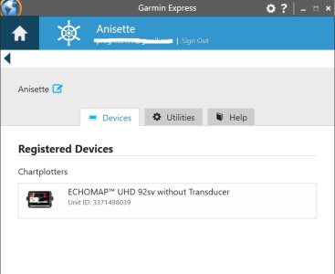
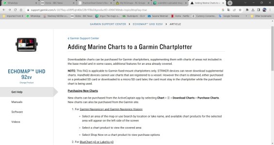
The plotter was installed last year by the 'yard' ..... it is an Echomap UHD 92v .... Active Captain ... Garmin Express ... all list it as this ..

All indications are that it is not old unit ... and definitely NOT a GPSMap unit.

I'm away for a week .... so wont have info in front of me till I return ... have that awful job of packing bag - which I'm putting off !!

em 92sv.jpg
 

Refueler

Well-known member
Joined
13 Sep 2008
Messages
20,414
Location
Far away from hooray henrys
Visit site
Seller wasn't sure about Plotter whether a 70 or 90 series ... that's why I keep posting 70 UHD ... it sticks in the mind !!

I don't know why it says without transducer as it has the typical Garmin mushroom GPS antenna on pushpit rail ... Airmar N2K 'ducer' for depth ... all connected.
 
Last edited:
Top