Digital sources of waypoints - buoys, harbours ... ?

pragmatist

Well-known member
Joined
7 May 2003
Messages
1,426
Visit site
We're about to start using OpenCPN for more than local sailing and I'm feeling lazy - hoping that our plans for the summer won't entail typing in lots of waypoints from charts or pilots, or using a mouse to position a waypoint and then type in name/details. Does anyone know of digital sources of waypoints - currently we're thinking West Country, South Coast, East Coast of the UK but who knows if we'll get further (France, Scotland) which can be uploaded (presumably gpx format) ?

Ideas welcome, comments about how hard work is good for the soul less so.
 

pragmatist

Well-known member
Joined
7 May 2003
Messages
1,426
Visit site
Pilot books - I *think* you can now download files as additional files from some of the publishers,
Thanks PhillM - looking for those but so far only finding paper versions - e.g. Cumberlidge's Channel Waypoint Guide. So if anyone knows of any which offer digital downloads I'd be very interested, despite having hordes of cruising guides (wonderful winter reading !).

There appears to be an OpenNav.com aviation database but I think many of their waypoints may be inaccessible by boat :)
 

Thistle

Well-known member
Joined
2 Oct 2004
Messages
3,991
Location
Here
Visit site
I avoid using waypoints I find in any published material. Why? Simply because a lot of other people may be using the same waypoints and, potentially, converging on the same point at the same time. The cynical side of me then suggests that if they are too lazy to work out the waypoint for themselves or don't know how to, they may also be too lazy to look where they are going or to learn the Colregs. I'm happy to take early action - at the planning stage - to avoid such folk.
Excessively cynical? Possibly. But we've all heard of fast mobos piling into navigation marks just as they reach their next waypoint: they're the kind of person I'd rather avoid on the water.
 

Sandy

Well-known member
Joined
31 Aug 2011
Messages
21,909
Location
On the Celtic Fringe
duckduckgo.com
Like @Thistle I avoid published waypoints as there is the risk that everybody has popped them in the chart plotter, put the boat on autopilot and poured a beer!

Most chartplotters allow you to touch the screen and create a waypoint. Does the mighty all singing, all dancing OpenCPN not do that?
 

James_Calvert

Well-known member
Joined
6 Oct 2001
Messages
2,537
Visit site
... comments about how hard work is good for the soul less so.

Can't resist the temptation...

Unless you are travelling at the speed of an aircraft you only actually need one waypoint at a time. So why not enter it as you need it?

OK, you might want a few more when prior planning a particular passage. But the same applies, why fill your system up with stuff you don't yet need?

The other thing is that published information cannot be taken as 100% reliable, so you need to do at least a gross error check on everything you use. Ideally you would do this as you enter stuff. But this is a pain... so keep the task manageable and it might get done.
 

johnalison

Well-known member
Joined
14 Feb 2007
Messages
41,016
Location
Essex
Visit site
Crikey, how old-fashioned can you get? It is not long ago since we had to key in the waypoint lat and long into keyboards of varying user-friendliness. For a route of half a dozen waypoints this would take me half an hour or more by the time I'd sorted it out. Now I can put in as many as I like in a couple of minutes. Naming them is pretty pointless on a plotter, though I name a few, and I can be sure that someone else's waypoints will be nowhere near where I want them, or, as stated, a potential source of collision.
 

ctva

Well-known member
Joined
8 Apr 2007
Messages
4,758
Visit site
Never use waypoints, simply create a route on the plotter each time and delete once used. No need to name waypoints or have lists, so last year.
 

PlanB

Well-known member
Joined
5 Sep 2004
Messages
2,601
Visit site
Like @Thistle I avoid published waypoints as there is the risk that everybody has popped them in the chart plotter, put the boat on autopilot and poured a beer!

Most chartplotters allow you to touch the screen and create a waypoint. Does the mighty all singing, all dancing OpenCPN not do that?
We were trained to use waypoints, but set a distance of, say, 50 m off in the chart plotter.
 

johnalison

Well-known member
Joined
14 Feb 2007
Messages
41,016
Location
Essex
Visit site
Quite apart from other considerations, a waypoint anywhere near a charted object will obscure that object on the plotter at some scales.
 

Daydream believer

Well-known member
Joined
6 Oct 2012
Messages
21,243
Location
Southminster, essex
Visit site
I enjoy working out routes & passage planning over the winter, so have over 25 set on a GPS. I do not actually use the chart plotter that much, but it is there in an emergency. I tend to sail the same waters over the years. That means that I can scribble a few compass bearings & distances on a pad from the logged route & off I go. My route to the CIs etc. is nearly always the same, as are the ones to the destinations around the Thames estuary & the Netherlands.
But for entering the waypoints, the Yeoman cannot be beaten. One can see the wider view on a paper chart, which is - in my opinion- important when passage planning. In the Thames most of my waypoints are on the edge of sandbanks. Probably explains why my son & daughter have run me aground 3 times en route to Ostend on the same spit off the Gunfleet sands just north of the old Gunfleet lighthouse on a falling tide. I tell them every time to watch the echo sounder- But can they??? :rolleyes: Nothing like peeing in the heads one minute & the basin the next, as one is thrown forward, as the boat shudders to a halt.
Having routes set enable me to work out some tides & the best dates for holidays regarding departure & arrival dates to best suit tides. One can make much better progress that way & it is always better if one can avoid having to get up at 04-00 in the morning to catch the tide.
I try to name waypoints so that I know what they mean. 200 plus numbers can be meaningless, if selecting a few for a new passage.
The only time that I use Reeds published ones are for harbour entrances. Vital forsudden appearance of fog, which has happened a couple of times over the years. I have never tried using digital ones.
 
Last edited:

awol

Well-known member
Joined
4 Jan 2005
Messages
6,835
Location
Me - Edinburgh; Boat - in the west
Visit site
The only (well, the only one I'm admitting to) near disaster I had last year was caused by the laziness (and stupidity) of inputting the co-ordinates for Belfast as a waypoint for a straight line from Arran and not looking at the chart. By the time I reached the Noriron coast it was pitch dark, had been blowing over 30kts for several hours, I was tired, oh, and was singlehanded and had not been below for a while 'cos the autotiller had packed up. The lights that I had assumed were Belfast were confusingly to the north of my planned track but the lighthouse to the south seemed to be in the right place. Then land suddenly loomed, I gybed, lay hove-to and the chart clearly showed Island Magee on the track between Arran and Belfast, the lights were Larne and no, I don't have or want a chartplotter in the cockpit - there's nowhere to put it.
 

Daydream believer

Well-known member
Joined
6 Oct 2012
Messages
21,243
Location
Southminster, essex
Visit site
, I don't have or want a chartplotter in the cockpit - there's nowhere to put it.
I know what you mean. I see no point of it being below if I sail single handed & having it on a swinging arm results in cables everywhere. Plus it would still be out of reach. . I have a death race AV100 autopilot & like you it goes wrong regularly- hence the Aeries.The control box needs to be near the helm & a chart plotter should be ditto
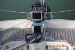
You may be interested in my solution. I have since changed the plotter & I also have a clear plastic hood over the new one.
plotter (600 x 401).jpg
 

DanTribe

Well-known member
Joined
8 Jan 2002
Messages
5,454
Location
Essex
Visit site
I was trying to show my granddaughter the basics of pilotage.
You remember ;
work out the tide time and range, get the tide direction and rate from the chart diamond, apply magnetic variation and compass deviation, estimate speed and leeway, set a compass course. often done in the dark and rain.
Then I said " but nowadays we just press a button and tell the boat to go there"
 

johnalison

Well-known member
Joined
14 Feb 2007
Messages
41,016
Location
Essex
Visit site
I enjoy working out routes & passage planning over the winter, so have over 25 set on a GPS. I do not actually use the chart plotter that much,
I enjoy setting up routes too but very differently. When we were doing 3-months cruises each year we would move on every day or two along the European coasts and seldom repeat the same one in the same year. Due to our chaotic planning process, I would never know where we would be the following week, so I would set up my route the evening before, taking a few minutes. Because we revisited the same areas often, I would delete some routes but not the waypoints, after use. I would keep some well-trodden routes and name them, such as Cuxhaven-Norderney. I found no reason to label the waypoints, though I have labelled a few, such as Pye End. One reason is that my plotter has no search facility, something that I can see would be nice, if not actually essential.
 

johnalison

Well-known member
Joined
14 Feb 2007
Messages
41,016
Location
Essex
Visit site
I was trying to show my granddaughter the basics of pilotage.
You remember ;
work out the tide time and range, get the tide direction and rate from the chart diamond, apply magnetic variation and compass deviation, estimate speed and leeway, set a compass course. often done in the dark and rain.
Then I said " but nowadays we just press a button and tell the boat to go there"
Or, "Where are we?" = 'Find Ship'.
 

jwilson

Well-known member
Joined
22 Jul 2006
Messages
6,120
Visit site
Does anyone actually USE other people's published waypoints? I cannot imagine doing so without a nagging worry as to whether they are right.

About 40+ years ago running a sailing school boat with beginners aboard I told the person helming to aim for that buoy over there (North Channel buoy after leaving Hurst) and went below to brew coffees and teas. Emerging from the companionway I was just in time to grab the tiller and by a violent S-curve miss hitting the big steel buoy by about 6 inches. Could not really fault the person on the tiller......
 
Top