tudorsailor
Well-known member
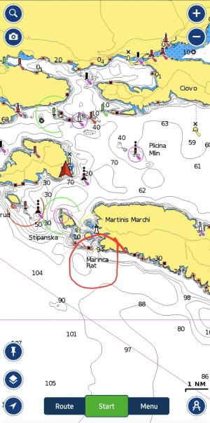
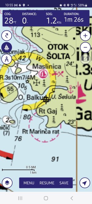
On my last trip we were sailing on the southern side of O Solta (which is near Split). I had Navionics running on my Raymarine MFD and Navionics running on a Tablet.
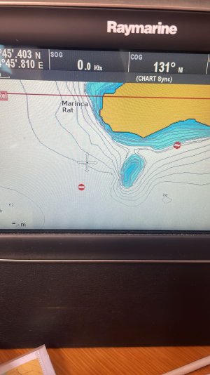
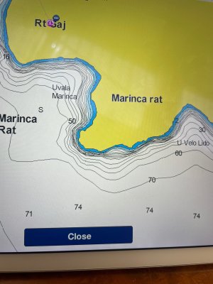
On the plotter that had charts installed about 4 weeks ago there was a shallow area but there one not shown on the tablet. On looking at my Imray paper chart I saw that the area is marked as restricted. I then updated the maps on the tablet and the shallow area disappeared and there is still no resitricted area shown A had a friend look on his phone and his tablet. Both with up to date charts from Navionics but one showed a shallow area and the other did not! On the Navionics Web viewer there is no shallow area. It is at 43°22.852N 16°12.597E I have looked at the sonar version of the chart and it does not show a shallow spot
I have contacted Navionics who say that the updated chart is correct ie no shallow
I worry that the area is in fact shallow.
Does anyone have the Croatian chart for this corner of Solta? FWIW I have sent an email to the Croatian Hydrographic office but with no reply
Thanks