Pye_End
Well-Known Member
Who was stand-on vessel?
Who was stand-on vessel?
This is often true, as the state owned ferry company’s vessels are usually yellow. For ferries run by cities and municipalities there is mostly a charge, as these are part of the public transport systems.By way of an aside, yellow ferries are free to use for vehicles and foot passengers (at least every one I've been on was free). That has an enormous economic benefit for island communities where people can commute to school or work, get deliveries from towns, visit sporting and cultural events and friends, etc. at no cost.
IIRC the ferry is usually the stand on vessel although local variations apply. Eg Poole, ferry is stand on except in relation to vessels under the command of a pilot.The ferry I would assume as restricted in ability to manoeuvre
Ref the "serious economic barrier". I don't know what happens down there, but in Scotland we have road equivalent tariff (RET), which means that the ferry charges for vehicles is roughly the same as the cost would be, if driving over the same distance on a road.There are an enormous number of yellow ferries in Sweden. Many are of the are roll-on roll-off free floating vessels (ie not line ferries), but there are a lot of line ferries too. If someone had seen only the former type then a line ferry might come as a surprise. Which of course is why they have warning signs on the shore and on the ferry, and flashing beacons.
By way of an aside, yellow ferries are free to use for vehicles and foot passengers (at least every one I've been on was free). That has an enormous economic benefit for island communities where people can commute to school or work, get deliveries from towns, visit sporting and cultural events and friends, etc. at no cost. Compare that to the exhorbiant cost of (for example) travelling on the Isle of Wight ferries that is a serious economic barrier for those living on the Island or wanting to visit it for business.
A truism of mapping and cartography is that the map is NOT the territory. All maps are representations of the territory, using conventional symbols and abstracting information that is relevant to the application. You only have to look at a road map, an OS map and a chart of the same area to see how maps for different purposes abstract and represent information in different ways.I agree the OP has no choice but to put this down to experience.
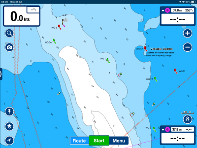
I am surprised, though, by the assumption that every feature and hazard will be on the chart. That is especially so for commercial electronic charts, but even those issued by national hydrographic agencies are only a guide to what is out there. They can never be comprehensive (indeed, a chart by definition is only partial - a selective representation/interpretation of reality - a 1:1 scale chart with everything on it is not only impossible but useless), and they can never be fully up to date.
Can't see ball-diamond-ball in post 11.The ferry I would assume as restricted in ability to manoeuvre
True, but I can’t help thinking that whoever produced the OP’s electronic chart made a sloppy job in omitting the fact that it is a cable ferry.I am surprised, though, by the assumption that every feature and hazard will be on the chart. That is especially so for commercial electronic charts, but even those issued by national hydrographic agencies are only a guide to what is out there.
But you do not know what level of chart detail the OP has set. It does look somewhat low.True, but I can’t help thinking that whoever produced the OP’s electronic chart made a sloppy job in omitting the fact that it is a cable ferry.
True. As I posted earlier it does feature correctly on the Navionics charts. Don’t know what chart the OP was using.But you do not know what level of chart detail the OP has set. It does look somewhat low.
I always work on the assumption that electronic maps / charts are produced by nerds in California or elsewhere with no understanding of cartography or hydrography.True, but I can’t help thinking that whoever produced the OP’s electronic chart made a sloppy job in omitting the fact that it is a cable ferry.
Sounds like a sensible attitude.I always work on the assumption that electronic maps / charts are produced by nerds in California or elsewhere with no understanding of cartography or hydrography.
At an early stage of my career, I had access to the UK Hydrographic Offices in Taunton and have seen the scale of the operation and amount of work that went in to compiling an Admiralty chart. While I agree entirely with the above I would be very surprised to see a commercial enterprise offering anything near an equivalent standard of quality control.However, from a consumers perspective, should we not be allowed to expect something better?
One of the risks with vector charts. Would be better if a certain level of detail was always present for a given zoom. Bit like a raster chart.But you do not know what level of chart detail the OP has set. It does look somewhat low.
Don't forget the three chain ferries at Torpoint. That appear to leave at random times just to snag any passing yacht.There are quite a few chain ferries in the UK, they do to be treated with caution.
Cowes (intermittent function!)
R Fal
R Dart
Poole harbour Sandbanks
I guess if the OP had never seen one before then it’s maybe understandable that the mistake was made. Think he was lucky to get away with no worse damage.
Yes, this wasn’t supposed to be an exhaustive list of course.Don't forget the three chain ferries at Torpoint. That appear to leave at random times just to snag any passing yacht.
Love there Restricted in Ability to Manoeuvre signs and lights even though they do head off to Falmouth from time to time for servicing.
Yes, this wasn’t supposed to be an exhaustive list of course.
")