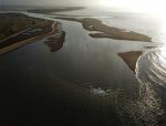
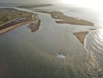
Deben entrance

Adios

...
Joined
20 Sep 2020
Messages
2,390
Visit site
The chartlet and the repositioned bouys are undoubtedly the best guide to entry or exit, combined with an eye on the depth sounder and a conservative view of the depths against chart datum.

Unless there has been a significant storm since the survey, it's likely to be good enough.
Its all seeming more professionally done than it used to be. The hand drawn chartlets in chandlers. Did the job though. All part of the fun isn't it.
 

AntarcticPilot

Well-known member
Joined
4 May 2007
Messages
10,069
Location
Cambridge, UK
www.cooperandyau.co.uk
Yeah very droll. Standard clause on such documents, daft really. The chartlet is signed off by Trinity House anyway.
All our maps of Antarctica bore the warning that the presence or absence of a feature on the map did NOT guarantee the presence or absence of a feature on the ground. Given the uncertainties of Antarctic mapping, it was sort of important - despite the maps being the best available.

"Not for navigation" is sort of shorthand for the same, with the added idea that things might have changed. It means "Don't read a series of waypoints off this map and expect to stay clear of dangers - the buoys are on a long scope and might not be where the chart says, the sandbanks move, and we might have missed something"

Anyone who doesn't have Crown Immunity pretty much has to put a warning on a map. The ideal is a statement of the limitations of the map, like that on the cover page of the map (the bit no-one reads ?), and that's the route we took. But that's too long-winded for the face of a chart or the pop-up screen of a plotter, so you get "Not for navigation" as a 21st century equivalent of "Here be Dragons"!
 

AntarcticPilot

Well-known member
Joined
4 May 2007
Messages
10,069
Location
Cambridge, UK
www.cooperandyau.co.uk
I think you've found the chink in their legal armour. Next one will say not to be used for navigation or pilotage or just "This should not be used"
I realize it's a joke answer! But pilotage implies local knowledge; navigation doesn't. So, saying it's an aid to pilotage would still place the burden on the pilot, not on the chart. I think that "Not for navigation" simply says "Do not rely on this as your sole source of navigational the information; use your eyes and any other source of data that is available to you to interpret the chart and adjust your course as necessary."

Some places it doesn't much matter - the "channel" from Pye End to Hamford Water isn't much deeper than the surroundings, except in a couple of places. But others - like the Deben entrance - it does.
 

Capt Popeye

Well-known member
Joined
30 Sep 2011
Messages
18,799
Location
Dawlish South Devon
Visit site
Yea the Walton Fort area was I recall a good Lobster fishing or potting area back in the 1950s

Also The Cut was used a lot back then, as I recall

My how the Banks have changed over time and then time again !
 

ballyabroad

Member
Joined
12 Aug 2012
Messages
214
Location
Boat River Deben, Suffolk. Home Nottinghamshire
Visit site
Just sailed out and back in over the Bar today. 3.4m depth at the Bar HW-90mins, so similar to the last couple of years. The channel between the Knolls and the beach does feel narrower adjacent to the Fort; where there is also a shallower section protruding out from the beach.

I have a suspicion it will be quite rolly in Easteries by the buoys before getting a little shelter from the outer banks.
 

Other threads that may be of interest

Top