Whoops - Boat Crashes in Ecrehous (Jersey)

ShaneAtSea

Well-Known Member
Joined
27 Jul 2020
Messages
452
Visit site
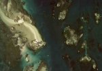
Emergency teams spent 12 hours rescuing the crew from a boat that was stranded 10ft in the air atop rocks off the coast of Jersey.

The motor cruiser collided with an underwater reef and became stuck on top of a rock on Friday morning.

Unable to move, the crew of the little vessel were plucked to safety by the RNLI and coastguards at the Ecrehous mini islands, in a rescue mission which lasted almost 12 hours.

Boat is stuck on top of rock 10ft in the air after colliding with reef

PRC_199576284.jpg
 
That's unlucky, seems like it made it back to Jersey ok and hopefully not too badly damaged.
Looks like it was east of the pebble bank at Marmotier away from the safety of the main NS channel.
 

Attachments

  • 2021.jpg
    2021.jpg
    51.1 KB · Views: 81
That's unlucky, seems like it made it back to Jersey ok and hopefully not too badly damaged.
Looks like it was east of the pebble bank at Marmotier away from the safety of the main NS channel.

For someone looking to buy my first boat this is my worst nightmare.

I'll buy buying a boat that has Garmin or Simrad systems installed. And an iPad with Navionics

What do you think is the cause?

Poor planning or not having the right equipment/software that wouldve warned them?

Or both

:cautious:
 
It's been 12 years since the last visit I used to bass fish out there for hours and hours on end as a kid. Looks likely to have either anchored in the "pool" and dragged, tide rips through there when there's enough water, or just drifted then been caught by a rapidly falling tide.

Most chart plotters will just have green there, not enough detail to show each cluster of rocks.
 
Could be any number of things - high tide can be disorientating without all the rocks showing amidst the expanse of green on the plotter. Definitely easier around low tide to pick your way round.

You don't really want to be going too off piste round that way though.


1631615967462.png
 
For someone looking to buy my first boat this is my worst nightmare.

I'll buy buying a boat that has Garmin or Simrad systems installed. And an iPad with Navionics

What do you think is the cause?

Poor planning or not having the right equipment/software that wouldve warned them?

Or both

:cautious:
Might I humbly suggest that the best way would be to learn to navigate and use all available means to watch what's happening. Plotters are brilliant, but ignore the echo sounder and transits and clearing bearings at your peril. The only thing that tells you reality in real time is the echo sounder and your eyes. After all, the plotter is only as good as the charting that's fed into it... (And sometimes you're safer actually going across the green and shallow bits on the chart!)
 
Difficult to pass that off as 'drying out for a bottom scrub'. :ROFLMAO:

We visited Les Eschrou about twenty years ago and having dropped anchor inside the pool (spring tides) calculated that we 'might' just stay afloat; I think the tidal prediction said we'd dry out by 2 or 3", but the air pressure wasn't very high. It was clean sand under us and the pilot book suggested (correctly) that the tides through the channel outside were wicked, so as the tide dropped we deployed a second anchor to ensure we'd touch down on sand and around and hour or so before low tide we went ashore in the dinghy for a walk around on the beach and tidal flats.
We got back to those cottages at just about low tide and sure enough the boat was clearly aground and slightly canted over, so we sat around chatting to people waiting for the tripper-boat home and a couple of other yotties, all of whom were most concerned about the 'little yacht that was aground and possibly going to sink' and concurred with their opinions about the idiots who'd foolishly abandoned it there. Once she'd refloated we said our farewells and rowed back out to enjoy a very pleasant night (the following morning's low water was predicted to be 4" higher.) at anchor.
 
Might I humbly suggest that the best way would be to learn to navigate and use all available means to watch what's happening. Plotters are brilliant, but ignore the echo sounder and transits and clearing bearings at your peril. The only thing that tells you reality in real time is the echo sounder and your eyes. After all, the plotter is only as good as the charting that's fed into it... (And sometimes you're safer actually going across the green and shallow bits on the chart!)

Yes and don't go for Les Ecrehous on springs as a first voyage! It's considered the easier of the 2 offshore reefs too, but it is still challenging for anyone not familiar with big tides.

This boat wasn't the first and won't be the last to do that, no one hurt so in the end no real harm done.
 
Might I humbly suggest that the best way would be to learn to navigate and use all available means to watch what's happening.

+1, this is the best advice Shane.
If you can still buy paper charts for the area where you will be boating, I still think that they are a useful backup - and you can use them for doing practical stuff like learning how to plot courses with a pencil, rather than punching buttons on your electronic plotter.

Of course i aim to use charts and tide tables for planning and then use the chart plotter as navigation

So are you saying that if i was to plot that course using Navionics it wouldnt tell me the location and depth of those rocks?

I thought that was the whole point of them of the software etc

:confused:
Paper , paper , paper + clock + tide tables .
Many moons ago in the 80s used to regularly sail to the Channel Islands and back in a long week end out of Bosham quay .
Not an electronic aid in sight in the early 80 s

Think of the “ software “ as an add on luxuary not a necessity.

Yes one night outside Alderney entrance we anchored and someone on anchor watch nodded off .
I woke up at dawn ( June light through the open port ) to see a rock about 3 M from the boat through my Port hole .
Nothing lost we just engine on ed and motored off carefully studying the chart .
Iirc went to Sark for the day before that night , yes at night sailing back to Bosham to meet enough water to cross Chi bar .

Fast fwd almost 40 yes you never forget the old ways .
Partly why my eyes glaze over reading plotter , I pad , + other threads tech threads .
 
Of course i aim to use charts and tide tables for planning and then use the chart plotter as navigation

So are you saying that if i was to plot that course using Navionics it wouldnt tell me the location and depth of those rocks?

I thought that was the whole point of them of the software etc

:confused:

It depends on how far in or out you've zoomed.

Plus you'd be using pilotage through there, rather than navigating per se.
 
So are you saying that if i was to plot that course using Navionics it wouldnt tell me the location and depth of those rocks?
Navionics might or it might not. It depends where you are in the world, when it was surveyed etc etc. Although the rocks don't move very much, whether they are where the plotter thinks they are is a big question. Even in our relatively well charted wayters of Europe, I can take you to plenty of places where the chart plotter will claim that you are in 'x' metres of water, but the reality is you're in another depth altogether.

Lots of people who hit rocks etc, or go aground think they know exactly where they are. Safe navigation is definitely NOT driving your boat along the screen on the Navionics display on your plotter.
 
Last edited:
Of course i aim to use charts and tide tables for planning and then use the chart plotter as navigation

So are you saying that if i was to plot that course using Navionics it wouldnt tell me the location and depth of those rocks?

:confused:

No, I never said anything like that.
I simply said that if you acquire some paper charts, you can learn the basic principles of navigation by using them, as referred to by Porto above, rather than just plotting way points on your plotter.

And as st599 notes above, it depends on how far in / out you are zoomed - there was a high profile incident some years ago of a racing yacht in the Volvo Ocean Race around the world literally crashing into a reef in the Indian Ocean at full speed at night - simply because they did not know it was there, because nobody had zoomed in enough on the plotter to bring it up.
 
Top