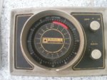
When was the last time you used Dead Reckoning/Estimated Position or took bearings in anger?

john_morris_uk

Well-known member
Joined
3 Jul 2002
Messages
27,925
Location
At sea somewhere.
yachtserendipity.wordpress.com
Best instrument on a yacht for me.
That and the echo sounder.

Last week I helped sail our daughters little Pandora 700 from Portsmouth to Cherbourg. No plotter, no radar and no AIS. We used a combination of HBC and Navionics on our phones. As the ships compass hadn’t been swung, one of the first things I did was to make sure it was reading accurately!

We did do some basic passage planning to make sure we didn’t end up down wind and down tide of our destination. In the event we touched over 8 knots over the ground as the tide took us past Pte de Barfleur.
 

flaming

Well-known member
Joined
24 Mar 2004
Messages
15,940
Visit site
I don't think I've ever had to navigate "in anger" using only DR etc. The most like that came back when I was earning my crust driving corporate race charters. One day we were out in the eastern solent when the biggest blackest cloud I have ever seen materialised. I nipped below and got my foulies and rolled the jib, then as it started to rain absolute stair rods sent all the guests (who had no foulies) below. I've never seen anything like it in UK waters, before or since. Visibilty dropped to maybe 3 boatlengths and the noise of the rain made it absolutely impossible to communicate with anyone not sat right next to you. With no autopilot I was now confined to the helm. I quickly realised my next problem.. Namely that I now had no visual references and whilst I had a full set of charts, a GPS and a plotter... They were all at the chart table and I wasn't. And even if I could have communicated with them, the only other people on the boat had no idea what they were or how to use them. Nor could I trust them to helm in the squally rain, even if they'd had suitable foulies... As I'd been in the main channel between Mother Bank and South Ryde middle when the rain arrived I also needed to move in case a large ship arrived... So I chose to steer a bit west of South and watched the depth sounder. I started to relax a bit once the depth showed I was out of the main channel. I then angled a little more West until I found 5m of water, then followed that contour around to Osbourne Bay. I was just starting to think I'd probably arrived as the course I was steering to maintain the 5m contour was getting close to North West when the rain cleared and yep, smack in the middle of Osbourne bay just outside the anchored boats. Felt quite good about that bit of blind nav from memory... If the rain hadn't cleared then my plan was to keep going until the 5m contour trended west again, then reverse my course and just plod up and down the 5m contour somewhere near Osbourne Bay until it did. Rain like that clearly wasn't going to last that long!

More generally however, I also don't think that the use of GPS and chartplotters etc means that you stop using all of the traditional techniques. It's just that some of them get more accurate and easier. For example, if you are tacking up a channel with a "hard edge" (say between Thames estuary sandbanks) in less than perfect conditions then a waypoint set on that edge of the channel and a "don't go above/below X BTW" and is easy to keep safe with reference to just 1 number display on the instruments. If you use a waypoint in the middle of the channel, then the BTW that puts you on the bricks changes as you get closer to the waypoint, so this relies on looking at the plotter to see where you are in relation to the dangerous edge of the channel. Yes you could use XTE, but this requires a lot more measuring on the plotter to work out what your safe max XTE is...
Of course traditional navigators know this technique of a max/min bearing as a clearing bearing, it's nothing new, just applied using technology to help. There is sometimes a school of thought that GPS means you stop using those techniques. I don't think so, it just makes them easier. And available in circumstances when you can't actually see the navigation mark...
 

Dutch01527

Well-known member
Joined
7 Jul 2016
Messages
687
Visit site
Close to land knowing where you are is essential. Crossing oceans it is really not as important as you might think.

A long time ago as a Merchant Navy officer we crossed the Atlantic to Mexico (before GPS) and cloud cover prevented celestial sights being taken for a week. DR position‘s from all navigators were all accurate to within about 20 miles when we made landfall.

Also took a coaster from Fleetwood, Lancashire to Tripoli, Libya with no charts after leaving the channel or Navigation aids whatsoever except radar. University holidays cash job with cowboy company and alcoholic Captain. I bought a European road atlas from WH Smith’s. Horrified me that we would even attempt it but it was pretty easy - keep well away from land using radar, DR for the Biscay ect and do not hit any islands
 

johnalison

Well-known member
Joined
14 Feb 2007
Messages
41,012
Location
Essex
Visit site
I think that most of us could make a decent job of setting and following a course with DR. The real test would come when the expected destination didn’t appear and there was no visible or electronic means of fixing the position. I am glad to say that I have never really been in this position since France and the Netherlands are quite big. There was one early occasion when I led another boat through fog and after fifty miles, partly cross tide Dieppe appeared on the nose, for which I got great credit, while I kept quiet about what I would have done if it hadn’t.
 

Kelpie

Well-known member
Joined
15 May 2005
Messages
7,767
Location
Afloat
Visit site
Yes, very impressive.

However, it used to be the case that in order to obtain an MCA Boatmaster's Licence the candidate had to demonstrate a thorough knowledge of the licence area so as to not need to refer to a chart while navigating in the area. All lights, buoys, marks, hazards, tidal streams etc had to be known along with the safe courses. Likewise candidates for a ship's Pilot Licence have to demonstrate a similar level of knowledge for their area.

It may well still be the case but I am a bit out of date.

I did a BML a few years ago, but for my area there was only one nav marker (light on the end of a breakwater). I was expected to know it, of course
 

AntarcticPilot

Well-known member
Joined
4 May 2007
Messages
10,589
Location
Cambridge, UK
www.cooperandyau.co.uk
I guess that most of us keep a mental picture of our position with respect to dangers, landmarks etc. I do it almost without thinking. It's not precise navigation; it's more a case of where are the hazards and which way do I go to avoid them. It's always worth remembering that DR is NOT precise, as Sir Cloudesly-Shovell and 2000 others would testify if they were able! Unfortunately, GPS encourages us to assume that all navigation is precise, and gives us unrealistic expectations of other methods. Given that compasses are only graduated to a degree, and that few helms can hold a course that accurately, the likely error after a mile from that alone is at least 33 m and increases proportionately with distance run; In practice, the error is more likely to be 100m per mile run, given the uncertainties in estimating tidal streams, leeway, log errors and so on.
 

Neeves

Well-known member
Joined
20 Nov 2011
Messages
13,186
Location
Sydney, Australia.
Visit site
A long time ago, actually at the time GPS was introduced we sailed back from Manilla to HK using dead reckoning. There was no need to take bearing - there is no land between Manilla and HK. We did sail up the coast to shorten the distance we sailed without reference to land.

We assiduously monitored speed and distance ran using a Walker type log and bearings. We did have a GPS, leant to us, but we did not note the important function that we needed to input which hemisphere we were for the device to work - we worked this out when we were about 10 miles from HK. We were confident we were going, roughly right, as at night the aircraft were all going in the same direction we were or coming from that same fixed point.

When we arrived in HK, 450nm later, we were 10nm in error, nearer Macau.

We now have 3 GPS, one that I bought not long after the passage, above (it can be AA battery powered). It was a Pronav 100 and simply gave lat and long. A 25 year old Raymarine chart plotter and a more recent Simrad chart plotter. I cannot imagine why we would need to use DR.

However when we transit Australia's east coast we simply count lighthouses - does that count? :)

Jonathan
 

srm

Well-known member
Joined
16 May 2004
Messages
3,248
Location
Azores, Terceira.
Visit site
Having a steel boat and unable to take reliable RDF bearings I made a number of Shetland / Norway crossings using DR in the 80's. Norway was easy to find, though the safe gaps between the islands could be elusive. Shetland was a smaller target but I was always close enough to either the north or south mouths to Lerwick harbour.

My first approach to the Norwegian coast in the later 70's on a GRP boat was in poor visibility and used a combination of a running fix plotting RDF bearings every six minutes until the echosounder lost the bottom. This gave me a contour that was the edge of a glacial trench out of the gap between the islands I was trying to find and a rough position. Then used the RDF bearing as a course towards the lighthouse at the side of the channel.
I mentioned this during my YM exam only be told that I could not do that as it was not accurate enough. My question "what else should I have done?" was met by silence.

Navigation used to be both an art and a science.
 

dunedin

Well-known member
Joined
3 Feb 2004
Messages
14,067
Location
Boat (over winters in) the Clyde
Visit site
On reflection I don’t think I have ever plotted a three point bearing / cocked hat on a chart in half a century or so of boating.
Used hand bearing compass quite often in the past for confirming transits, anchor watch and ship clearance.
Never noted an EP on a chart, though when out of sight of land do record Lat/Lon in notepad on regular basis (1-6 hours depending on how far from land)
 

ctva

Well-known member
Joined
8 Apr 2007
Messages
4,758
Visit site
Last done in April on checking some exam candidates.

Personally when sailing, I tend to double check bearings on dangers when close and for identifying objects. Always have the HBC close to hand but use the plotter or iPad for 90% of nav.
 
Top