Weather info when offshore

madabouttheboat

Well-known member
Joined
20 Jan 2005
Messages
1,351
Location
UK, but for Covid it's England
Visit site
Im a MoBoer and getting weather is usually pretty simple as I'm normally in port overnight or close to shore so I pretty much always have a phone signal. I got to wondering the other day, when a sailor heads offshore, say across the Atlantic, and is going to be at sea for a few weeks, how do you/they get updates? I guess you set off with a favourable forecast, but beyond say 3 or 4 days what are the options to keep an eye on things? You can't all carry expensive sat phones, do you?
 

Roberto

Well-known member
Joined
20 Jul 2001
Messages
5,158
Location
Lorient/Paris
sybrancaleone.blogspot.com
Options for all tastes and budgets, depending on area :
LF/HF voice bulletins
Radiotelex/rtty bulletins
Navtex
Radiofax charts
Data via SSB email (free if amateur, fee if through sailmail or equivalent)
Low-end satellite (iridium/inmarsat phones) is basically similar to SSB as to speed, high end/high speed have a look at Starlink or Inmarsat terminals.
Plenty to choose from :)

addition
there are also several other types of satellite "messagers" like InReach, Spot, etc, they can sometimes deliver small SMS style messages, with a weather-wise friend ashore people can send an SMS with their position/local conditions and the person ashore can advise as to the best route. For the price conscious sailor, it works also with Iridium and Isatphone sms facility, free for the land sender and very small charges for the phone owner onboard.
 
Last edited:

GHA

Well-known member
Joined
26 Jun 2013
Messages
12,289
Location
Hopefully somewhere warm
Visit site
Would be interesting to see from a much larger sample size but getting a realistic handle on what's most popular probably won't happen on this forum. The Arc published this > Survey of Comms for an Atlantic crossing – Yachting World


Radiofax charts
That's my go to but for the past few days on an ocean passage I got nothing readable, just when I really wanted to have a look. No idea why, then last night I hove to & went to bed 25 Nm south of Madeira rather than come in at night and turned on the radio & DWD was clear as a bell. Your name rang a bell as well which may well explain something, see Von Karman vortices post
 

GHA

Well-known member
Joined
26 Jun 2013
Messages
12,289
Location
Hopefully somewhere warm
Visit site
So anyone spending a week or 3 out in the ocean on here care to share what they actually use?

Geem mentioned getting reports sent to a garmin inreach, I like weatherfax, using a ham radio. Even if it didn't work for some reason a few days ago, it's usually OK.

Anyone else?
 

Fr J Hackett

Well-known member
Joined
26 Dec 2001
Messages
64,514
Location
Saou
Visit site
People should ask the question as to why and what use would they put weather forecasting to use when seriously offshore. eg a Biscay crossing whilst in most peoples minds is offshore does not really require it as an accurate 3 to 5 day forecast is obtainable before leaving. Contrast that with an Atlantic or Pacific crossing where after a few days you are on your own and grib forecasts of seastate and wind etc is available via internet from satellite ( Starlink Iridium etc) or the classic HF derived synoptic charts which are used for long term routing purposes. The alternative is as Sandy has said is to use tradition observations but that is only going to give you indications of the immediate one or two days advance warning of incoming weather which may or may not enable you to ameliorate your exposure and risk as well as setting up the boat by reducing sail etc to deal with anticipated conditions. Of course there is also the again traditional land based routing / forecast which is/ was largely reliant on HF comms.
The OP as a motor boat owner should bear in mind what yacht owners do with forecasts ie they don't generally travel in straight lines following the rhumb line but use the wind direction to their advantage and will on a long offshore passage will change the point of sail to avoid calms as well as high winds to maximise the efficiency of the yacht.
 

geem

Well-known member
Joined
27 Apr 2006
Messages
7,536
Location
Caribbean
Visit site
So anyone spending a week or 3 out in the ocean on here care to share what they actually use?

Geem mentioned getting reports sent to a garmin inreach, I like weatherfax, using a ham radio. Even if it didn't work for some reason a few days ago, it's usually OK.

Anyone else?
Most people we met on our travels use a Garmin Inreach. Increasingly, people are using Starlink with an Inreach as back up. I think we will buy Starlink before our next trans Atlantic in 2025. We will likely just use it for a month for the crossing then switch to the Digicel SIM that you can buy in Martinique and covers the whole Caribbean. 100GB for €35 is hard to beat
 

capnsensible

Well-known member
Joined
15 Mar 2007
Messages
43,923
Location
Atlantic
Visit site
I've been very impressed with Inreach and used it a few times on long passages. Did fail in coverage mid Pacific though but that may just have been some kinda glitch.

Had a lot of problems with Starlink on a Spain to Canaries passage this year. Mostly over the cost of willy nilly roaming.

Mind you. I've managed 4 Atlantic crossings with a barometer, but it's nice to have a fairy godmother. :)
 

AntarcticPilot

Well-known member
Joined
4 May 2007
Messages
10,160
Location
Cambridge, UK
www.cooperandyau.co.uk
Perhaps worth noting that a yacht on an ocean crossing passage is not likely to be capable of avoiding weather systems, only mitigating the severity of their impact. Weather forecasting beyond 5-7 days is very unreliable, and weather systems are hundreds of miles across, with uncertainties in their position and track that increase the further ahead you're looking. So the forecast is mainly useful to ensure you're heading for the favourable side of a weather system, not completely avoiding them. As sailing vessels (the vast majority of ocean crossers) take factors like trade-winds into account when planning their route, this is less useful than it seems to denizens of Europe.
 

geem

Well-known member
Joined
27 Apr 2006
Messages
7,536
Location
Caribbean
Visit site
Perhaps worth noting that a yacht on an ocean crossing passage is not likely to be capable of avoiding weather systems, only mitigating the severity of their impact. Weather forecasting beyond 5-7 days is very unreliable, and weather systems are hundreds of miles across, with uncertainties in their position and track that increase the further ahead you're looking. So the forecast is mainly useful to ensure you're heading for the favourable side of a weather system, not completely avoiding them. As sailing vessels (the vast majority of ocean crossers) take factors like trade-winds into account when planning their route, this is less useful than it seems to denizens of Europe.
If you are crossing the Atlantic from East to West, you are usually in trade wind conditions. The main variable is wind speed with winds predominately having and Easterly component. Crossing the Atlantic west to east it totally different. No trade winds. You need to steer a route through low pressure systems and high pressure systems. Positioning yourself successfully to get favourable winds can make the difference between a fast crossing with plenty of sailing or a slow crossing with lots of motoring. Worse case is the wrong side of a low pressure system, as you say, but large lows tend to be well forecast such that you have plenty of time to position yourself in the right spot for the movement of the low. You don't always want to avoid the low. They are after all, favourable SW winds if you position yourself on the bottom of the low. This is what we did on a recent crossing. We had strong winds for 24 hrs but hung on to the low for another 48hrs worth of good winds to propel us on to the Azores
 

GHA

Well-known member
Joined
26 Jun 2013
Messages
12,289
Location
Hopefully somewhere warm
Visit site
Perhaps worth noting that a yacht on an ocean crossing passage is not likely to be capable of avoiding weather systems, only mitigating the severity of their impact.
W to E would agree with that, you'd have difficulty finding any experienced ocean sailor who would say you can out run the weather in anything other than a hyperspeed racing machine. Though 4 days ahead even 50 odd miles south could take the sting out of a N Atlantic cold front up around 38N & maybe let you go onto port tack reefed down before the front hits so no need to gybe in the worst of it.
Though mostly IMHO we just kid ourselves to a large extent. Barometers are great but do nothing apart from let you know it's knocking at your door, was it Blondie Hasler who threw his barometer over the side as the boat was always ready anyway & he preferred relaxed ignorance to knowing something was going to happen he could do nothing about?

Over the years I reckon most of the "gang" I've been with just go & take what comes mostly, once out there you won't change things that much. Depends who you hang out with & how big the budget is.

Though saying that, after the past week getting shaken & stirred by what looks very much like Von Karman vortices, Von Karman vortices rock the boat, satellite images straight from noaa satellites could well make a difference now & then showing significant weather features which the models completely fail to show on the model output. Just be pretty easy to impliment with a raspberry pi & another antenna on the radar arch. Going a fair bit W would have made that passage much less of a fairground ride.


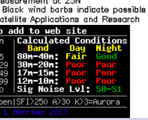
(Edit - maybe it's not personal about wfax 😁 1717279881493.png)
 
Last edited:

GHA

Well-known member
Joined
26 Jun 2013
Messages
12,289
Location
Hopefully somewhere warm
Visit site
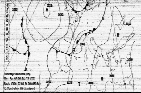
Little update in the off chance someone might actually be interested. Been a while since I've played with the ham radio offshore, but it worked well. Wfax reception was sketchy but good thing about wfax is even with lots of interference you can very often still see enough for it to be useful. Rfax schedule was out of date even though it was a fairly recent download. One more for the "before ocean passage" checksheet. This was forecast from 2 days before suspected landfall, though with a cut off low around all bets are off for any kind of accuracy, they just do whatever they want from moment to moment >
1718012287797.png

Winlink, which lets you (slowly) send & receive emails over ham radio got a grib which turned out to be accurate enough to be useful. Maybe just by chance the cut off low did what the models thought 2 days ahead.
Latest winlink software is $70!! Otherwise very, Very slow & cuts off every 5 minutes. Boat gets what the boat needs so paid & tried it out just now. Clear as a bell connection from Algarve to Switzerland & only took 1 minute to download a 5k 4 day grib. Worth the dollars!!
There are a fair few position reports in winlink so ham is still very much still alive & well in the world girdler cruising community, not round Europe though.
Starlink seems to be the new thing for thems with the budget 🙂

Anyone have experience getting wfax outside the north atlantic?
 

Roberto

Well-known member
Joined
20 Jul 2001
Messages
5,158
Location
Lorient/Paris
sybrancaleone.blogspot.com
Winlink, which lets you (slowly) send & receive emails over ham radio got a grib which turned out to be accurate enough to be useful. Maybe just by chance the cut off low did what the models thought 2 days ahead.
Latest winlink software is $70!! Otherwise very, Very slow & cuts off every 5 minutes. Boat gets what the boat needs so paid & tried it out just now. Clear as a bell connection from Algarve to Switzerland & only took 1 minute to download a 5k 4 day grib. Worth the dollars!!
There are a fair few position reports in winlink so ham is still very much still alive & well in the world girdler cruising community, not round Europe though.
20 y ago I was beta tester for Winlink previous software "Winmor", it was slow indeed but one could get small files through, even had a medical email conversation while on transat, happily no need to send pictures.
A few years ago WinMor tnc has been superseded by Vara (+Ardop), still used through Winlink Express: Vara is really a bomb, speeds between Pactor 3 and Pactor 4, a few days ago I downloaded a 50k file in a matter of minutes. The software ramps up and down data transfer speeds every few seconds depending on conditions, it begins at low speed and increases it as it goes, the larger the file the higher likely speed (I saw a peak at 12k, more than Iridium).
With small files, say a few kb, most of the connection time is for "handshaking" with the land station, once data transfer begins it's impressively fast (by SSB/Iridium standards, Starlink is of course on a different planet). Do not hesistate to give it a try with larger files.
Guess "Switzerland" was HB9AK, very powerful signal I touched receiving at +10/15dB inside a marina. :)

If you log on to Winlink.org, then --> "Message viewer" it will open a window with all messages being exchanged by at least one US ham station (they made it for FCC compliance), you'll see the amount of messages with grib requests, positions reports, saildocs queries etc which are definitely from maritime users, and that is only US hams, there are many many others from everywhere just look at active callsigns in Winlink other pages. Excellent system :)

Also, if one is "late" with the weatherfax schedule and loses some (typical early morning sleep with US charts) , most image files are available in about 15k files, they can be downloaded later very rapidly.
 
  • Like
Reactions: GHA

franksingleton

Well-known member
Joined
27 Oct 2002
Messages
3,499
Location
UK when not sailing
weather.mailasail.com
Options for all tastes and budgets, depending on area :
LF/HF voice bulletins
Radiotelex/rtty bulletins
Navtex
Radiofax charts
Data via SSB email (free if amateur, fee if through sailmail or equivalent)
Low-end satellite (iridium/inmarsat phones) is basically similar to SSB as to speed, high end/high speed have a look at Starlink or Inmarsat terminals.
Plenty to choose from :)

addition
there are also several other types of satellite "messagers" like InReach, Spot, etc, they can sometimes deliver small SMS style messages, with a weather-wise friend ashore people can send an SMS with their position/local conditions and the person ashore can advise as to the best route. For the price conscious sailor, it works also with Iridium and Isatphone sms facility, free for the land sender and very small charges for the phone owner onboard.
I would only add that, using SSB radio or Satphone, data compression is necessary. Saildocs provides a free system to get GRIB data and texts of many web pages. See their site or my, hopefully simplified, version at http://weather.mailasail.com/Franks...l.com/Franks-Weather/Saildocs-Free-Grib-Files and SailDocs Models - Franks-Weather - The Weather Window.
The Saildocs service is the only one that gives total control of the size of GRIB forecasts.

A useful service for High Seas forecasts and NAVTEX forecasts is the WMO-IMO WWMIWS.
 
Last edited:

GHA

Well-known member
Joined
26 Jun 2013
Messages
12,289
Location
Hopefully somewhere warm
Visit site
20 y ago I was beta tester for Winlink previous software "Winmor", it was slow indeed but one could get small files through, even had a medical email conversation while on transat, happily no need to send pictures.
A few years ago WinMor tnc has been superseded by Vara (+Ardop), still used through Winlink Express: Vara is really a bomb, speeds between Pactor 3 and Pactor 4, a few days ago I downloaded a 50k file in a matter of minutes. The software ramps up and down data transfer speeds every few seconds depending on conditions, it begins at low speed and increases it as it goes, the larger the file the higher likely speed (I saw a peak at 12k, more than Iridium).
With small files, say a few kb, most of the connection time is for "handshaking" with the land station, once data transfer begins it's impressively fast (by SSB/Iridium standards, Starlink is of course on a different planet). Do not hesistate to give it a try with larger files.
Guess "Switzerland" was HB9AK, very powerful signal I touched receiving at +10/15dB inside a marina. :)

If you log on to Winlink.org, then --> "Message viewer" it will open a window with all messages being exchanged by at least one US ham station (they made it for FCC compliance), you'll see the amount of messages with grib requests, positions reports, saildocs queries etc which are definitely from maritime users, and that is only US hams, there are many many others from everywhere just look at active callsigns in Winlink other pages. Excellent system :)

Also, if one is "late" with the weatherfax schedule and loses some (typical early morning sleep with US charts) , most image files are available in about 15k files, they can be downloaded later very rapidly.
Thanks!
It was indeed HB9AK. Just did a test, shrunk a synoptic & saved as a jpg onto a linux machine I have in the cloud the downloaded that using saildocs send http... , 27K file, and it worked, could hear the speed ramping as you said with noise coming 6 going.
So fantastic!!
Satellite images next 😎
And some metal round the Rasp Pi, tuning the ham radio trips that out, or rather the gps & sensors go offline.
 
Top