dukes4monny
Well-Known Member
The following is quite a long post, but I hope that some might find it useful.........
I've done the RYA DS and YM theory courses and a DS practical course, all have been very useful, BUT, now I have my own yacht I was not happy with using some of the navigation methods which I had been taught......I'll try and explain:
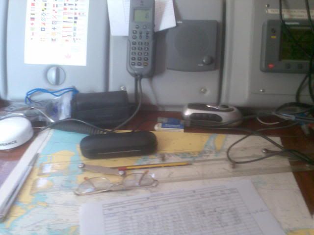
I find that taking manual plots (hand bearing compass) with a small chart table onto a chart is frought with possible errors and I end up double and treble checking everything...........basically it was taking too long down below especially when short / single handed and trying to show an inexperienced crew how to do this would take too long.
My yacht came fitted with a nice Navman plotter, the dogs dooda's, turn it on and I know where I am, job sorted........but, as we all know these things are prone to failing and should not be relied on too much.......and I did want a backup of my position on the paper chart just in case this happened.
Yes, I can get the Lat/Long from the plotter (fitted in the cockpit) and plot this directly on the chart, but as we all know this is fairly easy when navigating a desk in the classroom, but when doing this in a choppy sea under way with a small nav station it is far from easy.........or accurate.
After considering my options, I have come up with a solution which has made my navigation a lot easier and accurate and I am actually starting to enjoy it and it's fairly easy to teach a novice........
I now use my trusty handheld GPS and charts in the following way:
For each chart I create a waypoint (or two) which I call my waypoint 'datum' e.g. WPD1. This is simply a convenient point on the chart which allows me to enter a simple (round) lat/long, this reduces possible typing errors. This is marked on the chart and is entered into the GPS with the same name. Some books suggest using the center of the compass rose.......this is ok if this coincides with a nice 'round' lat/long.........which is not always the case.
I can then enter my route waypoints with appropriate names (WPT1 - WPT2 etc.).
When underway and I want to plot my current position on the chart I simply select the waypoint datum for the current chart (WPD1 etc.) in the GPS and this instantly gives me the range and bearing TO that datum, which I then simply plot directly (adjusted for True) onto the chart to the datum point with my Breton plotter and dividers which takes seconds...........
When done simply switch the GPS back to the current route waypoint.
I know that this relies on the GPS.......my handheld uses batteries which will run it for 24 hours, and I still have the chartplotter as back up........and if all that fails I still have my paper chart too.......
I like to keep things simple and as you can probably tell I'm definately a belt and braces (with a spare belt.......and braces) type of person.
I'm sure that some people might be able to pick holes in my method.........but I'm happy with it. It's got me doing my navigation using paper charts, and I am able to relax a bit more on longer passages /forums/images/graemlins/grin.gif
PS, having re-read this it's probably a more appropriate method for those with small chart tables..........
I've done the RYA DS and YM theory courses and a DS practical course, all have been very useful, BUT, now I have my own yacht I was not happy with using some of the navigation methods which I had been taught......I'll try and explain:
I find that taking manual plots (hand bearing compass) with a small chart table onto a chart is frought with possible errors and I end up double and treble checking everything...........basically it was taking too long down below especially when short / single handed and trying to show an inexperienced crew how to do this would take too long.
My yacht came fitted with a nice Navman plotter, the dogs dooda's, turn it on and I know where I am, job sorted........but, as we all know these things are prone to failing and should not be relied on too much.......and I did want a backup of my position on the paper chart just in case this happened.
Yes, I can get the Lat/Long from the plotter (fitted in the cockpit) and plot this directly on the chart, but as we all know this is fairly easy when navigating a desk in the classroom, but when doing this in a choppy sea under way with a small nav station it is far from easy.........or accurate.
After considering my options, I have come up with a solution which has made my navigation a lot easier and accurate and I am actually starting to enjoy it and it's fairly easy to teach a novice........
I now use my trusty handheld GPS and charts in the following way:
For each chart I create a waypoint (or two) which I call my waypoint 'datum' e.g. WPD1. This is simply a convenient point on the chart which allows me to enter a simple (round) lat/long, this reduces possible typing errors. This is marked on the chart and is entered into the GPS with the same name. Some books suggest using the center of the compass rose.......this is ok if this coincides with a nice 'round' lat/long.........which is not always the case.
I can then enter my route waypoints with appropriate names (WPT1 - WPT2 etc.).
When underway and I want to plot my current position on the chart I simply select the waypoint datum for the current chart (WPD1 etc.) in the GPS and this instantly gives me the range and bearing TO that datum, which I then simply plot directly (adjusted for True) onto the chart to the datum point with my Breton plotter and dividers which takes seconds...........
When done simply switch the GPS back to the current route waypoint.
I know that this relies on the GPS.......my handheld uses batteries which will run it for 24 hours, and I still have the chartplotter as back up........and if all that fails I still have my paper chart too.......
I like to keep things simple and as you can probably tell I'm definately a belt and braces (with a spare belt.......and braces) type of person.
I'm sure that some people might be able to pick holes in my method.........but I'm happy with it. It's got me doing my navigation using paper charts, and I am able to relax a bit more on longer passages /forums/images/graemlins/grin.gif
PS, having re-read this it's probably a more appropriate method for those with small chart tables..........