dunedin
Well-Known Member
There are perhaps a few more material differences between flying an aircraft and sailing a yacht than converting from feet to metres ;-)My point missed methinks.
There are perhaps a few more material differences between flying an aircraft and sailing a yacht than converting from feet to metres ;-)My point missed methinks.
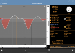
Tidal curves are nevertheless useful especially when anchoring. In the attached example it can be seen that the tide is predicted to fall another 6 feet, irrespective of atmospheric pressure, the change is the same. So very useful when deciding where to anchor if you want to get as close to shore a possible.Graphs look pretty, but I have to question their accuracy for areas with unusual tides.
This one looks pretty for my club
View attachment 147829
but, in reality, after high water the tide drops very slowly for an hour or two, then someone pulls the plug and the bath empties. I'd love an app that does the local calculations for each hour to draw a graph, but I've yet to find one, so I've given up on graphs, as they seem to give a false sense of accuracy.

The big problem that I have with these online websites / apps is none of them show the double or extended high water say at Poole. The picture is from admiralty tides NP 191/94 Swanage to Chichester. I don't think it is in print any more but keep laminated copies on board.
View attachment 147961

Which website or app is that ?
Tides Planner by ImrayWhich website or app is that ?
The Absolute Tides app certainly does show the double/extended HW, just as the other two examples quoted above.The big problem that I have with these online websites / apps is none of them show the double or extended high water say at Poole. The picture is from admiralty tides NP 191/94 Swanage to Chichester. I don't think it is in print any more but keep laminated copies on board.
View attachment 147961
The Absolute Tides app (which uses UKHO data) seems to show the complex double high water at PooleThe big problem that I have with these online websites / apps is none of them show the double or extended high water say at Poole. The picture is from admiralty tides NP 191/94 Swanage to Chichester. I don't think it is in print any more but keep laminated copies on board.
View attachment 147961
Feet????Tides Planner and Absolute tides. I can’t see how to change Absolute tides to feet….no use to me.
Absolute Tides use the same data as Reed's allowing you co cross check your calculations.IMHO Reed's Almanac and the Secondary Port calculations are the most reliable source,and keep your brain cells in working order, as a bonus.