Ideas for using old charts?

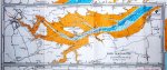
I'm looking for an old chart of the Blackwater. In fathoms!

I've a Stanford No.4 : The Essex Rivers (Blackwater, Colne, Crouch, Roach, Mersea Quarters and Maplin)
Corrected to 1974, so not that old
The Blackwater chartlet covers Maldon to just past Bradwell marina.

If SWMBO doesn't want to part with it I could scan it.
 
Last edited:
Useful for planning your route with the kiddies at home. You don't mind when the dog goes and sits right in the middle of the Thames then with his muddy paws and latest slimy chew toy.

vua0bEel.jpg
 
Whilst the British Merchant Navy used them as gaskets for Doxfords (my former employers, very much still in business, had, at one point, the only all-Doxford fleet on the planet - the Tonnage Manager made use of the then-new offer of the Fairplay Data Base to order a print out of all Doxford engined liner tweendeckers of a certain size, with a view to buying them*, and received, by air mail, within a week, a print out of our own fleet!) the ships of other nations used them to patch holes in ventilator cowls, decks, etc. A couple of charts and four coats of paint and she's good!

*The flyboys in the same outfit ("Arrive in better shape!") did end up owning every Rolls-Royce engined Tristar on the planet...same principle..
 
Today I've taken a load of old charts off the boat. Some of these date back to the early 90's and are probably of no use to anyone for navigation anymore. I think the newest is 2005. Quite a few are in good condition and I think it would be sad to just chuck them in the recycling. Has anyone got any ideas as to what I could do with them/who I could give them to so that they go to a better place than a shredder?

Gerry Goldwyre - architect / artist / Masterchef winner - created a series of paintings using old charts. See, for example, http://scottishartshop.com/artist/gerry-goldwyre.
 
Top