Ammonite
Well-Known Member
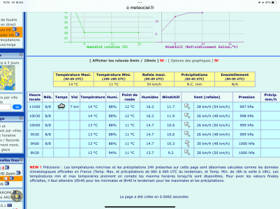
I experienced a similar situation this morning in the Southampton area. A look at the last hours observations suggested to was going to absolutely chuck it down in a few minutes but the forecast for the next hour indicated no rain. Sure enough it chucked it down.
Last edited:


")