Cruising Guide to the Baltic

BabaYaga

Well-known member
Joined
19 Dec 2008
Messages
2,490
Location
Sweden
Visit site
The Baltic is a big place to cover in a single cruising guide, even at 439 pages.
If you indicate what kind of visit to the region that you have in mind, interest in specific areas, duration etc, you may get better answers.
 

dunedin

Well-known member
Joined
3 Feb 2004
Messages
13,981
Location
Boat (over winters in) the Clyde
Visit site
As BabaYaga says the Baltic is a big place, so need to narrow down somewhat. I found the RCPF Baltic guide too generic.

The Harbour Guide by contrast was brilliant. The books are very expensive but the online subscription was great value Harbour Guide | Harbour Guide

I also found the detailed guides to Norway and Denmark useful - eg
- Norwegian Cruising Guide - online best Norwegian Cruising Guide – The Recreational Mariner's Guide
- Denmark guide by the late Nicholas Hill - Germany and Denmark
 

mattonthesea

Well-known member
Joined
28 Nov 2009
Messages
1,394
Location
Bristol
ayearatsea.co.uk
We've been cruising the Baltic a while. TBH I find the pilot books unhelpful. Much better it's to join the Cruising Association, look at their cruising guides and use the Captain's Mate app. And talk to locals 🙂.

And for a less risk adverse approach you could try this one. We were given it by a neighbour in Finland.
165 Rocks: and other stuff to tie your boat... by Edge, Martin
165 Rocks to Tie Up to in Finland and Eastern Sweden. Caveat emptor: you may find you laughing at yourself!
 

johnalison

Well-known member
Joined
14 Feb 2007
Messages
40,844
Location
Essex
Visit site
We've been cruising the Baltic a while. TBH I find the pilot books unhelpful. Much better it's to join the Cruising Association, look at their cruising guides and use the Captain's Mate app. And talk to locals 🙂.

And for a less risk adverse approach you could try this one. We were given it by a neighbour in Finland.
165 Rocks: and other stuff to tie your boat... by Edge, Martin
165 Rocks to Tie Up to in Finland and Eastern Sweden. Caveat emptor: you may find you laughing at yourself!
Spot on. We got most of our best tips on where to go from locals. For Swedish west coast we just used a harbour guide and charts and for the rest of the southern Baltic we used German chart folios and their associated pilots which were mainly harbour guides. I think that my editions no longer exist but the Germans do good stuff which is not hard to understand, even for me.
 

Laser310

Well-known member
Joined
15 Sep 2014
Messages
1,382
Visit site
Thanks for all the tips

I agree; it's a big place for one book.

My only experience there was a few years ago, when a friend bought a new Swan, and I went to the yard for the commissioning, and then helped take the boat to Guernsey.

We didn't stop much.., but I thought it was fantastic, and have wanted to return.

How big of a problem is a (nearly) 9ft draft?
 

jbweston

Well-known member
Joined
25 Jun 2005
Messages
845
Location
Me: Ashby-de-la-Zouch. Boat: The Clyde
Visit site
Another vote for the Cruising Association and both its information phone app Captain's Mate and its excellent (and free) pdf (print at home or read on computer on board) country guides for each country which go into more detail than the RCC pilot book The Baltic Sea. The RCC book is still useful though as it has comprehensive information on many of the main harbours.

Penguin and I had 12 years out in the Baltic, Denmark, West Sweden and southern Norway and the CA guides plus the RCC pilot have been excellent helps.

Like johnalison above I always supplemented Navionics on the plotter with the Delius Klasing (German) sportsboat chart folios which come with harbour guides which include harbour chartlets.

It's worth mentioning that I never used any sort of tide tables or app, although accessing official government forecasts of the sea level can be important if depths or bridge clearances are critical, especially if funny weather is going to have its way with levels.

There are a lot of CA members either based in the Baltic and Nordic countries or who regularly cruise there from the UK and many of them are very happy to share information.
 

BabaYaga

Well-known member
Joined
19 Dec 2008
Messages
2,490
Location
Sweden
Visit site
How big of a problem is a (nearly) 9ft draft?
If you plan to visit the archipelagic areas of southern Finland, Åland, Stockholm archipelago and southwards along the Swedish east cost, such great draft will be a considerable limitation, especially when it comes to 'natural harbours' and some passages between islands and skerries. Still, there is plenty of opportunity to find sheltered anchorages in many places. Bring a dinghy.
In marinas and guest harbours that draft would rarely be a problem, but you might not be able to visit some smaller harbours on islands and in coastal settlements.
It is the small scale, archipelagic structure, in combination with the non-tidal conditions, that make these areas unique as cruising grounds. So I think it would be a pity to come all this way only to do marina hopping. To find courage to stray off from the buoyed fairways you will need good depth data.
Harbour guide as a subscription was already mentioned above. I have only used some of there printed work, but for a visitor, the online subscription version appears to be good value.
Exclusively for Swedish waters I would also like to mention the chart company Hydrographica, producer of large scale (mostly 1:10 000) charts for leisure sailors. Buying their prints would not be economical for a visitor, but my understanding is that their data can be had as add-ons to the big electronic chart producers, like Navionics, C-map and Sea Pilot.
 

dunedin

Well-known member
Joined
3 Feb 2004
Messages
13,981
Location
Boat (over winters in) the Clyde
Visit site
How big of a problem is a (nearly) 9ft draft?
As noted the Baltic is a very big area, so the draft constraints will vary quite a bit by area.
But even 2m was constraining in many places - eg with a slight negative water stand, there seemed to be almost no harbours on Sweden's S coast open to us. Lots of Denmark also had shallow harbours.
I suspect you should be well equipped to survey a few rocks (or "kiss a rock", as we were told).
Of course there are lots of X-Yachts and Arconas sailing these waters, and some of them are deep. But it restricts where can go.
Beam is also a factor with box moorings (enter between solid posts). At 3.8m our choice was often a little restricted. Much more and again some smaller harbours may be difficult.
 

bergie

Active member
Joined
2 Feb 2021
Messages
140
lille-oe.de
We have the “Baltic Sea and Approaches” book and have found it generally useless. You get better port information from No Foreign Land.

The Swedish Hamnguiden series is great for finding anchorages / places for “Scandinavian mooring” (stern anchor, bow tied to land). The Finnish equivalent is also good, though not as well edited as the Swedish one. The Finnish one also has English text available, unlike the Swedish books.

For Finland the SailMate app gives free access to the official raster charts. You can also pay to get the “sea scouts routes” which gives you a lot of anchorage documentation, some which didn’t fit in their books.

Our website has documentation for last three seasons on the Baltic including tracks where we sailed and places we stopped, if useful for inspiration.
 
Last edited:

Laser310

Well-known member
Joined
15 Sep 2014
Messages
1,382
Visit site
well, i was mislead about the draft.

it's only 7.4ft, which, from the comments is not ideal, but i'm guessing is a lot better than nearly 9ft.
 

bergie

Active member
Joined
2 Feb 2021
Messages
140
lille-oe.de
Couple of additional links:

UUVI has many outdoor sites in the Gulf of Finland. These have free moorings, and often a sauna or at least a grill place supplied with firewood. These are maintained by the various municipalities.

Solrutten is a co-op operating multiple island harbours on the Finnish west coast. These you need to pay a small fee for, but there is usually a nice sauna etc available.

Swedish Cruising Association (SXK) has a lot of member buoys and even some island harbours peppered around the whole Swedish coast, usually in very scenic places. Members can stay for free for a night per buoy. And even if not a member, at least keeping the locations in mind is a good idea, as usually there is space to anchor as well.

Here you can see us sitting on one of their mooring balls:
36210df32965832c78a56f42f3a35d0e.jpg

(Stendörren nature reserve)
 

HenrikH

Active member
Joined
17 Nov 2019
Messages
128
Visit site
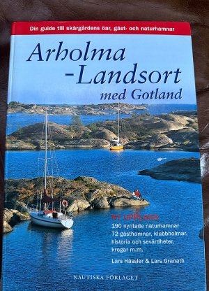
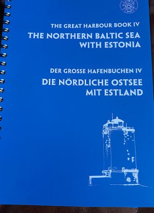
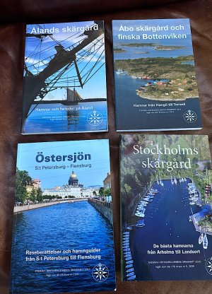
The most complete guides tend to be the local ones. Here are a couple, in addition to the extensive list by Bergie.

IMG_2024-01-07-184809.jpgIMG_2024-01-07-184639.jpgIMG_1306.jpg
 

johnalison

Well-known member
Joined
14 Feb 2007
Messages
40,844
Location
Essex
Visit site
The most complete guides tend to be the local ones. Here are a couple, in addition to the extensive list by Bergie.
I agree. There are so many very small places that are well worth visiting that never get into the general guides. In Sweden we used to pick up excellent local maps free from harbour offices, showing the harbour and surrounding land. There are also free marina guides in many places, usually with plenty of advertising and incomprehensible advice.
 

BabaYaga

Well-known member
Joined
19 Dec 2008
Messages
2,490
Location
Sweden
Visit site
Best way to get access to charts on computer/tablet/phone in the Nordics countries is probably Skippo.
Skippo
Available on the web or as an app through AppStore etc. The basic version is free and mostly suitable for planning. For a modest annual fee you get detailed harbour information and some plotting functionality. An additional annual fee gives access to all the large scale charts by Hydrographica, mentioned i post #10 (the bulk of these cover the archipelago on the Swedish east coast).
 

westhinder

Well-known member
Joined
15 Feb 2003
Messages
2,531
Location
Belgium
Visit site
Any experience with Navionics charts on chartplotter? I fully expect that not every rock will be on them, but as their data is sourced from the national hydrographic offices, I would hope that they are reasonably reliable. On the west coast of Norway we did not have any complaints.
 
Top