Chartplotter in cockpit or Nav station - Opinions

collinsp

Active Member
Joined
5 May 2021
Messages
46
Visit site
Hi Guys,

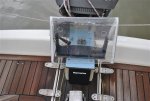
Currently refitting a new (to me) boat out and wanted to get peoples opinion on chartplotter in the cockpit or the Nav station? The boat previously had the plotter at the nav station but i have to change out the wind and auto pilot controls so considering putting the Garmin in the cockpit with the new controls. The alternative would be to use my Ipad at the cockpit with Navionics linked to a Digital yacht wireless which should give me a lot of the info i need at the cockpit and then the GPS, and RADAR, at the Nav sation. Would save quite a bit of room in the cockpit pod.

Would love to hear peoples experience with either option and the pluses and minuses.

Thanks,

Paul
 
In the cockpit - definitely if wheel steered and preferably with tiller steered, although the latter may present problems with siting the plotter. Most modern plotters are designed for external location in terms of viewing, operation and weatherproofing. Also they almost all have a facility to use a tablet as a repeater at the chart table.
 
My one sits behind the tiller above the autopilot control. I have made a polycarbonate hood to go over it in rain. I also put the hood over the bracket when not using the plotter, so I can store the plotter below. That is why you can only see the bracket in the picture. The bracket does rotate so I can see it from whichever side I am seated. I put it here so that I can adjust it when helming, to see the AIS targets & details, which is why I have it rather than course direction. It is better for my eyesight. Placing it on a bulkhead would be out of reach & if anyone was with me, one can bet that sod's law would dictate that they would be leaning on it so one could never see it. Plus being touch screen they would be altering the screen when they pushed it.
 

Attachments

  • Cockpit instrument cover (600 x 402).jpg
    Cockpit instrument cover (600 x 402).jpg
    58.8 KB · Views: 69
Last edited:
It depends on how you use your boat. If you're planning to run 1980's RYA courses with full crew then definitely fit at the nav station. That way the helmsman can't see the chart and the navigator can pointlessly shout instructions up through the hatch. For pretty much any other usage put it at the helm so the person steering can see the intended course.
Ideally, have a second station of some type indoors so that someone else can "do navigation" and see if anything needs to change later on without the helm being in the way or getting distracted. On a short handed boat the autopilot will generally steer while this happens anyway so again putting it at the helm would be better.

If your boat is tiller steered, there's the extra question of where to fit on deck. The obvious location is the bulkhead but that's often covered by ropes or people.
 
Probably also important to recognise that plotters are usually not navigation tools, they're data display tools. Navigation would usually be done elsewhere whether on paper, laptop, app etc. then imported and the plotter used to carry out the plan. Often for short journeys you'd point and shoot for a waypoint, but that's not navigating it's just choosing where to aim for.
 
I would usually be the first to say 'in the cockpit' (although perhaps not at the helm, as on our boat at least, there's where the skipper aims not to be most of the time!)...

However, having devised our new system to have two Garmin MFDs (a 7" at the chart table and a 12" at the helm) I have run out of funds for the larger plotter, so will spend the coming season - at least - running the 7" below deck and a tablet with ActiveCaptain mirroring above.

I'm not suggesting this as ideal, but OTOH the price difference between a decent-sized display for the cockpit (I'd say 9"/10" absolute minimum) and the smallest (7") displays can be massive. Maybe there is something to be said for running a smaller, cheaper, MFD below - where it is safe from the elements, damage, theft etc, - and mirroring a tablet in the cockpit?

Now if only you could actually see most modern tablet screens in decent sunlight...!
 
Now if only you could actually see most modern tablet screens in decent sunlight...!

Which, of course, is why a proper plotter is best in that location.

All of the plotters we have had could be seen easily in bright sunlight, 2 X Raymarine, 1X Garmin.

First Mates tablet is a waste of time in bright conditions.

Even when not being used for nav...................................
 
In an ideal world, I would have a smallish screen at the helm for finding dodging rocks in unfamiliar waters and a second, probably larger screen at the nav station. Is it is, I have a tablet that mounts at the helm and can be taken below - or even home - when needed.
 
Would love to hear peoples experience with either option and the pluses and minuses.
I mostly single hand so at the helm, I have a wheel, is the ideal place as all the information is at hand when maneuvering the boat. For the grown up stuff passage planning, navigating and writing up the log book I use a paper chart at the nav station transferring notes into a wee booklet that I carry.

If I have anybody else onboard they tend to be given the task of helming and can get excited at the 'toy' as most think that only the information that the screen tells them is true, e.g. they will hit the big ship in 36 minutes at a distance of 5 NM, rather than trust their five senses.

I strongly recommend that you get a remote mic that you can use when at the helm, it makes life a lot easier when going in or out of a controlled port,
 
I'm not suggesting this as ideal, but OTOH the price difference between a decent-sized display for the cockpit (I'd say 9"/10" absolute minimum) and the smallest (7") displays can be massive. Maybe there is something to be said for running a smaller, cheaper, MFD below - where it is safe from the elements, damage, theft etc, - and mirroring a tablet in the cockpit?
I have always found a 7" MFD adequate.

I can see that a 7" display would be inadequate if you had a wheel helm and no autopilot - the skipper would be in the helmsman's way while trying to navigate or add waypoints. (Hooray for display mirroring to tablets, though.)

A 7" display by the companionway is readable if someone else is at the tiller or singlehanded.
 
My plotter is at the nav station. I don't claim that my choice is right for you: put it where you find convenient, according to your boat, type of sailing and skill and anxiety level, but my thinking is this:

If in the cockpit where would I put it?

- If on the pod at the wheel it's not visible to anyone 95% of the time (on passage we tend to use the autopilot so are not behind the wheel) and when single-handed I tend to be in the cockpit forward of the wheel so I can adjust sails and generally sail the boat. Steering is carried out by pressing the +-1 and +-10 degrees buttons on the AP, which I can do by reaching round.

- If the plotter went at the 'instrument garage' over the companion way I'd be restricted to rather a minuscule one which would be hopeless for radar and which would be too small (or my eyes not good enough) to see from behind the wheel, especially if it's raining so where's that advantage? On a bulkhead would mean mounting it in a vulnerable place where ropes are coiled up and / or people lean.

I think the argument that it's better when using the plotter 'to dodge rocks when single-handed' is specious tbh. To make any difference that means that 20 seconds counts. A sailing boat boat travels at around 3m/s, so that's 60m. I think that going full-tilt, in zero vis, between rocks only +/- 60m away which you can't see or detect with soundings , while relying totally on GPS, is astoundingly bad seamanship and passage planning. In fact I doubt anyone really does this: transits and clearance bearings, looking at the water colour, wave patterns and water disturbances, following depth contours, slowing down and old-fashioned thinking ahead are much better than the virtual reality mindset which I've noticed some people get into when just looking at a plotter. I'd say that you should only use the plotter to confirm what you already decided to do.

On the very few occasions I really want to see it when actually at the wheel I use a iPhone with Navionics on it, but that's so rare that I feel it shouldn't dominate the logic of the positioning. And, actually the times I really would like to see the electronic chart while steering has been with Antares charts of W Scotland, and ironically these can't be displayed on a plotter but need a laptop or tablet anyway.
 
I think the argument that it's better when using the plotter 'to dodge rocks when single-handed' is specious tbh. To make any difference that means that 20 seconds counts.
This may actually have saved wrecking a boat I was helming into Dartmouth during my first year sailing.

The skipper was colourblind, I was too inexperienced to know what the green light meant and none of the other crew noticed that we were in that sector of the lights.

I think I mentioned the rock to the skipper and he said we were fine, but I steered to port of it anyway. It was only some time afterwards that I realised what had happened.
 
Last edited:
I have a basic small old raymarine plotter just above the companionway, it is good enough to keep me on track and confirm where I am especially at night, I use it for speed and bearing also even if I know exactly where I am.

At the nav table I have a larger plotter and an android touch screen which runs Navionics, I can see the radar and the plotters at the nav table whilst sitting in the cockpit and like you, I steer with the autopilot..(I find this very satisfactory especially at night or in poor visibility.)

So if you must choose I suggest you need one in the cockpit. (I also have Navionics on my phone which reassured me about my auto pilot if I am making some food...as sometimes I don't even turn on instruments if I am just out for a jolly around..
 
If you ever venture to Scandinavia, there is no match. Navigating between islets and underground rocks, a plotter at the nav station is of little value. In the old days we sat with charts on our lap. In the Med, anywhere works, but port entry feels safer with the digital presentation in front of the helmsman
 
There is a small problem with night vision especially when single handed. I use an autohelm to steer the boat and have the displays close to where I can tweek the heading. I can see the screens from the helm too but not so well. Those displays kill my night vision, making me more dependent on radar and AIS.
 
while relying totally on GPS, is astoundingly bad
I can't remember the last time I've seen any youtube global cruiser using a paper chart or written notes. They all steer via their tablet at the helm and most also rarely use their marine plotters unless they are inside at the chart table.
I've never used my chart table plotter and most the time the one at the helm needs to be pointing forwards as that's where everyone sits.
 
Cockpit. The one on the nav station I use to keep an eye on things when off watch or brewing up and for a bit of planning when in harbour. I have ais and radar overlay so being able to see while steering is important to me.
 
I can't remember the last time I've seen any youtube global cruiser using a paper chart or written notes. They all steer via their tablet at the helm and most also rarely use their marine plotters unless they are inside at the chart table.
I've never used my chart table plotter and most the time the one at the helm needs to be pointing forwards as that's where everyone sits.
Possibly true, but a non-sequitur from my point which was to say that it's good practice to use your eyes to look around you, not spend all your attention on a screen. Charts can be wrong or the surveys very old: it's a bit like delivery drivers turning into fields or into rivers because 'the satnav said so'.
 
Top