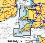
What chart card for my Raymarine C90W chart plotter?

philipm

Member
Joined
4 Feb 2008
Messages
116
Location
Staffordshire
Visit site
I bought a boat with a built-in Raymarine chart plotter last year which had previously lived in the south of France (I'm in the UK). I suspect the previous owner removed the chart card from the card slot so I need to purchase a new one.

The Raymarine website offers a bewildering array of different charts (Navionics, C-Map etc etc etc ) - presumably some are more detailed than others although the website doesn't make that clear.

Can anyone help me cut through all this and advise what type of card I need? I will be on the north Wales coast.

Cheers!
 

pvb

Well-known member
Joined
16 May 2001
Messages
45,604
Location
UK East Coast
Visit site
The C90W uses Navionics charts on a CF (CompactFlash) cartridge. Unfortunately, Navionics have I believe stopped making CF charts, but it's still possible to find them in stock with some suppliers, or you can buy a Navionics Plus card and download thenm yourself. You need to choose a chart which covers your intended cruising area.
 

laika

Well-known member
Joined
6 Apr 2011
Messages
8,159
Location
London / Gosport
Visit site
The C90W uses Navionics charts on a CF (CompactFlash) cartridge. Unfortunately, Navionics have I believe stopped making CF charts

No question on the statement that a Navionics CF card is required or dunedin's recommendation of chart (although if you're on the south coast and more likely to go south than north, consider the western europe chart instead) but are you sure they've stopped making CF cards? Certainly updates are still available:
https://d2wb2wm9dm62ai.cloudfront.net/wysiwyg/docs/Compatibility_guides_plotter/EMEA_APAC_CompatibilityGuide.pdf

Last year's boat show Navionics certainly seemed to be flogging CF cards but that's not to say they haven't stopped...
 

pvb

Well-known member
Joined
16 May 2001
Messages
45,604
Location
UK East Coast
Visit site
No question on the statement that a Navionics CF card is required or dunedin's recommendation of chart (although if you're on the south coast and more likely to go south than north, consider the western europe chart instead) but are you sure they've stopped making CF cards? Certainly updates are still available:
https://d2wb2wm9dm62ai.cloudfront.net/wysiwyg/docs/Compatibility_guides_plotter/EMEA_APAC_CompatibilityGuide.pdf

Last year's boat show Navionics certainly seemed to be flogging CF cards but that's not to say they haven't stopped...

https://www.navionics.com/usa/blog/post/compact-flash-cards-discontinued
 

prv

Well-known member
Joined
29 Nov 2009
Messages
37,363
Location
Southampton
Visit site

I think that could be just a really badly phrased announcement that the pre-programmed products are no longer available on CF. These have been on the way out for some years, in favour of the Navionics+ self-download ones that don’t need chandlers to keep a range of areas on the shelf getting increasingly out of date.

Notice that “Global Regions SKUs, which allow the customer to choose any one Navionics+ coverage areas” will remain available.

Pete
 

philipm

Member
Joined
4 Feb 2008
Messages
116
Location
Staffordshire
Visit site
We have a C90W bought new in 2011. The chart was pre-loaded for all of Europe. Are you sure yours is blank ?

There is no card in the slot and it shows a boat icon in the middle of a blank page when I turn it on (I'm on a river inland - not sure if that's relevant). Do you have a card in the slot?
 

philipm

Member
Joined
4 Feb 2008
Messages
116
Location
Staffordshire
Visit site
That's interesting Jim. So it was actually loaded on to the hardware, not as a card.

Maybe mine is loaded too but only for coastal areas hence why it has not shown anything on the screen whilst I've been boating inland.

Wonder if I can check that on the settings or similar. Failing that I will wait to see what it shows when I move it to the coast next month.
 

PaulRainbow

Well-known member
Joined
16 May 2016
Messages
15,958
Location
Suffolk
Visit site
That's interesting Jim. So it was actually loaded on to the hardware, not as a card.

Maybe mine is loaded too but only for coastal areas hence why it has not shown anything on the screen whilst I've been boating inland.

Wonder if I can check that on the settings or similar. Failing that I will wait to see what it shows when I move it to the coast next month.

The C90W came pre-loaded with Navionics Silver cartography. Not sure where you are inland, but i doubt it covers anywhere on non-tidal waters, top of the range chart cards will generally not cover non-tidal waters, unless specifically for that area. Go through the menus of the plotter and you should find the software version and which charts are installed.

That said, the plotter may well be up to 8 years old, so you may want to buy up to date charts even if the Silver ones are installed.
 

oldmanofthehills

Well-known member
Joined
13 Aug 2010
Messages
4,831
Location
Bristol / Cornwall
Visit site
If you scroll left or right till you get to coast you will soon tell. If its blobby and lacks detail you have no chart, if it shows buoys and contours you have chart.

I suspect you have no chart and previous owner took chart and SD card with them. Navionics not that helpful supporting old products and cant add charts to old style cards like my 5 year old one. But Chart 28XG is what you want. You buy card from them or dealer then they download chart
 

PaulRainbow

Well-known member
Joined
16 May 2016
Messages
15,958
Location
Suffolk
Visit site
Thanks Paul, good info. I'm on the Severn.

I'll be at the boat this week and will take a look.

Cheers

The pre-installed charts will not have coverage for the non-tidal Severn, neither does the 28XG, i don't know of any coastal chart package that does.
 

PaulRainbow

Well-known member
Joined
16 May 2016
Messages
15,958
Location
Suffolk
Visit site
I suspect you have no chart and previous owner took chart and SD card with them. Navionics not that helpful supporting old products and cant add charts to old style cards like my 5 year old one. But Chart 28XG is what you want. You buy card from them or dealer then they download chart

Guess you didn't read the rest of the thread, try post #12 :)
 

dunedin

Well-known member
Joined
3 Feb 2004
Messages
12,686
Location
Boat (over winters in) the Clyde
Visit site
NO. Never had one. It was loaded when I got it.

Not quite sure about the older devices, but some Raymarine plotters had an option when new of including a basic chart for Europe. Navionics version names changed over time, but our e7 came with Navionics Silver (if I recall correctly) for Europe - however, this did not include any detail beyond the 10m contour, and was not updatable without buying the (then) Navionics Gold which was more detailed and covering smaller areas.
Our E90W also has a preloaded base map, not on CF card, and I think similar constraints to the old Navionics Silver, but no paperwork for this so not entirely sure.
Useful backup for delivery trips out of area, but I would not want to rely on the base map for local cruising area.
 

oldmanofthehills

Well-known member
Joined
13 Aug 2010
Messages
4,831
Location
Bristol / Cornwall
Visit site
Guess you didn't read the rest of the thread, try post #12 :)

I certainly did but added extra concerning Navionics interface re elderly products as a result of a 3 months saga trying to get the selfsame 28XG chart updated. We eventually didn't bother as Cardiff Barrage can be seen and the pillars for the 2nd Severn Crossing are on existing rocks so generally in my avoid-zone. I also clarified another way to better tell if he had any chart installed, which I was pretty sure he didn't. Navionics file names can be cryptic and don't always match map names
 
Top