Some help with tide please!

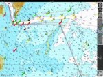
Okay, for simplicity I've split the routes at a waypoint off Ramsgate to make it easier to correlate my results with TGs.

And for clarity and so there is no misunderstanding, this is in no way a competition nor is any criticism of TG or CTTE implied. It's an exercise in comparing two sources of passage planning data.

Speed through the water is set to 4 knots to match the CTTE tables. HW Sheerness is approx 04:40UTC

I do all my passage planning and nav in UTC so add one hour to all times for BST
Times in brackets are TGs times for the same route and start time)
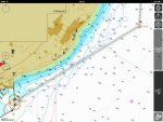
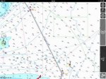
Dover to Ramsgate - this leg is the same for all four routes.
13.75NM 3h25m without tides

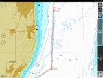
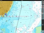
Route 1: via Foulgers, Little Sunk then clear the head of the Gunfleet and into Harwich 39.18NM (39.07NM)
HW Sheerness -2 (02:40UTC off Ramsgate) 8h36m (8h41m)
HW Sheerness -1 (03:40UTC off Ramsgate) 9h05m (9h03m)
HW Sheerness (04:40UTC off Ramsgate) 9h48m (9h42m)
HW Sheerness +1 (05:40UTC off Ramsgate) 10h43m (10h44m)

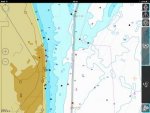
Route 2: via Black Deep and Goldmer Gate 41.16NM (39.73NM)
HW Sheerness -2 (02:40UTC off Ramsgate) 9h17m (9h02m)
HW Sheerness -1 (03:40UTC off Ramsgate) 9h39m (9h18m)
HW Sheerness (04:40UTC off Ramsgate) 10h14m (9h56m)
HW Sheerness +1 (05:40UTC off Ramsgate) 11h09m (10h53m)

(Note: my distance is about 2NM longer which would account for the greater disparity between the passage times)

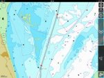
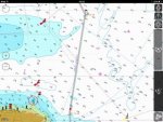
Route 3: via Foulgers, Black Seep and Cork Sand Beacon 43.15NM (42.12NM)
HW Sheerness -2 (02:40UTC off Ramsgate) 9h29m (10h05m)
HW Sheerness -1 (03:40UTC off Ramsgate) 10h02m (10:51m)
HW Sheerness (04:40UTC off Ramsgate) 11h09m (11h28m)
HW Sheerness +1 (05:40UTC off Ramsgate) 11h56m (12h03m)

Route 4: Outside route 43.15NM (42.12NM)
HW Sheerness -2 (02:40UTC off Ramsgate) 10h44m (11h02m)
HW Sheerness -1 (03:40UTC off Ramsgate) 10h46m (11:11m)
HW Sheerness (04:40UTC off Ramsgate) 11h09m (11h41m)
HW Sheerness +1 (05:40UTC off Ramsgate) 12h08m (12h03m)
HW Sheerness +2 (06:40UTC off Ramsgate) 12h39m (10h03m)**

** Is there an error here TG? One hates to suggest so but that 10:03 passage time looks a bit squiffy?... )

The variance between the CTTE results and the software output is, well, variable! It would be surprising if it wasn't :). The correlation isn't by any means perfect and on a couple of the calcs it's at odds by in excess of half an hour however for the most part it's within ten or fifteen minutes. For me that's within the bounds of acceptability given that tidal calcs are never going to be an exact science

I would never, ever, put my faith in a single source of data anyway (I used the software to work up a probable optimum plan because it's much faster than doing multiple tidal calcs by hand and then plot the tides manually if it's likely to be mission critical on timings or routeing to account for set and drift)

For all of the above, departure times from Dover to reach the waypoint off Ramsgate at the desired time would be ...

HW Sheerness -2 22:30UTC!
HW Sheerness -1 00:30UTC
HW Sheerness 02:000UTC
HW Sheerness +1 03:10UTC
HW Sheerness +2 04:10UTC

HW Sheerness -2 is a crock and highlights a problem I've found with planning from Ramsgate and not from Dover. The optimum time off Ramsgate is, for every route, HW Sheerness -2 (or earlier - I haven't calculated the routes for HW Sheerness -2) but the tide is still running foul off Dover if you leave early enough to arrive off Ramsgate at 02:40UTC. It takes 4h19m at that time of night compared to 2h42m if you depart Dover at 01:00UTC and 2h26m if you depart at 03:10UTC

Bit like TG said, if I wuz going there, I wouldn't be starting from here :D

I'd still personally leave at between 04:00UTC and 05:00UTC and accept that the passage would be a couple of hours longer unless the conditions were going to be such that minimising time at sea was critical.

In summary, is the software vindicated?

I think so, others may thing differently. I was looking for correlations with a variance of substantially less than an hour and that's what I've got. For the most part, the correlations are within a matter of minutes and if anyone claims they can calculate the effects of tidal streams to the minute I'll larf myself silly :)

quick edit - I forgot to mention that the variance in route mileage is not insignificant. I may revisit this with my copy of CTTE in the next few days and try and remove that variable from the results
 
Really interesting, I've requested a meeting with SWMBO to discuss cracking on to Ramsgate this evening, but I think we'd prefer an earlier arrival at Dover then the dreaded 4am set off, easier if we're anchored in Dover, it's good holding and we're half an hour nearer the entrance.
 
Ignore the Route 4 +2 time. That should be the time for Route 1 +2! No idea how it got there but obviously I put it there.

I would regard all the Route 1 variances within tolerance given that this is passage planning not a train timetable. Route 2 is not bad either. Route 3 there is clearly 'something going on' since 'I' am longer for a shorter journey. I suspect an anomaly there somewhere. Route 4 similarly is a bit further out than I would expect. I wonder if it could be a difference in how the sector from the Cork Beacon into Harwich is calculated since that sector is effectively two legs for tide/time calculations. I must think about it.

But I will first knock up some Dover to Ramsgate tables. Was thinking I could give three options for the first leg; 1. being from outside the western entrance of Dover Harbour, 2. being the edge of the TSS either having received or expecting favourable tide across the shipping lanes and 3. being from around the SW Goodwins as though going to or from Calais.
 
It's proving to be an interesting exercise and one I'm minded to spend some more time on

Routes 3 and 4 intrigue me as there's something going on and it would be nice to understand what! I think you're probably right TG and it'll be interesting to compare the leg times between the software and the planning tables

I need my copy of CTTE :)
 
Dover to Ramsgate ... why the Western Entrance?

I've never had an issue with using the Eastern Entrance when leaving towards or approaching from Ramsgate, Port Control have invariably offered it without being asked and it seems to me a better bet than going outside and having to cross the ferry lane when they're winding up the engines to full chat
 
Yup Eastern it is then up the inside of the goodwins. That outside route anomaly is interesting, but the wind turbines and the mildly intricate navigation turn an otherwise boring trip into an interesting one though. Got caught in fog there once, couldn't see half a cable, I never really trust plotters, much as I love the iPad, we relied heavily on the RADAR and were fine. Still if the outside route isn't an anomaly we'd use that and shave 2 hours off!
 
An Imray and Forumites plug.


ac7813845c2f3570b0b69548bc0d4323.jpg
 
Following a high level consultation meeting - on the foredeck with afternoon tea - we increased the revs as there's no wind and we're pressing on for Ramsgate. More expensive but surely a better option?
 
Following a high level consultation meeting - on the foredeck with afternoon tea - we increased the revs as there's no wind and we're pressing on for Ramsgate. More expensive but surely a better option?

Didn't like to say but providing everything else is ok I think the better decision. Don't understand the point about the outside route and shaving two hours - its longer.
 
Dover to Ramsgate ... why the Western Entrance?

Maybe I'm out of touch with them but I still thought they preferred us to use the Western Entrance - which I think is generally pretty 'orrid when the tide is in full chat past. Is this an official change of policy?

Mr and Mrs Watson must be having a lovely dawn at sea this morning!
 
I think maybe that used to be the case TG, but every time we've been in and out over the last four years the Eastern entrance has been offered

I do make a point, when I call Port Control, of telling them where I'm inbound from / outbound to and so far they've always taken the hint!

And from memory, when I did the passage planning for the delivery trip a couple of months back, I recall noticing that the pilotage directions had changed from something along the lines of "you might get lucky and be offered the eastern entrance" to "you can use either enentrance"

And it is indeed a lovely start to the day. Shame I've got to go and do some work!
 
Well we left Ramsgate at 6am and we're about 5 miles from Harwich. That makes it 8 hours door to door so to speak, not bad I reckon. We've had the chute up most of the way and the wind is freshening so it'll be fun getting it down later :o

It has been the most fantastic sail, almost perfect Colvic Watson weather, just half a cap full more of breeze earlier on.

Here's us going through Foulgers


View attachment 53222


Experienced yachtsmen will note that we are healing by approximately 5 degrees, this may be one of the few photos in existence of a CW35 healing by so much.
Thanks to all for the impeccable advice, spot on. And cheers to Vara for calling round last night, hopefully there will be time for coffee next time, but as you noticed the curry was immanent :D
 
Last edited:
Hi all:

Well we left Ramsgate at 6am and we're about 5 miles from Harwich. That makes it 8 hours door to door so to speak, not bad I reckon. We've had the chute up most of the way and the wind is freshening so it'll be fun getting it down later


Sailing from Ramsgate instead of Dover saved you 3 hrs 6 mins and 14 NM. A smart decision to reduce Saturdays voyage time, thus managing to avoid the worst of the adverse streams from Fisherman through to Harwich, (worst time being 11:30 - 17:00). You could have saved us all a lot of head scratching over whether it was better to use the favourable streams from Dover to Ramsgate early in the day and bite the bullet from the Inner Fisherman onwards or time departure later to avoid the worst of the adverse streams from 'The Fishermen' to Cork Sand in the afternoon.

The problem is so much easier to solve if departure is from Ramsgate instead of Dover. This explains your impressive passage time of 8 hours compared to the av. 12-14 hours of other members.

I have worked a manual version of the Dover to Harwich passage using Garmin BlueChart and Tides Planner on the iPad, taking best advantage of the Dover-Ramsgate early streams, but making heavy going of the bad streams from Fisherman to Harwich. It still comes out at 12 hrs 57 min with an early start from Dover of 04:45, arrival at 17:42 in time for supper. A later start though at say 08:45 would encounter adverse streams between Dover and Ramsgate but have better streams from 'Fisherman Number 3' onwards, but arriving about 3 hours later at Harwich.

I'm curious to know what swung the issue, as far as departing from Ramsgate rather than Dover on Saturday morning; the extra 'lay in' or the easier calculations.

W1(04:45) W2(05:15) W3(05:45) W4(06:45) W5(07:45) W6(08:45) W7(09:45) W8(10:45) W9(11:15) W10(12:15) W11(13:15) W12(14:15) W13(15:15) W14(16:15) W15(16:33) W16(17:26) W17(17:42). How does this compare with the clever PC software used by some you wealthy, techy individuals. I've used Garmin BlueChart Mobile and Marine Tides Planner here because Garmin is the only iPad navigation app that I have in which I have charts of the East Coast. If any of you want another good exercise try Tide Planning a route from Portland Harbour Yacht Marina to Christchurch Harbour. The whole journey can be done in daylight in less than 8 hours in a 4 knots sailing yacht, if you time it right and choose the right date.

Dover to Harwich.jpg
W1.jpgW2-W3.jpgW3-W4.jpgW4-W5.jpgW5-W6.jpgW6-W7.jpgW7-W8.jpgW8-W10.jpgW10-W12.jpgW12-W14.jpgW14-W17.jpg

Read more at http://www.ybw.com/forums/showthrea...p-with-tide-please!/page8#7cMfm04MlrQIpGge.99
 
Last edited:
Hi all:


Sailing from Ramsgate instead of Dover saved you 3 hrs 6 mins and 14 NM. A smart decision to reduce Saturdays voyage time, thus managing to avoid the worst of the adverse streams from Fisherman through to Harwich, (worst time being 11:30 - 17:00). You could have saved us all a lot of head scratching over whether it was better to use the favourable streams from Dover to Ramsgate early in the day and bite the bullet from the Inner Fisherman onwards or time departure later to avoid the worst of the adverse streams from 'The Fishermen' to Cork Sand in the afternoon.

The problem is so much easier to solve if departure is from Ramsgate instead of Dover. This explains your impressive passage time of 8 hours compared to the av. 12-14 hours of other members.

I have worked a manual version of the Dover to Harwich passage using Garmin BlueChart and Tides Planner on the iPad, taking best advantage of the Dover-Ramsgate early streams, but making heavy going of the bad streams from Fisherman to Harwich. It still comes out at 12 hrs 57 min with an early start from Dover of 04:45, arrival at 17:42 in time for supper. A later start though at say 08:45 would encounter adverse streams between Dover and Ramsgate but have better streams from 'Fisherman Number 3' onwards, but arriving about 3 hours later at Harwich.

I'm curious to know what swung the issue, as far as departing from Ramsgate rather than Dover on Saturday morning; the extra 'lay in' or the easier calculations.

W1(04:45) W2(05:15) W3(05:45) W4(06:45) W5(07:45) W6(08:45) W7(09:45) W8(10:45) W9(11:15) W10(12:15) W11(13:15) W12(14:15) W13(15:15) W14(16:15) W15(16:33) W16(17:26) W17(17:42). How does this compare with the clever PC software used by some you wealthy, techy individuals. I've used Garmin BlueChart Mobile and Marine Tides Planner here because Garmin is the only iPad navigation app that I have in which I have charts of the East Coast. If any of you want another good exercise try Tide Planning a route from Portland Harbour Yacht Marina to Christchurch Harbour. The whole journey can be done in daylight in less than 8 hours in a 4 knots sailing yacht, if you time it right and choose the right date.

View attachment 53515
View attachment 53504View attachment 53505View attachment 53506View attachment 53507View attachment 53508View attachment 53509View attachment 53510View attachment 53511View attachment 53512View attachment 53513View attachment 53514

Read more at http://www.ybw.com/forums/showthrea...p-with-tide-please!/page8#7cMfm04MlrQIpGge.99

Wow!!!
 
I have worked another manual version of the Dover to Harwich passage using Transas iSailor and Tides Planner on the iPad, this time leaving 4 hours later and heading the bad streams from Dover-North Foreland, but taking full advantage of the favourable streams from Inner Fisherman to Harwich. I figured that either one or the other option would be better. It comes out at 14 hrs 17 min with a latish start from Dover of 08:45, arrival at Harwich Shelf (Grisle) 23:02. Not really a better Passage Plan though, regarding best streams or ETA. It takes 1 hour 7 minutes longer than with the 04:45 start, with an after dark arrival at Harwich. All in all a heavy days sail.

As far as departing from Ramsgate rather than Dover on Saturday morning; A departure from Ramsgate instead of Dover is by far the best option.

These screen shots show 16, ‘ 1 hour ’ waypoints as worked out using the Transas iSailor iPad App, along with Marine Tides Planner again. iSailor, in my opinion, gives good representations of the Admiralty Charts we know and love, with as much detail as you would ever need, depending on the zoom factor you choose. Times are as follows: (Slightly different than the iSailor estimates because they are calculated from TTW distances, not the OTG distances used by most navigating Apps to calculate ETA.

W1(08:45) W2(09:45) W3(10:45) W4(11:45) W5(12:45) W6(13:45) W7(14:45) W8(15:45) W9(16:45) W10(17:45) W11(18:45) W12(19:45) W13(20:45) W14(21:37) W15(22:35) W16(23:02).

I would be interested to know how well my calculations compare with the sophisticated software some of you have used to work out this route. The working took me about an hour and a half for each case and was very tedious.

I’d say that I’d rather trust my own working than rely entirely upon a Laptop App to decide my route and waypoints for me though, particularly across this stretch of water.

W1-1024.jpeg
W1-W2iS.jpeg

W2-W3iS.jpeg
W3-W4iS.jpeg
W4-W5iS.jpeg
W5-W6iS.jpeg
W6-W7iS.jpeg
W7-W8iS.jpeg
W8-W9iS.jpeg
W9-W10iS.jpeg
W10-W11iS.jpeg
W11-W12iS.jpeg
W12-W13iS.jpeg
W14%2CW15%2CW16iS.jpeg


Got there in the end.
 

Attachments

  • W1.jpg
    W1.jpg
    23 KB · Views: 0
  • W1-W2.jpg
    W1-W2.jpg
    22.1 KB · Views: 0
  • W2-W3.jpg
    W2-W3.jpg
    22.3 KB · Views: 0
  • W3-W4.jpg
    W3-W4.jpg
    23 KB · Views: 0
  • W4-W5.jpg
    W4-W5.jpg
    23.4 KB · Views: 0
  • W5-W6.jpg
    W5-W6.jpg
    22.4 KB · Views: 0
  • W6-W7.jpg
    W6-W7.jpg
    22.4 KB · Views: 0
  • W7-W8.jpg
    W7-W8.jpg
    23.6 KB · Views: 0
  • W8-W9.jpg
    W8-W9.jpg
    24 KB · Views: 0
  • W9-W10.jpg
    W9-W10.jpg
    23.7 KB · Views: 0
  • W10-W11.jpg
    W10-W11.jpg
    23.6 KB · Views: 0
  • W11-W12.jpg
    W11-W12.jpg
    23.6 KB · Views: 0
  • W12-W13.jpg
    W12-W13.jpg
    23.9 KB · Views: 0
  • W14,W15,W16.jpg
    W14,W15,W16.jpg
    23.7 KB · Views: 0
Last edited:
As a prominent luddite, it is well known that I don't have a chart plotter on board except running my laptop when I am doing surveys so I cannot answer your question. At the risk of being accused of advertising, my tables would have allowed you to work out the different options in much less time than your IT based workings. And you have the advantage of being able to review what the tide is doing to you in each sector of the passage. My tables, however, go no further south than Ramsgate. There was a reason for that, well several actually but a big one being that there is a tidal 'gate' really south of there for any cross-estuary passages. You can do it of course but you must at yacht speeds take a tidal hit.

Having gone across to Boulogne this summer, I made myself a Dover-Ramsgate table and I will shortly make this available (FREE) on my web site. I just have to top and tail it into a neat PDF but have got diverted onto another project temporarily. The idea is that it will stand alone for the Dover-Ramsgate passage or link in with the other tables in my book. Using this supplement would be very quick.

As to your image question, upload your images to a free hosting site such as Photobucket (there are others) and then you can copy the image URL like this:


For some reason I always get the URL showing which I have never been able to fathom (others don't) but it gives you the full size image
 
I’d say that I’d rather trust my own working than rely entirely upon a Laptop App to decide my route and waypoints for me though, particularly across this stretch of water.QUOTE]

As a confirmed technophile, I'm the opposite of Tiller Girl however even I would never, ever, use software to decide my route and waypoints even if such a facility were available (actually, it is now with auto-routing on some of the Navionics apps)

In fact, on a wider note, it is a bad mindset to think of the software deciding anything.
 
Top