Round Britain day 77

Concerto

Well-known member
Joined
16 Jul 2014
Messages
6,152
Location
Chatham Maritime Marina
Visit site
Time to move again. After checking the best time to enter Strangford Lough would be 18.50 and back working to when I should leave Carrickfergus, the big guess was what was going to be my average speed over the ground. Well my estimate said I should leave at 13.00.

That gave me a bit of time to do a few things before leaving at a civilised hour, including using the drone. For once I left at exactly to the minute. The wind forecast was for S veering to W 6 to 8 knots. Yet another forecast that did not match reality. Leaving Belfast Lough meant a course of 091 degrees. I raised full main and tightly trimmed the sheet with the wind very close to the centre line of the boat to motor sail. So the wind was ESE, not in any forecast I saw. As I started the turn at Orlock Point, inside the Copeland Islands, the wind remained on the nose. There was still a little bit of adverse tide and a few white caps, so definitely more than 6 to 8 knots.

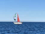
There were a few other yachts out sailing northwards and several following me under engine. One boat had a slightly strange off wind sail up that looked too small and set without a pole or the tack fixed like a cruising chute.

The more the course turned southerly, so the wind kept veering. There was no point in trying to beat with a headsail as I would arrive later than the ideal entry time, so I continued motor sailing. However I decided it was better to tack the main on a regular basis as it would flog otherwise. I was only tacking through 20 degress, but it did make a big of difference. About a mile and a half before the buoy to enter the lough, I dropped the mainsail and rigged for berthing both sides. Fitting 4 fenders each side and lines took quite a while, so I nearly overshot the buoy. According to the tidal guides it should be slack water but it had just turned and was entering the lough. Great fun entering the narrows doing between 8 and 10 knots over the ground.

The plan was to enter the Portaferry marina, provided there was space. When I tried the land line and mobile numbers, there was no reply. The approach is not too bad provided you are close to the shore. There are some green cans to help you in, but the cross tide eases rapidly once in the entrance. On the end of the hammerhead is a plan showing which are visitor berths. I wanted to berth into wind and tide, and the best berth for me was inside the hammerhead. Not quite enough room to turn straight in, so a little reversing to assist swinging the stern with propwash and forward on full helm got me correctly lined up. Gently easing into the berth, I hopped on the pontoon and secured the aft spring and then the forward spring, then both brest ropes. A little final adjustment and I was completely tied up in about 2 minutes with no assistance. An almost perfect mooring up, if I say so myself. It was now 19.30 and I had travelled 38 miles. The log showed there was only 0.12 knots of tide flowing through the marina.

Once I had tidied up on deck, the marina manager came over to tell me the gate code and point out the toilet and shower. He had seen me moor up and said I did it very neatly. When he realised how far I have travelled this year, he was impressed as I was singlehanded. To me it is nothing unusual.

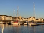
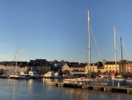
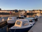
Slightly later I noticed there was a warm glow from the sun and decided to capture some shots of the marina.

Carrickfergus B 1000pix.jpg
Drone view of Carrickfergus marina

IMG_5850 1000pix.jpg
The odd looking downwind sail

IMG_5852 1000pix.jpg
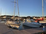
Concerto in Portaferry Marina

IMG_5854 1000pix.jpg

IMG_5855 1000pix.jpg

IMG_5857 1000pix.jpg

IMG_5858 1000pix.jpg
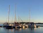
They squeeze them in tight here

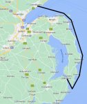
RB Map 21.jpg

For anyone wanting to read the reports from the start, this is the link to first one.
Round Britian day 1
 
Last edited:

LONG_KEELER

Well-known member
Joined
21 Jul 2009
Messages
3,721
Location
East Coast
Visit site
You are clearly having a great time.

I've noticed that you haven't been Clubbing yet , to really know the locals.

Perhaps your plan is to stick to afternoon tea dances.
 

Concerto

Well-known member
Joined
16 Jul 2014
Messages
6,152
Location
Chatham Maritime Marina
Visit site
You are clearly having a great time.

I've noticed that you haven't been Clubbing yet , to really know the locals.

Perhaps your plan is to stick to afternoon tea dances.
A number of the clubs have frequently been closed as they only open at weekends. Most evenings are filled with cooking, washing up, emails and forum postings, so little time for socialising.

I can be very chatty, but too many years of travelling and staying in a different hotel almost every night has meant I am used to my own company. The idea of a tea dance would not go down with my wife, she would get jealous.
 

Concerto

Well-known member
Joined
16 Jul 2014
Messages
6,152
Location
Chatham Maritime Marina
Visit site
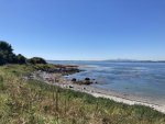
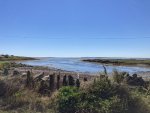
Another warm sunny day and ideal to cycle to see the area around the entrance to Strangford Lough. After getting close to the tip of both sides, I have cycled over 30 miles. There were a few surprises along the way. It is better to let the photos show what I mean.

IMG_5863 1000pix.jpg
Bar Hall Bay with the mountains of Mourne in the distance

IMG_5866 1000pix.jpg
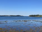
Near to Portaferry looking at the entrance

IMG_5869 1000pix.jpg
Looking into the lough from the Portaferry side

IMG_5873  1000pix.jpg
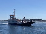
The ferry across the lough, adults only £1 each way and bikes go free

IMG_5883 1000pix.jpg
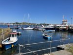
Strangford Marina, yes there is a small one

IMG_5889 1000pix.jpg
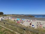
Close to the lough entrance is a popular beach. There are several more closer to the entrance but not as popular

IMG_5891 1000pix.jpg
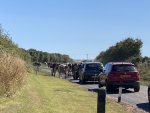
It was busy on the A2, cows take piority

IMG_5896 1000pix.jpg
Kilclief Castle

DJI_0122 Strangford 1000pix.jpg
Drone view looking towards Portaferry

DJI_0128 Strangford 1000pix.jpg
Drone view looking towards the entrance

DJI_0130 Strangford 1000pix.jpg
Drone view with the lough extending in the distance

DJI_0133 Portaferry 1000pix.jpg
Portaferry marina and town
 

Blueboatman

Well-known member
Joined
10 Jul 2005
Messages
13,862
Visit site
It does look very green after Kent and Sussex just niw
And beautiful , the drone and bike seem ace additions . Cycling and sailing tourism , ?

What a year for visiting historically wet wet wet NI!
 

ashtead

Well-known member
Joined
17 Jun 2008
Messages
6,412
Location
Surrey and Gosport UK
Visit site
Have we had any photos of the drone yet ? Has anyone objected to drone flying as yet? Certainly an interesting account -was the yacht with green sail a Mirage -it reminded me of Greek charter yachts from the 80s.
 

Concerto

Well-known member
Joined
16 Jul 2014
Messages
6,152
Location
Chatham Maritime Marina
Visit site
All the effort I am putting in to make this trip memorable does seem to be very well received by you all. The past week and the next week have been a bit of recouperation for some of my earlier exploits. My aim is to encourage others to try cruising over longer distances by using modern technology. With planning it is quite possible to cover reasonable distances in a day, all my trips are basically day sails. The photos of the places I have visited try to show the harbours, sights along the way and interesting places to visit. This trip has used marinas almost exclusively, but on a future trip I will anchor a lot more and explore some of the wilder places rather than towns.

The bike was an unplanned purchase but has been a massive bonus and I keep wanting to see what is over the next rise or hill. Google maps is very helpful in indicating places that might be interesting to see, but personal recommendations from people I chat with also helps. The mileage on the bike is nearly 140 miles so far, so it is now close to £10 per mile, still an ouch number that will rapidly drop over time. Storing a bike on a 32ft yacht is not easy and getting in and out of the cabin is tight. The weight is not very light and due to the shape, can easily snag the handle bars and pedals. Walking it along to my side gates is narrow, not to mention lifting down on to a pontoon. If I was using my inflatable, I would need to use a block and tackle from the boom as it would be impossible to do it safely any other way.

Sorry I never thought of taking a photo of the drone. Will do this later. The drone has built in advice on where I cannot fly via the GPS mapping, e.g. close to airports, hence no drone photos of Belfast harbour. Yesterday I found out that drones are not allowed to be flown over any Isle of Man harbours. You are not allowed to fly drones at any National Trust properties, so I could not capture the World Heritage sites at Brodgar on Shetland. Another limiting factor is windspeed. On several occassions I have be shown wind warnings when the wind is about 25mph. It can fly at up to 35 mph, so not a big safety margin, but flying lower reduces windspeed. For this reason I have not been able to get all the drone photos and videos I would like. Currently I have set the range of the drone to 2km, but I could increase this up to 10km in perfect conditions. The height is limited to 120m, but can fly to 4000m, but in the UK you should never fly above 400m. Several of the wide landscapes have been taken at 120m and nearly 1km away. These numbers are shown on the control display, including battery level and speed. It really is very easy to fly as the GPS positioning can hold it very steady. If you are unsure of where the drone is, then let it hover and then turn to view the area around so you can fly in the right direction. This is very useful if the Return To Home button is being affected by a poor GPS signal or other radio interference like a strong radar nearby. The only problem I have found is strong sunlight can make the camera have a haze or bloom. The answer is to fly backwards toward the sun and the problem is solved. As the drone and controller in their storage bag are quite small, I can carry it in my backpack when out on the bike.

Last night I forgot to include this photo from the drone showing the water flow out of Strangford Lough. The strongest flow is shown clearly as the darker line of water. This is from the south shore near the narrowest point.

GAUR3254 Strangford 1000pix.jpg
 
Last edited:

Concerto

Well-known member
Joined
16 Jul 2014
Messages
6,152
Location
Chatham Maritime Marina
Visit site
You are correct. I was going from memory and put metres instead of feet. Post now corrected.

Last night a light aircraft flew into the lough at low level and I guess below 100m, I presume he was below the accepted safe level. He would never have seen a drone as small as mine. Perhaps he was slightly reckless but just proves the 400ft limit is sensible.
 

AngusMcDoon

Well-known member
Joined
20 Oct 2004
Messages
8,832
Location
Up some Hebridean loch
Visit site
You are not allowed to fly drones at any National Trust properties, so I could not capture the World Heritage sites at Brodgar on Shetland.

You are not allowed to take off, land or operate your drone at National Trust properties or on their land, but you can fly over their land and properties if you take off, land and operate from elsewhere, your drone is class C0 or less than 250g, there are no other restrictions on the airspace, like airports, prisons, nuclear sites etc, and you keep the drone in sight.
 

LONG_KEELER

Well-known member
Joined
21 Jul 2009
Messages
3,721
Location
East Coast
Visit site
All the effort I am putting in to make this trip memorable does seem to be very well received by you all. The past week and the next week have been a bit of recouperation for some of my earlier exploits. My aim is to encourage others to try cruising over longer distances by using modern technology. With planning it is quite possible to cover reasonable distances in a day, all my trips are basically day sails. The photos of the places I have visited try to show the harbours, sights along the way and interesting places to visit. This trip has used marinas almost exclusively, but on a future trip I will anchor a lot more and explore some of the wilder places rather than towns.

The bike was an unplanned purchase but has been a massive bonus and I keep wanting to see what is over the next rise or hill. Google maps is very helpful in indicating places that might be interesting to see, but personal recommendations from people I chat with also helps. The mileage on the bike is nearly 140 miles so far, so it is now close to £10 per mile, still an ouch number that will rapidly drop over time. Storing a bike on a 32ft yacht is not easy and getting in and out of the cabin is tight. The weight is not very light and due to the shape, can easily snag the handle bars and pedals. Walking it along to my side gates is narrow, not to mention lifting down on to a pontoon. If I was using my inflatable, I would need to use a block and tackle from the boom as it would be impossible to do it safely any other way.

Sorry I never thought of taking a photo of the drone. Will do this later. The drone has built in advice on where I cannot fly via the GPS mapping, e.g. close to airports, hence no drone photos of Belfast harbour. Yesterday I found out that drones are not allowed to be flown over any Isle of Man harbours. You are not allowed to fly drones at any National Trust properties, so I could not capture the World Heritage sites at Brodgar on Shetland. Another limiting factor is windspeed. On several occassions I have be shown wind warnings when the wind is about 25mph. It can fly at up to 35 mph, so not a big safety margin, but flying lower reduces windspeed. For this reason I have not been able to get all the drone photos and videos I would like. Currently I have set the range of the drone to 2km, but I could increase this up to 10km in perfect conditions. The height is limited to 120m, but can fly to 4000m, but in the UK you should never fly above 400m. Several of the wide landscapes have been taken at 120m and nearly 1km away. These numbers are shown on the control display, including battery level and speed. It really is very easy to fly as the GPS positioning can hold it very steady. If you are unsure of where the drone is, then let it hover and then turn to view the area around so you can fly in the right direction. This is very useful if the Return To Home button is being affected by a poor GPS signal or other radio interference like a strong radar nearby. The only problem I have found is strong sunlight can make the camera have a haze or bloom. The answer is to fly backwards toward the sun and the problem is solved. As the drone and controller in their storage bag are quite small, I can carry it in my backpack when out on the bike.

Last night I forgot to include this photo from the drone showing the water flow out of Strangford Lough. The strongest flow is shown clearly as the darker line of water. This is from the south shore near the narrowest point.

View attachment 140649
Your trip seems to underline the need for us humans to have new experiences whereas "stuff" only has a short term value. Brilliant that you have made the time for this trip and have kept yourself fit ,
 

ashtead

Well-known member
Joined
17 Jun 2008
Messages
6,412
Location
Surrey and Gosport UK
Visit site
Thank you for the drone info as the photos are great but they might not be so keen on them in the Solent I guess .useful to know though the mapping displays no fly zones- I saw a tourist/ flyer on an island in Thailand being given a real lecture by a someone as his drone buzzed the beach and it soon landed etc .the latest drone business in France is flying supplies to your yacht by drone but not certain it would catch on here.
 

John 32i

Active member
Joined
5 Jul 2011
Messages
818
Location
Levington
Visit site
All the effort I am putting in to make this trip memorable does seem to be very well received by you all. The past week and the next week have been a bit of recouperation for some of my earlier exploits. My aim is to encourage others to try cruising over longer distances by using modern technology. With planning it is quite possible to cover reasonable distances in a day, all my trips are basically day sails. The photos of the places I have visited try to show the harbours, sights along the way and interesting places to visit. This trip has used marinas almost exclusively, but on a future trip I will anchor a lot more and explore some of the wilder places rather than towns.

The bike was an unplanned purchase but has been a massive bonus and I keep wanting to see what is over the next rise or hill. Google maps is very helpful in indicating places that might be interesting to see, but personal recommendations from people I chat with also helps. The mileage on the bike is nearly 140 miles so far, so it is now close to £10 per mile, still an ouch number that will rapidly drop over time. Storing a bike on a 32ft yacht is not easy and getting in and out of the cabin is tight. The weight is not very light and due to the shape, can easily snag the handle bars and pedals. Walking it along to my side gates is narrow, not to mention lifting down on to a pontoon. If I was using my inflatable, I would need to use a block and tackle from the boom as it would be impossible to do it safely any other way.

Sorry I never thought of taking a photo of the drone. Will do this later. The drone has built in advice on where I cannot fly via the GPS mapping, e.g. close to airports, hence no drone photos of Belfast harbour. Yesterday I found out that drones are not allowed to be flown over any Isle of Man harbours. You are not allowed to fly drones at any National Trust properties, so I could not capture the World Heritage sites at Brodgar on Shetland. Another limiting factor is windspeed. On several occassions I have be shown wind warnings when the wind is about 25mph. It can fly at up to 35 mph, so not a big safety margin, but flying lower reduces windspeed. For this reason I have not been able to get all the drone photos and videos I would like. Currently I have set the range of the drone to 2km, but I could increase this up to 10km in perfect conditions. The height is limited to 120m, but can fly to 4000m, but in the UK you should never fly above 400m. Several of the wide landscapes have been taken at 120m and nearly 1km away. These numbers are shown on the control display, including battery level and speed. It really is very easy to fly as the GPS positioning can hold it very steady. If you are unsure of where the drone is, then let it hover and then turn to view the area around so you can fly in the right direction. This is very useful if the Return To Home button is being affected by a poor GPS signal or other radio interference like a strong radar nearby. The only problem I have found is strong sunlight can make the camera have a haze or bloom. The answer is to fly backwards toward the sun and the problem is solved. As the drone and controller in their storage bag are quite small, I can carry it in my backpack when out on the bike.

Last night I forgot to include this photo from the drone showing the water flow out of Strangford Lough. The strongest flow is shown clearly as the darker line of water. This is from the south shore near the narrowest point.

View attachment 140649
“My aim is to encourage others to try cruising over longer distances by using modern technology. With planning it is quite possible to cover reasonable distances in a day, all my trips are basically day sails”

Your blog has been a great inspiration and I read it each morning over coffee - would a 2 M draft be a problem with most of the marinas you have visited?

Thanks and fair winds for the rest of the trip
 

Concerto

Well-known member
Joined
16 Jul 2014
Messages
6,152
Location
Chatham Maritime Marina
Visit site
“My aim is to encourage others to try cruising over longer distances by using modern technology. With planning it is quite possible to cover reasonable distances in a day, all my trips are basically day sails”

Your blog has been a great inspiration and I read it each morning over coffee - would a 2 M draft be a problem with most of the marinas you have visited?

Thanks and fair winds for the rest of the trip
I draw 1.6m and had no problems anywhere. There may be a problem at LW springs in a very small number of the very small marinas. Your draft should certainly not stop you undertaking a similar voyage.
 

Concerto

Well-known member
Joined
16 Jul 2014
Messages
6,152
Location
Chatham Maritime Marina
Visit site
Have we had any photos of the drone yet ?
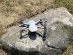
Today I remembered to take a photo of the drone, It is a DJI Mini 2 and is under the 250 gram weight limit, so is classified as a toy. It is certainly no toy, but a very powerful and sophisticated drone.

IMG_5908 1000pix.jpg

This is the web site with full details.
DJI Mini 2 - Make Your Moments Fly - DJI

An even more advanced one has just been launched the Mini 3 with even more features for several hundred pounds more.
DJI Mini 3 Pro - Fly Mini, Create Big - DJI

Was the yacht with green sail a Mirage -it reminded me of Greek charter yachts from the 80s.
It looked like a Mirage to me. It was being sailed singlehanded, but it was odd as the green sail was floating and controlled by the 2 sheets. It was not a spinnaker or a cruising chute or an asymetrical. It did look too small for the boat.
 
Top