Plotter essential?

Is a chart plotter essential/vital to your sailing?

  • I have a GPS

    Votes: 72 35.1%
  • I have a chart plotter

    Votes: 40 19.5%
  • I have both

    Votes: 113 55.1%
  • I have neither

    Votes: 5 2.4%
  • A GPS is a must have

    Votes: 63 30.7%
  • A GPS is a nice to have

    Votes: 73 35.6%
  • A chart plotter is a must have

    Votes: 30 14.6%
  • A chart plotter is a nice to have

    Votes: 114 55.6%
  • More than happy to sail without electronic nav gizmos

    Votes: 84 41.0%

  • Total voters
    205
PS - It will be interesting to hear what you have to say after you have had a seasons use out of the plotter.

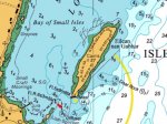
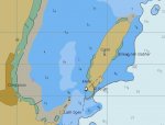
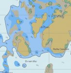
It's not as if I've never used one before. When I bought the one on Kindred Spirit I intended to use it much more, but I found panning and zooming around a little screen to be fiddly compared with looking at a real chart. Zoomed in, you can't see your surroundings; zoomed out most of the data disappears. I also didn't like the way some bright spark had made each light on the screen flash like the real thing, instead of writing down its characteristics. Now I have to count flashes twice!

These are of course problems with this specific plotter rather than with all plotter-kind, but I don't think they're uncommon on smaller devices.

I would probably gravitate more towards the plotter if I had to manually transfer fixes from GPS to chart, and couldn't pick off a bearing and distance until I had done so. That's even slower and more awkward than scrolling a plotter :). But I have a Yeoman, so it doesn't apply.

The size of the new boat may have an impact too. On KS the chart table is directly under the hatch, I can go from chart to binoculars by putting a foot on the bottom step and standing up. The new one is two or three paces and I'd probably need to go up a couple of steps before I could see out properly.

Pete
 
The IMO requirement for a ship to be in possession of charts of the area being transited has been amended so that electronic charts are acceptable. Therefore, there is a very good chance that most vessels earning their living at sea will not have any paper charts at all..... therefore a chart plotter is essential.:rolleyes:

The last ship I was on (last August) used paper charts, AIS, radar in port, speed log and that's it! No chart plotter, I would guess it will have one either and I would guess that many don't carry them. The only commercial shipping that will carry them and use them 24/7 is the fishing industry - but then the electronics on board a modern fishing boat would put a 747 to shame!
 
The last ship I was on (last August) used paper charts, AIS, radar in port, speed log and that's it! No chart plotter, I would guess it will have one either and I would guess that many don't carry them. The only commercial shipping that will carry them and use them 24/7 is the fishing industry - but then the electronics on board a modern fishing boat would put a 747 to shame!

Ships are random on plotters or not, some do some do not, VERY hard to predict which will and which wont. I guess it comes down to the superintended/ management. I have seen old (30 years) Greek owned ships with them, and new (18 month old) Dutch and American ships without...
 
Lightning strikes are more common than most people think, especially if you are talking blue water sailing. I have met three boats that have suffered strikes, including one which had no signs of physical damage, i.e., not a direct hit, but not one piece of electronic kit was left working. Paper charts will not look so 'optional' in those circumstances.
Oh, and his compass deviation was completely different, too.
When his problem was being discussed over sundowners in the cockpit, the best we could come up with was to keep a hand held GPS in a tin box (like a biscuit tin), as a Faraday cage, with it´s batteries out, and, of course some paper charts. USA charts are sold with the right to copy them, so they are readily available.
 
Because as I said, electronic charts are not necessarily correct. Admiralty paper charts are correct to the best of human knowledge. Computer and plotter charts are not. By a very long way.

You are confusing chart accuracy with positioning accuracy - the positioning accuracy of Modern GPS (WAAS http://en.wikipedia.org/wiki/Wide_Area_Augmentation_System which is what my SH CP300 does) is better and more consistent than that used in the surveys that produced the information to create paper charts, ipso facto, the charts are wrong so when combined with a more accurate and consistent positioning system, there is an error.

Electronic charts are based on the same information as paper charts and are also augmented with more modern electronic data. Please read section "1420 Digital Chart Accuracy" in this MSI Document for a full explanation. All charts will improve with time now we have a much more accurate and consistent positioning system with which to do the surveys.

http://msi.nga.mil/MSISiteContent/StaticFiles/NAV_PUBS/APN/Chapt-14.pdf

Similarly, some mariners transiting a range that marks the centerline of a channel report that the vessel icon plots along the edge or even outside of the channel. Mariners now expect, just as they did 20 years ago, that the horizontal accuracy of their charts will be as accurate as the positioning system available to them. Unfortunately, any electronic chart based on a paper chart, whether it is raster or vector, is not able to meet this expectation.
The overall horizontal accuracy of data portrayed on paper charts is a combination of the accuracy of the underlying source data and the accuracy of the chart compilation process. Most paper charts are generalized composite documents compiled from survey data that have been collected by various sources over a long period of time. A given chart might encompass one area that is based on a lead line and sextant hydrographic survey conducted in 1890, while another area of the same chart might have been surveyed in the year 2000 with a full-coverage shallow-water multibeam system. In the U.S., agencies have typically used the most accurate hydrographic survey instrumentation available at the time of the survey.
While survey positioning methods have changed over the years, standards have generally been such that surveys were conducted with a positioning accuracy of better than 0.75 millimeters at the scale of the chart. Therefore, on a 1:20,000-scale chart, the survey data was required to be accurate to 15 meters. Features whose positions originate in the local notice to mariners, reported by unknown source, are usually charted with qualifying notations like position approximate (PA) or position doubtful (PD). The charted positions of these features, if they do exist, may be in error by miles.

Mandatory Carriage of ECDIS (Electronic Chart Display and Information System)

In 2009, the Maritime Safety Committee (MSC) of the IMO agreed to the formal adoption of a mandatory carriage requirement for ECDIS. The changes to SOLAS Regulation V19 mean that all large passenger, tanker and cargo ships will be obliged to fit ECDIS on a rolling timetable that begins in July 2012

http://www.ecdis-info.com/

http://www.ukho.gov.uk/ProductsandServices/ElectronicCharts/Pages/DigitalChartFacts.aspx

http://www.admiralty.co.uk/SiteColl...ty-9-stages-to-ECDIS-regulations-brochure.pdf

Additional information laid over ENCs

The Admiralty Information Overlay is the only service to include the worldwide Temporary and Preliminary Notices to Mariners to support your ships sailing compliantly with ECDIS and ENCs.
The Overlay is also the only service to include the results of the comprehensive reviews of the world’s ENCs undertaken by UKHO in order to identify and resolve navigationally significant differences with existing paper charts.
200,000+ That’s how many individual pieces of new information Admiralty rigorously checks every year – making sure the safest level of navigational information is available.
Latest updates – just a mouse click away
Receive instant, regular updates of Notices to Mariners, as well as Temporary & Preliminary Notices – online, via CD or email.
Quality assurance that’s second to none
Know that you’re using world-class navigational information, thanks to our industry-leading combination of expertise, meticulous processes and close working relationships with national hydrographic offices worldwide.

The world is going digital, and it will be better and more accurate than that which went before.

If anyone enjoys navigating with paper, pencil and compass then carry on. I certainly don't want to tell anyone how they should ensure the safety of their vessel.

What I can't support are the statements that modern, technology based systems are innacurate and should be second place to systems with so much room for human error. The fundamental problem being that paper charts were created from survey information based on less accurate positioning systems than we have available today.

We are now at the mature end of a transition from old to new navigation technology, the clock will not be turned back, but as always the responsibility lies with the skipper to recognise when something is not right and to come up with a backup plan.
 
Last edited:
Interesting poll,,
Answered have both, would have prefered to say (more than)happpyto sail without(electronic nav gizmos).
Currently available electronic nav devices are more than gizmos!
I prefer to use all available options, and keep my eyes open.
 
Last edited:
Lightning strikes are more common than most people think, especially if you are talking blue water sailing. I have met three boats that have suffered strikes, including one which had no signs of physical damage, i.e., not a direct hit, but not one piece of electronic kit was left working. Paper charts will not look so 'optional' in those circumstances.
Oh, and his compass deviation was completely different, too.
When his problem was being discussed over sundowners in the cockpit, the best we could come up with was to keep a hand held GPS in a tin box (like a biscuit tin), as a Faraday cage, with it´s batteries out, and, of course some paper charts. USA charts are sold with the right to copy them, so they are readily available.

Hmm you are assumig that all plotters are rigged to something that a lightening strike could affect. If you have an iPhone with charts in your pocket then you'll still have a plotter unless you get hit by lightening then you've probably got a bigger problem on your hands ....
 
I've been following the 'Seems to be legal...' thread with some amazement.
Was particularly surprised by the number of people who seemed to regard a functioning chart plotter as essential/vital.
I find this point of view even stranger since most forumites seem to be of SAGA qualifying age.

Anyway, poll attached

Essential is the wrong word. You can navigate with the tools that the Polynesians used and they didnt even have charts so arguably charts arent essential. It's more a question of what is sensible and what is stupid. To my mind it would be stupid to deliberately navigate without a GPS which reliably gives an position far more accurately than any effort at EPS or messing with a sextant. And they are as cheap as chips.
 
The last ship I was on (last August) used paper charts, AIS, radar in port, speed log and that's it! !

So no method of position finding out of sight of land? Surprising. In fact I would call that negligent. And I'm not sure it complies with obligations for SOLAS vessels.


On a different subject I'm amazed and frankly doubtful about the 42% happy to sail without any electronics. I have taught navigation in the past and the hundreds of sailors who have passed through my classes have given me a fair appreciation of the average skill level with plotter and pencil. It isnt up to non electronic navigation on a desk let alone in a bucking small yacht in a rough sea. I reckon the 42% is a macho man response with a significant proportion suffering from brown trousers if they had to try to do it in real life and outside sheltered coastal waters..
 
Last edited:
On a different subject I'm amazed and frankly doubtful about the 42% happy to sail without any electronics. I have taught navigation in the past and the hundreds of sailors who have passed through my classes have given me a fair appreciation of the average skill level with plotter and pencil. It isnt up to non electronic navigation on a desk let alone in a bucking small yacht in a rough sea. I reckon the 42% is a macho man response with a significant proportion suffering from brown trousers if they had to try to do it in real life and outside sheltered coastal waters..

I voted for that option because in home waters and in decent visibility the GPS/Plotter is more there for information rather than a navigational necessity. Similarly we took our first boat from Chichester to Burnham on Crouch without a working GPS which included crossing the Thames Estuary in poor visibility.

However I would not want to cross the North Sea or similar offshore journey without a working GPS.
 
I've been following the 'Seems to be legal...' thread with some amazement.
Was particularly surprised by the number of people who seemed to regard a functioning chart plotter as essential/vital.
I find this point of view even stranger since most forumites seem to be of SAGA qualifying age.

"SAGA qualifying age" :confused:
Whatever that is then I probably qualify, having regularly crossed the North Sea from NE England to Holland before the days of Plotters or GPS and usually with total cloud cover so no sextant fixes either. Okay, I did have RDF - a modified small radio to increase the LW coverage to the beacon range in a home-made pelorus mounted on the bulkhead - but the bearings were always a bit vague. So most of the time I was a bit lost (well, more than a bit, sometimes), especially the time I was headed by light winds and took four days, having sighted Cromer before tacking once again to lay IJmuiden. But even then, one had to aim high to know to turn right when seeing the coastline and sailing parallel until an identifiable landmark appeared. The longer it took the more difficult to work out how much the tides had swished us up and down the North Sea every six hours.

So I know I can do it ... but prefer not to - it fact it would be stupid and unseamanlike not to use all available aids. I now have a plotter in the wheelhouse, a netbook running OpenCPN fed by a separate GPS/AIS receiver on the chartable, a backup HH GPS. Oh, and a drawer-full of Adriatic and Ionian paper charts that rarely get taken out.
 
On a different subject I'm amazed and frankly doubtful about the 42% happy to sail without any electronics. I have taught navigation in the past and the hundreds of sailors who have passed through my classes have given me a fair appreciation of the average skill level with plotter and pencil. It isnt up to non electronic navigation on a desk let alone in a bucking small yacht in a rough sea. I reckon the 42% is a macho man response with a significant proportion suffering from brown trousers if they had to try to do it in real life and outside sheltered coastal waters..

Was 'outside sheltered coastal waters' implied in the question?
You can get pretty far with a chart, compass, and decent vis.
 
Was 'outside sheltered coastal waters' implied in the question?
You can get pretty far with a chart, compass, and decent vis.

In decent viz and home waters you don't really need a chart or positioning device at all, you can use the old mk one eyeball but for offshore and no landmarks ....
 
I have toys and paper charts on my boat but I can't afford the plotter(s), charts and updates of a pukka ENC system, and don't know anyone who can. What I do know is that paper UKHO charts give me my best chance of being aware of the obstacles and with a plotter the raster version doesn't have the limitations of a vector version. Of course I use the toys cause they're so easy but if I had to lose one, I know which it would be.

An example from my toys is below. That venerable icon Sceptre managed to find Goat Rock(03) a couple of years ago - if they were using the vector version I can understand why.
 

Attachments

  • Sgeir Gabhar.JPG
    Sgeir Gabhar.JPG
    56.7 KB · Views: 0
  • Sgeir Gabhar not.JPG
    Sgeir Gabhar not.JPG
    37 KB · Views: 0
There seems to be a general acceptance that GPS is OK so it's actually a question of whether you then plot the GPS position on a paper chart, or allow a plotter to do it for you.

Since the satellites went into orbit in the early 90s there have been massive, if behind the scenes, improvements in GPS due to increases in DSP power, advances in corrective technologies, increases in computing power and reductions in price.

In a modern GPS, multi channel capability allows the reciever to use more satelites for a fix.
Antenna diversity allows accurate reception of weaker signals.
More powerful Digital Signal Processors allow identification and estimation/elimination of reflected signals. (Multi-path analysis)
Some use doppler shift measurements to help determine speed and direction.
Selective Availability has been turned off.
WAAS allows for corrections to satellite positions based on ground measurements.

The end result is that a modern GPS reciever is a powerful computational piece of electronics which will deliver a level of accuracy, consistency and reprodcability that is impossible with compass or sextant. It will also deliver information on the quality of the position it calculates.

So GPS is fundamentally OK as long as you understand the position quality information.

Paper charts are human creations based on historical data gathered over decades, alot of which pre-dates GPS and the quality is dependent on territory. A chart is just a pictorial representation of a geographical area, it is not the area itself - so the accuracy of the survey data, and the positioning systems used at the time are directly reflected in the accuracy of the chart. If you use the same positioning system used to collect the survey data, then all will be consistent and OK and accuracy will seem fine.

However, combine accurate modern GPS with this data and it's a different story.

Because humans know boats don't float on roads or in fields we would not plot a GPS position on a road or in a field. We would instinctively correct the position, assuming the GPS was wrong when in actual fact, if the GPS fix quality is good (WAAS for example) then it is the chart that is wrong.

A chart plotter assumes the fix is correct and will plot it on the chart at the fix position. We then assume the plotter/gps is faulty - in actual fact the chart data is faulty, just as faulty as the paper chart.

What a chart plotter does is consistently and correctly, in all circumstances, plot the GPS position on the chart data. It is not subject to human error due to fatigue, brain fade, or human intuition plotting what you want to see, rather than what was measured. Every chart failure will show up, and in older systems with fewer receivers, no WAAS and less powerful DSP capabilities, the GPS fix itself may also be less accurate - a combination of these problems is probably what gives rise to stories of plotters merrily plotting tracks through islands and over land.

A modern plotter with up-to-date charts is a fantastic aid to navigation, if you have one then it should be switched on and used - even if navigating with paper. Being familiar with your plotter is just as important as not losing your paper skills. Becoming lazy with respect to either form of navigation is a discipline problem of the individual - a plotter won't make a skipper lazy if they are sufficiently alert and interested in their surroundings, but you also need to practice and play with the plotter to get the most out of it.

Compass, pencil and paper navigation are useful skills, but as with all manual or mental skills you use it or lose it, it's a question of discipline.

Having sailed on the West Coast of Scotland in the days before GPS it was a buttock clenching experience at times, so I can only agree with Barnac1e - I prefer to use all available methods that are within my budget and I love my plotter.
 
I have toys and paper charts on my boat but I can't afford the plotter(s), charts and updates of a pukka ENC system, and don't know anyone who can. What I do know is that paper UKHO charts give me my best chance of being aware of the obstacles and with a plotter the raster version doesn't have the limitations of a vector version. Of course I use the toys cause they're so easy but if I had to lose one, I know which it would be.

An example from my toys is below. That venerable icon Sceptre managed to find Goat Rock(03) a couple of years ago - if they were using the vector version I can understand why.

http://www.navionics.com/de/webapp

I'd get some new toys, like the navionics app - it's got Goat Rock ...... is the fish farm really there?

GoatRock.JPG
 
http://www.navionics.com/de/webapp

I'd get some new toys, like the navionics app - it's got Goat Rock ...... is the fish farm really there?

Nope!

I can manage to find rocks that are clearly charted on both the toys and the paper yins, or at least my crew do! Having found the Goat Rock anomaly and seen detail disappearing on scale change on others' plotters, I have a sceptical view and the disclaimer screen on start up does nothing to dispel it. Doesn't stop me using the toys but I have more faith in the paper and a magnifying glass to counter my failing eyesight and have learned the hard way to preview intended new routes with them.

Here's another example - how does the Navionics deal with it?
 

Attachments

  • erraid.JPG
    erraid.JPG
    72.1 KB · Views: 0
  • erraid 2.JPG
    erraid 2.JPG
    43.7 KB · Views: 0
Having found the place, eventually, the rock, NW of Rankins Rocks at the southern end of the channel, is marked on the Navionics chart, as are all but one of the rest, the one at the northern end.

Your point is well made for sailing in this kind of territory but to be fair these are in tight channels that I'm guessing most of us wouldn't venture into without some local knowledge.
 
>As for paper charts, well if you have an iPad you can stuff it with up to date charts and use that as your back up to the fixed plotter. Not only that the iPad will be a plotter as well.

If you put charts on a computer it can fail just as a plotter can. That's why you must carry charts as a backup.

>Could you please explain why?

The reason is above. Relying on anything electrical on board is not a good idea, hence we carried charts and why and never wasted money on a plotter or computer charts.
 
Top