Navionics updates

magicol

Member
Joined
17 Jun 2012
Messages
80
Location
Scotland
Visit site
The new harbour breakwater at Millport on the Isle of Cumbrae appears to be completed. Although we have not yet visited this year, reports suggest that the moorings have been reinstalled for the new season. This fairly significant development in a busy harbour doesn’t appear to have been recognised yet on my Navionics App. It got me wondering just how responsive the Navionics charts are. I get frequent messages telling me my charts “are old” and require “updating” virtually every day on the App and I dutifully press the update button on the assumption that I then have the most up to date charts possible. However, the Millport breakwater is not marked on my charts; should I expect it to be there?
I guess there is a formal process for altering charts; this just seems a bit slow. Can anyone help?
 

dunedin

Well-known member
Joined
3 Feb 2004
Messages
13,048
Location
Boat (over winters in) the Clyde
Visit site
The new harbour breakwater at Millport on the Isle of Cumbrae appears to be completed. Although we have not yet visited this year, reports suggest that the moorings have been reinstalled for the new season. This fairly significant development in a busy harbour doesn’t appear to have been recognised yet on my Navionics App. It got me wondering just how responsive the Navionics charts are. I get frequent messages telling me my charts “are old” and require “updating” virtually every day on the App and I dutifully press the update button on the assumption that I then have the most up to date charts possible. However, the Millport breakwater is not marked on my charts; should I expect it to be there?
I guess there is a formal process for altering charts; this just seems a bit slow. Can anyone help?
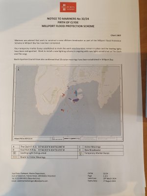
The majority of chart data in the UK comes from UKHO. So generally it needs UKHO to decide to update their base chart data - which can be subject to delay. Then it is available immediately on the (expensive) commercial vector charts. But I gather that UKHO sometimes takes weeks or months to issue the information to leisure chart publishers like Navionics.
Sometimes leisure chart publishers cut out the middleman UKHO and update directly.
But also, has there been an official notification of the completion been issued by the Clyde authorities (Peel Ports)? Not noticed it but may have missed.
 

arc1

Member
Joined
28 Jul 2020
Messages
75
Visit site
The majority of chart data in the UK comes from UKHO. So generally it needs UKHO to decide to update their base chart data - which can be subject to delay. Then it is available immediately on the (expensive) commercial vector charts. But I gather that UKHO sometimes takes weeks or months to issue the information to leisure chart publishers like Navionics.
Sometimes leisure chart publishers cut out the middleman UKHO and update directly.
But also, has there been an official notification of the completion been issued by the Clyde authorities (Peel Ports)? Not noticed it but may have missed.
Not seen a notification that work is complete, but the CNTM that detailed the restrictions whilst works ongoing is no longer in force.
Looking to visit at some stage soonish just out of curiosity, planning to enter from West and avoid any large floating object. Wondering if breakwater will reduce any residual SWly swell if wind has been blowing that way...
 

tillergirl

Well-known member
Joined
5 Nov 2002
Messages
8,425
Location
West Mersea
Visit site
I regret I have a low opinion of Navionics' updating process. I monitored a change in the Thames Estuary in 2022. On 15th September the UKHO issued a block which showed a change of location in an important swatchway. Effectively a drying knoll had moved towards the NE. Navionics did nothing until 24th November, 2022 when, bizarrely it placed a drying height of 0.4m in the swatchway. The drying height was critical and it was placed in the right place. But Navionics did not update the drying contour at that time. That meant the 0.4m drying was shown in the blue (i.e. the approximate 2m to 5m contour). So you HAD to spot the very small underline to realise it was a drying height. Would you assume it was a correct drying height while all around seemed to have 2m+. It wasn't until 31st December that the contours was correctly place. Bizarrely the 0.4m drying was removed and further onto the drying knoll had 0.8 drying. So being 'up-to-date' needs to be taken with care. In 2023 bizarrely suddenly placed a small circular drying patch with 0.3m drying in the NE part of the swatchway. Given that I had surveyed that area in 2023, it was a surprise. No idea where it came from and later the drying patch disappeared. A few miles away Navionics took an age to correct buoyage at the Ray Sand. It is correct today but early ths year they moved the Buxey Beacon and now on the Chartfinder the beacon is missing completely. But don't worry, you'll be able to see the beacon! While the buoyage is now correct, a User report had placed one of the buoys in the wrong place and the report is still there.
 
Top