Leighb
Well-Known Member
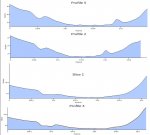
Thanks, I was not looking far enough from Stone Banks RHB.Having just checked the chart on my iPad, it’s not quite as “hole shaped“ as I thought, but still a deeper anomaly in a relatively flat area. See below - “The Well” near Armada mark.
View attachment 103654
")
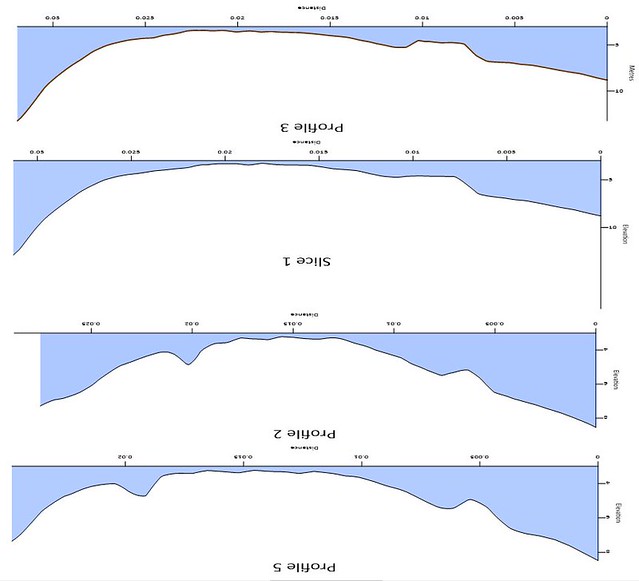 Image18