STATUE
Active member
I knew it once !
What does one call an estuary that has no river flowing into it - like Salcombe ?
Thanks.
What does one call an estuary that has no river flowing into it - like Salcombe ?
Thanks.
RiaI knew it once !
What does one call an estuary that has no river flowing into it - like Salcombe ?
Thanks.
Salcombe does have rivers (or streams) flowing into it!
I think the critical distinction is that the Salcombe 'estuary' is not so much an estuary of the modest watercourses that flow into it, as older, bigger valleys that have been flooded by the sea. (I am sure Antarctic Pilot or someone else could provide us with a more succinct definition, though.).
More philosophically, there is no clear dividing line between an estuary and a ria, as far as I can see. I don't think the Blackwater (Essex) estuary would be described as a ria, but it's valley is too big for the Blackwater river to have created. In that case it's because, IIRC, the much bigger 'Thames' once flowed out through that valley. (Perhaps when the 'Thames' was still a tributary of the 'Rhine', and the 'North Sea' was the Rhine Estuary, and unconnected to the 'English Channel'/'Manche'!)
(What is, and is not, the 'Thames' is another philosophical conundrum! ? )
Having my childhood holidays in Cornwall, I always knew what the sea was because you only had to poke your bow out of Mevagissey harbour and you were in it. In the Thames estuary, PLA notwithstanding, there is no point at which you can be sure. Sometimes it happens as soon as you leave Harwich harbour and at other times not until you pass Longsand Head.Well yes , I viewed a sort of geographical programme a few years ago , and in it they appeared to declare that far up the River Thames can be described 'as on Sea ' due i recall because the Tide Effects can actually flow far up river , so a sort of 'Westminster upon Sea is possible !
Yea well I thought , some Achademics , can surely believe anythings possible ?
Re the 'Ria' ;my understanding is that what appears to be an Estuary is only an Estuary IF it is supplied mainly by river Waters flowing into it ; If he apparent Estuary is mainly fed by the Sea Levels then its a 'Ria' ; understand that Salcome up to Kingsbridge is mainly fed from the Sea levels ; but they do I understand have a Harbour Master , like normal Estuarys so do
Ria
A long, narrow inlet formed by the partial submergence of a river valley.
Origin - Late 19th century from Spanish ría ‘estuary’.
Estuary
The tidal mouth of a large river, where the tide meets the stream.
Origin - Mid 16th century (denoting a tidal inlet of any size): from Latin aestuarium ‘tidal part of a shore’, from aestus ‘tide’.
What about: A Ria is the flooded valley of a mostly dried up river that was formed during the last ice age when the sea level was lower? An estuary is the mouth of a current river?Re the 'Ria' ;my understanding is that what appears to be an Estuary is only an Estuary IF it is supplied mainly by river Waters flowing into it ; If he apparent Estuary is mainly fed by the Sea Levels then its a 'Ria' ; understand that Salcome up to Kingsbridge is mainly fed from the Sea levels ;
Thats nice. In the UK the devil gets credit for everything. It would be called "the Devil's handprint". Bit of a worry really that trend. Just tested that theory on maps of the UK. Sure enough God gets barely a mention compared to the devil. And this is just official names on a map there must be many more locally known names.Five rias in Galicia formed by God putting his hand down?


Would an inlet be where the sea came through onto a low point on the land and washed it out? The land around there drains into the estuary but maybe its considered that that wasn't what formed the shape of the land? This is the mouth, it looks like the gap between hills being lower than the sea level it is naturally part of the sea.Thought Salcome is described as an ‘inlet’


and as the sea level rose it makes sense that the lowest parts of the land would flood first hence river mouths flooded where it had been worn lower by erosion and then was further eroded by tidal action. eg River Deben to form the Deben Ria as I shall hence forth call it. Sounds a bit more exotic as well.Funny to think that the English Channel was once an estuary , a marsh, and you could walk over from Le Continent
About 5 hours would do it I imagine
Would an inlet be where the sea came through onto a low point on the land and washed it out? The land around there drains into the estuary but maybe its considered that that wasn't what formed the shape of the land? This is the mouth, it looks like the gap between hills being lower than the sea level it is naturally part of the sea.
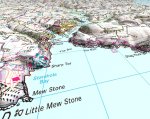
View attachment 139442
inland it does look like the sea could have washed it out rather than rivers formed it. The inlets along the north Norfolk coast are even more clearly sea breaches of the land while most of the rain falling on the land drains backwards and comes out at great yarmouth.
View attachment 139443

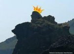
Ha! I'll look out for that when I'm passing nextOur late Empress Victoria will live in Salcombe for ever, happily riding one of her pigs.
View attachment 139444
To S/B leaving, in the Bar area. It's quite uncanny whn you see it in the flesh!Ha! I'll look out for that when I'm passing next