Entry to Padstow Tidal height and depth in entry channel

Many thanks for that. I carry a lead line and use it quite often. I sometimes just put a tape measure down, but the salt does not much for its life. You suggest going for worst case, thats 3.5 metres drying height, but as Lysted posted it closer to 1 metre, that is a huge difference.
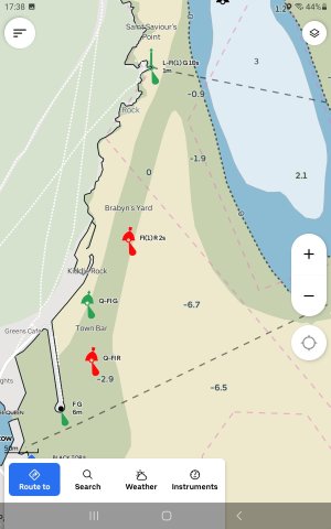
But you need to find a reason for the difference to be able to make a judgement which is correct.
 
It's a good example of the weakness of raster charts and of relying on UKHO in a leisure vessel. Navionics have been remarkably accurate for us, including mirroring the antares charts very well in Scotland.
While Dunedin is technically correct, that advice would see almost nobody entering Padstow as official charts say it's impossible.

It is possible to see the source of Navionics charts if you wish to. It's also possible to see the enhanced version which includes the depth data of other Navionics users who have been in that location, which greatly enhances resolution compared to traditional soundings which may happen every 200 years or so if you're lucky.
As Navionics is primarily based upon UKHO data not sure what basis you have for saying the Navionics will be the more accurate in this case.
And can you tell me how to see the chart data source used on Navionics, as I am not aware that is possible.

It is true that sometimes Navionics (and/or C Map and others) may incorporate additional information, such as from harbourmasters. But difficult to tell if this is the case or not - without asking the harbourmaster.
And I am pretty certain that Navionics does not reflect Antares Chart data - beyond the fact that Antares report to UKHO many chart errors each year and some of these ripple through into chart corrections at UKHO then onto commercial charts.
 
It's a good example of the weakness of raster charts and of relying on UKHO in a leisure vessel. Navionics have been remarkably accurate for us, including mirroring the antares charts very well in Scotland.
While Dunedin is technically correct, that advice would see almost nobody entering Padstow as official charts say it's impossible.

It is possible to see the source of Navionics charts if you wish to. It's also possible to see the enhanced version which includes the depth data of other Navionics users who have been in that location, which greatly enhances resolution compared to traditional soundings which may happen every 200 years or so if you're lucky.
Yes, thats why for a while we decided there was not enough depth. Many thanks for the Navionics info
 
not sure what basis you have for saying the Navionics will be the more accurate in this case.
Well, in this instance we know that the Navionics isn’t missing any soundings and the raster one clearly is, since it’s common knowledge that there is a channel there.
Generally though, Navionics also has community data which shows actual readings from people who have been there recently. This has proven extremely accurate for us.m but can be switched off to check “proper sources”.
Source data is fully available in the kayers of the chart, the method to see it varies by app and device. Realistically though, we’re not on an RYA course so must admit that almost nobody ever looks at that information on paper or otherwise. We trust our charts to be accurate and anywhere dodgy we take more care. Knowing whether it was a sailing dinghy in 1825 with a lead line or not makes no difference to me.
I didn’t say Navionics included Antares data, I said it matched it well in almost all locations. That community sourced data matches so well is a testament to the data collection techniques used.

In any case, for this thread the Navionics isn’t missing very clearly the better chart since it shows what those of us who have visited know to be true!
 
Our RWYC club members regularly use Padstow. We are used to dock access around High water.

The general advice is don't arrive before half tide at Doom Bar never be late.

If you are late or far too early it is comfiest to anchor off the RNLI station rather than off the bar.

If you can get over Doom Bar too early you may have to wait for a few minutes outside the main dock.

Having a deep draft it pays to hold back a little longer!

If you keep to the right of the dock access channel you are in deeper water and less likely to be swept over the drying sand banks by the flood tide.

See screen shot.

Also keep relatively close to the outer wall of the outer harbour.

There was a floating pontoon outside the dock gate but this usually fills up with boats waiting for the Dock to open.
My advice would be to call up the HM to check on lock opening time before you leave the deep water moorings in the River.

There was a very shallow patch immediately opposite the gate on exit. (See screen shot) This could delay your outward bound trip!

I believe that the harbour channel is regularly cleared by excavators the HM will have more info of IF and When.

A top tip is you can get a Med Moor, walk ashore stern to berth if you arrange with HM. Easy to get doggy ashore and closest to the shop that sells the best (fresh) Oggies.

From memory fuel was available from the HM but only in your own containers.
 

Attachments

  • Screenshot_20260206-173815_Orca.jpg
    Screenshot_20260206-173815_Orca.jpg
    146.4 KB · Views: 18
Our RWYC club members regularly use Padstow. We are used to dock access around High water.

The general advice is don't arrive before half tide at Doom Bar never be late.

If you are late or far too early it is comfiest to anchor off the RNLI station rather than off the bar.

If you can get over Doom Bar too early you may have to wait for a few minutes outside the main dock.

Having a deep draft it pays to hold back a little longer!

If you keep to the right of the dock access channel you are in deeper water and less likely to be swept over the drying sand banks by the flood tide.

See screen shot.

Also keep relatively close to the outer wall of the outer harbour.

There was a floating pontoon outside the dock gate but this usually fills up with boats waiting for the Dock to open.
My advice would be to call up the HM to check on lock opening time before you leave the deep water moorings in the River.

There was a very shallow patch immediately opposite the gate on exit. (See screen shot) This could delay your outward bound trip!

I believe that the harbour channel is regularly cleared by excavators the HM will have more info of IF and When.

A top tip is you can get a Med Moor, walk ashore stern to berth if you arrange with HM. Easy to get doggy ashore and closest to the shop that sells the best (fresh) Oggies.

From memory fuel was available from the HM but only in your own containers.
Many thanks for the info, very useful. Stern too mooring good to get the dug ashore. We will be in contact with the harbourmaster and will not go up the dock channel till we have spoken to him. Is if feasible to anchor in the river (if no mooring available) while waiting or it the flood tide too strong?
 
Many thanks for the info, very useful. Stern too mooring good to get the dug ashore. We will be in contact with the harbourmaster and will not go up the dock channel till we have spoken to him. Is if feasible to anchor in the river (if no mooring available) while waiting or it the flood tide too strong?
One anchors at Stepper Point on the western side of entrance. There is a whitish box or marker on the cliffs at about the right spot. Then once tide right crosses the bar and proceeds.

As TSB said there is small waiting pontoon just outside the lock gates and we have used to go pasty hunting while waiting for the gate

One can also anchor by the old lifeboat slip just before the bar to await the tide, and a few fishing boats used to be moored there , but except in a few winds it offers little better protection the stepper and it involves some seeking of water depth
 
Correction/Clarification: Coming in the channel by The doom bar is to port ie keep the Bar to Starboard. Thus keep central shallows to port after the bar coming in....

It’s a well defined channel for quite large vessels such as fishing boats and dredgers

The dredger "Mannin" which was Padstow based for many years (owned by harbour commissioners) has a draught of about 2.25m. It's not fin keel tho!
Many fairly large beam trawlers often visit Padstow, and they will have at least a similar D. Usually more, so as to swing big props for towing heavy gear.
 
Many thanks for the info, very useful. Stern too mooring good to get the dug ashore. We will be in contact with the harbourmaster and will not go up the dock channel till we have spoken to him. Is if feasible to anchor in the river (if no mooring available) while waiting or it the flood tide too strong?
Yes it most certainly is possible - done it many times. Indeed if you want to leave early to go up the Bristol channel, its best to lock out the lock before and anchor in the channel to time your departure.
 
Top