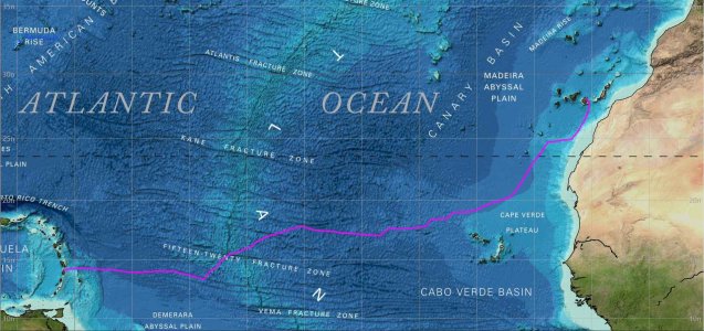
Commemorative chart plot

Keen_Ed

Active member
Joined
13 Dec 2002
Messages
1,818
Visit site
Does anybody know of a company that does plotting on charts for commemorative purposes. This is for a transatlantic voyage.

I’m thinking of a sort of 2d plotter drawing the GPS track on a paper chart. With plots every few hours, a system other than doing it by hand would be much neater.

Thanks!
 

dunedin

Well-known member
Joined
3 Feb 2004
Messages
13,959
Location
Boat (over winters in) the Clyde
Visit site
Have you already done the crossing? Our chart plotter can record the track and then I download it to the SD card and then the home computer.
There are very easy ways to then show this on a basic chart (i have a compiled track of “the story so far” covering 17,000 miles and 8 years). I also think you could overlay this on a raster chart of the Atlantic using something like MemoryMap.

Or just buy the paper chart of the Atlantic and hand draw the crossing on to it (as I also did for a differnt boat voyage)
 

rogerthebodger

Well-known member
Joined
3 Nov 2001
Messages
13,525
Visit site
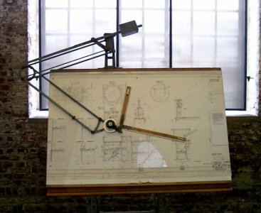
What you need is an old fashioned drafting machine to plot the route by hand

Drawing Machine.jpg

I used to use one when I started work many moons age
 

river

New member
Joined
22 Jul 2016
Messages
4
Visit site
You might be interested in a light chart. These are framed charts with lights that flash in the patterns of the lighthouses etc. They can, however, be made with your own custom lights marking the route of an ocean passage.

e.g. Irish Sea | Mysite
 

AntarcticPilot

Well-known member
Joined
4 May 2007
Messages
10,539
Location
Cambridge, UK
www.cooperandyau.co.uk
There are so many ways to do this that it isn't easy to give advice! I tend to think in terms of Geographic Information Systems (e.g. QGIS), but Google Earth will do the job - you just need to convert your track to a KML file (there are many utilities that will do that), and then import it into Google Earth. Once you've got it into a suitable package, it's easy to output it to PDF and your local print shop can print it; they will advise on ink and media suitable for the final location.
 

Laser310

Well-known member
Joined
15 Sep 2014
Messages
1,382
Visit site
Does anybody know of a company that does plotting on charts for commemorative purposes. This is for a transatlantic voyage.

I’m thinking of a sort of 2d plotter drawing the GPS track on a paper chart. With plots every few hours, a system other than doing it by hand would be much neater.

Thanks!
for a crossing last year, I tried a few plots.

Navigational charts were okay.., but a bit boring.

I thought this bathymetric chart was more interesting

I am going to change the pink track to another more visible color

2022-GC-SL.jpg
 
Top