JumbleDuck
Well-Known Member
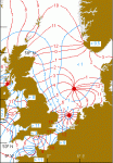
For work I need a co-tidal chart showing an amphidromic point. I thought the UKHO did a North Sea one, but all I can find from them is NP214 for the Persian Gulf, which would do at a pinch. My Google-fu has failed to find anything useful online - can anybody point me at something, maybe from RYA training materials? At this stage a scan would be very useful too (PM for email address), and rights will be properly negotiated before anything goes public.

")