C-Map or Navionics?

lustyd

Well-known member
Joined
27 Jul 2010
Messages
12,503
Visit site
A further thought: maybe Navionics did go through the automatic reduction process with erroneous data. What I don't know enough about is what happens if the user has the wrong date/time set on their nav system. Is it possible to do this and still collect Sonarchart data?
I doubt this would be possible without some sort of intent. The GPS includes a time stamp in UTC and I would guess they need multiple sources to be roughly in line. Given that it's a new and innovative idea though there will certainly be some teething and discovery. I'm quite certain the people two hundred years ago with lead lines went through similar snags. Given the data in some of our charts we may still have some of their snags present too, so I'm definitely in favour of anything that increases the frequency of survey to more than once a century!
 

Roberto

Well-known member
Joined
20 Jul 2001
Messages
5,423
Location
Lorient/Paris
sybrancaleone.blogspot.com
One can only assume (hopefully) that the example above is an atypical mistake.
Unfortunately not so, at least in non-Mediterranean French coasts there have been plenty of cases (google French forum Hisse-et-oh there are threads with dozens of similar cases reported. Navionics reaction in those cases has been to remove user soundings and bring back Sonar charts pretty much to the original HO data.

This is the current "regular" Navionics chart, 1st error now the drying tongue between the two islets has become land, yellow, though there still are the various underlined soundings nearby (underlined 3, 4, etc). With a chart like this one cannot expect to be able to sail over that tongue, ever, whereas with a height of tide of say 3m part of it will be just covered, with 5m most boats would be able to cross.
glennav.jpg

This is the current "Sonar" chart, all those uncorrected, raw user soundings have been removed, at the same time they also removed almost all drying area data from official sources, who knows why. They probably added their usual mathematically interpolated contours, note the yellow and green contours are identical so no user contributed modifications.
glenson.jpg


Add.
I see you are from Guernsey, I'll try and dig out something similar from the area, the Minkies, Chausey etc come to mind.
 
Last edited:

requiem

Active member
Joined
20 Mar 2019
Messages
254
Visit site
I doubt this would be possible without some sort of intent. The GPS includes a time stamp in UTC and I would guess they need multiple sources to be roughly in line.

Using GPS time is the obvious solution, but that ignores the case of older plotters that were intended to be replaced before GPS rollover became hit them. Thus an older plotter could have incorrect GPS timestamps.

To the original query, I might have a slight preference for C-Map (I do like the tidal presentation) but don't really care as for me it's a second opinion. If you're using official ENCs on your tablet, either should work. If you're using Navionics on a tablet, C-Map on the plotter provides an alternative against which to compare.
 

lustyd

Well-known member
Joined
27 Jul 2010
Messages
12,503
Visit site
Yes that's true, my old Raymarine GPS had this time issue. I would expect nothing that supports Navionics uploading would be that old though? I'd expect them to work this out fairly quickly too and start putting some quality controls against incoming data, and it appears that as above this is already happening.

I'm not sure why people have such high expectations of software solutions when CQR anchors were acceptable for so many years!
 

Roberto

Well-known member
Joined
20 Jul 2001
Messages
5,423
Location
Lorient/Paris
sybrancaleone.blogspot.com
Yes - the Minkies need constant updating!!
Sorry I found no Minquiers (but I have an old copy of Malcolm Robson guide :) ), I have a series of screenshots of the NE corner of Herm but without reference of the underlying type of chart + they are just outside the area where I can check official SHOM hydrography (found at data.shom.fr if you need), I oculd email them to you if you wish.
Meanwhile, other examples of Sonar and Non-Sonar charts which I find interesting

This is the same area as before (Glénan islands), intermediate version of Sonar charts, the differences with official charts (and reality) are striking, among others appearance of non existing drying areas

gleninterm.jpg

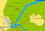
Entrance to St Vaast (for anyone who likes oysters): the two channels do not exist all, the area dries; this seems the integration of raw user soundings sent from some fishing boat returning at highish water, without any correction for height of tide. Today's chart both Sonar and regular are essentially back to SHOM data
navtatihou.png

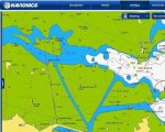
Very similar care, access to Roscoff; the blue channels do not exist. Below the regular chart before updating. These are port entrances not the lost rock north of Greenland, this false information can be dangerous

nav roscoff.jpg
nav roscoff 2.jpg

There are numerous more, Perros Guirec, etc etc with similar errors.


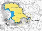
Other types of misleading information: Sonar chart of Cape Horn: surely there are plenty of local boats sailing all around and send back soundings to create those beautiful contours? This is their other axe: interpolate fictive contours from scant HO data to make them look appealing.

nav cap horn.jpg

Link below: plain error, still in today charts: obstruction symbol probably misread, in real life people walk upon it, Navionics regular and Sonar charts introduce plenty of nice contours with water everywhere.
Tablet chartplotting- not Navionics

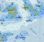
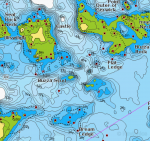
Scillys anyone? I have no access to official HO charts so do not know what is there

nav scilly.jpg

nav scilly son.jpg
 

requiem

Active member
Joined
20 Mar 2019
Messages
254
Visit site
Scillys anyone? I have no access to official HO charts so do not know what is there

From a quick glance, a few spots where being able to refer to both might be helpful?

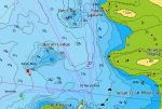
Bacon Ledge, west side of Saint Mary's (not true HO, but oeSENC). The survey date is June 2017, CATZOC B.
1643739485559.png
1643742190801.png

Or west of Samson / Bryher. The survey date is 1862, CATZOC C.
1643742486801.png
1643742398199.png
 
Last edited:

HenrikH

Active member
Joined
17 Nov 2019
Messages
129
Visit site
I have Navionics on my plotter, phone and ipad. I was a very good relationship, even with the irrelevant Sonarchart. But there is a dark side: Garmin took over. Now they are setting the trap, today I got the message «you have to open an account« when I tried to open my Navionics app. Next step may not be pretty.
 

ChromeDome

Well-known member
Joined
25 Sep 2020
Messages
3,905
Location
Commonly in Denmark. Dizzy Too, most of the time.
Visit site
I have Navionics Platinum Plus on a Lowrance HDS 10 and on an iPad which subscription covers my phone (Android) also. Mainly using the HDS, though.

It is a Gen1 HDS and I looked for a potential replacement. Navionics now is owned by Garmin which logically makes for some alignment between them but they still are not hardware compatible. Garmin charts are for Garmin, most other hardware makes can do C-Map and Navision.

The urge to reuse my chart, transducer and NMEA 2000 network connectors brings Lowrance and the cousins Simrad & B&G into focus.
And this weighs into the business case (changing network etc. isn't cheap) more than the minor differences in chart features. So unless a bargain or profitable sale of old gear changes the calculation, Navionics will remain.

As always the future is uncertain.
In 2016 the Lowrance/Simrad/B&G owner 'Navico' aquired C-Map, in 2021 'Navico' was aquired by Brunswick (Mercury engines, 16 boat brands, 19 accessories brands and then some). So the game now mainly is between Brunswick and Garmin and the competition should benefit you and me as customers.
 

KompetentKrew

Well-known member
Joined
27 May 2018
Messages
2,454
Visit site
The urge to reuse my chart, transducer and NMEA 2000 network connectors brings Lowrance and the cousins Simrad & B&G into focus.
And this weighs into the business case (changing network etc. isn't cheap) more than the minor differences in chart features. So unless a bargain or profitable sale of old gear changes the calculation, Navionics will remain.

As always the future is uncertain.
In 2016 the Lowrance/Simrad/B&G owner 'Navico' aquired C-Map, in 2021 'Navico' was aquired by Brunswick (Mercury engines, 16 boat brands, 19 accessories brands and then some). So the game now mainly is between Brunswick and Garmin and the competition should benefit you and me as customers.
I'm very pleased with my B&G Vulcan chartplotter, and prefer C-Map charts, if it's any help.
 

Arcady

Active member
Joined
9 Dec 2010
Messages
643
Location
Guernsey
Visit site
Thank you all. I think I’ve decided to go with Navionics; not that the charts are necessarily better, but cross-device compatibility seems better and I get the impression that customer support is better too. I will remember to use sonarchart data with caution - if at all!
 
Top