tudorsailor
Well-Known Member
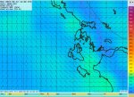
I am keen to try out the openskiron forecast and compare it to my regular Predictwind. Since I will be in the Ionian next week I have been looking at wind near Zante. For this afternoon, Predictwind PWG has 30kn but Predictwind PWC 6Kn. OpenSkiron on zgrib shows 36kn
Is there a way to see what the wind was like over the past 24hours
Second question is what is the most userfriendly Gribviewer. Zygrib is not nice as once the wind is loaded it is difficult to see the land. The interface is one reason I stick to PreictWind
Thanks
TudorSailor
Is there a way to see what the wind was like over the past 24hours
Second question is what is the most userfriendly Gribviewer. Zygrib is not nice as once the wind is loaded it is difficult to see the land. The interface is one reason I stick to PreictWind
Thanks
TudorSailor