simonjk
Well-Known Member
Hi,
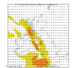
A quick heads-up not to be caught out by the severe gale force gusts transiting east through the Irish Sea and SW Approaches Sunday morning and then moving east through the Channel during the day.
Winds could reach in excess of severe gale force in gusts. More wind gust charts are here https://buff.ly/2BLAef3 Chart below shows starts of the gusts between 7am and 1pm Sunday.
I'm also posting about this to my FB group at https://www.facebook.com/groups/weatherschool/
Stay safe!
Simon

