CaptainBob
Well-Known Member
Perhaps it's not possible with a single route, but I'm trying to autoroute across Ray/Buxey Sand from Crouch to Blackwater and can't seem to force it to do it. Am I missing something or do I need to set up two separate routes (if I wish to use the autoroute function)?
See attached.
Thank you")
See attached.
Thank you
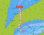
 Image4