Sextant skills

Laminar Flow

Well-known member
Joined
14 Jan 2020
Messages
1,881
Location
West Coast
Visit site
I do have a 'pelorus' made/modified for my 'Ocean' viva from a reclaimed 'Grey Funnel Liner' dumb compass, specifically for the Suns Amplitude stuff. My examiner, a notoriously grumpy ex-Lifeboats cox'n, was so intrigued he pulled out his own 'Blue Peter' model he'd made in perspex years before, and we spent the rest of the examination comparing each others'.....

I s'pose our Lammie F. was thinking about the venerable Station Pointer device, which is admittedly rather tricky to utilise on an iPad screen or a Raymarine Integrated Display.

51504380446_b4e8551234_b.jpg


One can use the 10" Portland Plotter for much the same purpose, but at much lower cost. So much so that I printed the thing onto photocopier transparency, with instructions, and gave a renamed copy to my YM students 'back in the day'.

51503582892_2054bb9390_c.jpg
That is interesting, but I was not referring to plotters. Rather I was suggesting that a sextant can be used in terrestrial navigation for measuring angles between marks or for taking bearings relative to the boats line of travel.
 

lustyd

Well-known member
Joined
27 Jul 2010
Messages
12,508
Visit site
I'll take a punt that you're overlooking something that happens in greenwich at 1pm...
That would depend. Did you actually mean 12:52:18 at Greenwich today? And 12:51:57 tomorrow? Otherwise you're right, I have no idea what's happening in Greenwich at 13:00:00 you'll need to be more specific.
 

Skylark

Well-known member
Joined
4 Jun 2007
Messages
7,414
Location
Home: North West, Boat: The Clyde
Visit site
That is interesting, but I was not referring to plotters. Rather I was suggesting that a sextant can be used in terrestrial navigation for measuring angles between marks or for taking bearings relative to the boats line of travel.
I consider myself as a keen, recreational navigator hence always keen to learn new skills and/or applications.

I’m familiar with using the sextant to take horizontal angles between, say, three identifiable marks. Fairly simply geometry to create two position circles and a fix where the two cross.

Under what circumstances have you used this technique and how does it compare to the perhaps more traditional approach of using a hand bearing compass to sight the three marks and construction a 3-point fix, with or without Station Pointer? What are the pros and cons of each technique and how does their accuracies compare?
 

Laminar Flow

Well-known member
Joined
14 Jan 2020
Messages
1,881
Location
West Coast
Visit site
I consider myself as a keen, recreational navigator hence always keen to learn new skills and/or applications.

I’m familiar with using the sextant to take horizontal angles between, say, three identifiable marks. Fairly simply geometry to create two position circles and a fix where the two cross.

Under what circumstances have you used this technique and how does it compare to the perhaps more traditional approach of using a hand bearing compass to sight the three marks and construction a 3-point fix, with or without Station Pointer? What are the pros and cons of each technique and how does their accuracies compare?
Compared to taking bearings with a compass of course you do not have to bother with either variation or deviation. Also when taking bearings off ship's course it is more likely the case that, if the (fixed) main compass was properly swung, deviation will have been precisely determined. That may not be a given moving about the deck with a handbearing.

You can also do things like presetting a clearance angle between two marks, to assure passage past an off-lying obstruction etc.
 
D

Deleted member 36384

Guest
Compared to taking bearings with a compass of course you do not have to bother with either variation or deviation. Also when taking bearings off ship's course it is more likely the case that, if the (fixed) main compass was properly swung, deviation will have been precisely determined. That may not be a given moving about the deck with a handbearing.

You can also do things like presetting a clearance angle between two marks, to assure passage past an off-lying obstruction etc.

Interesting stuff, especially the clearance bearing part.
 

john_morris_uk

Well-known member
Joined
3 Jul 2002
Messages
27,927
Location
At sea somewhere.
yachtserendipity.wordpress.com
I consider myself as a keen, recreational navigator hence always keen to learn new skills and/or applications.

I’m familiar with using the sextant to take horizontal angles between, say, three identifiable marks. Fairly simply geometry to create two position circles and a fix where the two cross.

Under what circumstances have you used this technique and how does it compare to the perhaps more traditional approach of using a hand bearing compass to sight the three marks and construction a 3-point fix, with or without Station Pointer? What are the pros and cons of each technique and how does their accuracies compare?
When surveys were done of inshore waters from a small boat (using a lead line) the precise position of the boat would usually have been determined by horizontal sextant angles. It's a much more precise fix than bearings that produce a cocked hat which tells you that you are somewhere in the vicinity of the triangle you've drawn...
 

Barnacle Bill

Active member
Joined
27 Aug 2009
Messages
530
Location
County Kilkenny, Ireland
www.aztecsailing.co.uk
Astro navigation is a skill - not a massively hard one - and it's nice to think that one can master a skill that was of fundamental importance to sailors pre GPS (about 1990).

Today ocean sailors' primary position fixing method is, naturally, GPS. But if you are intending to cross an ocean there is a considerable comfort in knowing that you could fix your position to within a few miles with no electronics or electrical power.

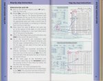
It's unrealistic to expect ocean skippers to use a sextant regularly, so in Reeds Ocean Handbook we made it as simple as possible to do an astro navigation sight by providing a step by step guide, using the concise sight reduction table in The Nautical Almanac (you don't need to carry any additional sight reduction tables - just The Nautical Almanac itself).

Reeds Ocean Handbook

005small.JPG
 
Last edited:

LadyInBed

Well-known member
Joined
2 Sep 2001
Messages
15,224
Location
Me - Zumerzet Boat - Wareham
montymariner.co.uk
As an aid to position fixing for vertical sextant angles on objects, I have used a sextant often in the past. It’s a very quick and accurate way of position fixing when an object’s height is known and the distance off is marked on a single position line. In my case a low cost plastic sextant was adequate.
Before GPS, I once put our dive club boat over a wreck taking horizontal sextant angles with my plastic sextant, I was quite pleased with myself! ?
 

lustyd

Well-known member
Joined
27 Jul 2010
Messages
12,508
Visit site
Another overcomplicated approach as far as I'm concerned. I realise it works for some, but personally I think it makes more sense to explain the how before diving into what LHA is. By the time all of the terms have been explained I lose interest and have forgotten most of them because they had zero context while being explained. The video I linked is great because it explains the context first so by the time you need the terms later on it's obvious what they are and why they're useful.
 

Blueboatman

Well-known member
Joined
10 Jul 2005
Messages
13,880
Visit site
My venerable Rustler36, which I have now sold, I used to pride myself that I could sail it with the batteries turned off . No biggie of course , wind vane steering , nice big chart table , binoculars , Walker log , etc nice?

But I sold it to a Frenchman ( amateur status, Marc Cambounet and jolly good luck to him, A Donf and all that ) who is an entrant in next years GGR , where he will be using sextant a lot I think - the Corinthian self reliance and indeed , doing Astro is surely something interesting on passage rather than watching endless box sets passively on a iPhone and watching the distance to run numbers count down?? …
my two bobs worth
 

zoidberg

Well-known member
Joined
12 Nov 2016
Messages
6,355
Visit site
....an entrant in next years GGR , where he will be using sextant a lot I think - the Corinthian self reliance and indeed , doing Astro is surely something interesting on passage

Like many others, I followed the progress and tribulations of the entrants in the last GGR with considerable interest, having met a handful of them. I learned quite a lot - and they most certainly did - but one skill I admired above all was how some of them managed to navigate a dead-straight easterly course day after day just a couple of miles north/clear of the southern Ice Limit line, without electronics and using only astro - when the skies had been totally obscured by thick cloud for days and days, with no sights possible.

That suggests a competence in DR, or something, considerably beyond even the 'master navigators' who taught air navigation at the RAF's Nav School, and would likely have puzzled even the legendary Sir Francis Chichester.
 

capnsensible

Well-known member
Joined
15 Mar 2007
Messages
46,664
Location
Atlantic
Visit site
If you have a copy of the Nautical Almanac, the exact time of the meridian passage can be found at the bottom right hand side of the daily page.
It varies over the year by a few minutes from exactly 1200.
If you put in your head that, for our purposes, the earth stands still and the sun moves, the 360 degrees of the earth divided by 24 hours of sun means that relatively, the sun moves 15 degrees of longtitude every hour, a degree every four minutes. Back to this shortly.
At sea, one can fairly estimate ones position and be prepared for a noon sight for latitude. This just means measuring he angle between the bottom of the sun and the horizon starting a bit before when you estimate it's gonna stop rising and start setting. An easy couple of adds and take always will give you latitude.
Coz you also noted the exact time, another easy add, from sun movement as above gives you longtitude.
Hey presto, you got a position. Close enough mid ocean.

Gimme ten minutes more with a real sextant and a student, they got basic Astro nailed. It really is that easy......well apart from a bumpy boat. And cloud. And vomit for about two peeps in five. ?
 

capnsensible

Well-known member
Joined
15 Mar 2007
Messages
46,664
Location
Atlantic
Visit site
Given that that's time based I would hazard a guess that they derive their time from GPS or at least an atomic clock. Weird I never knew about that though, I worked at the museum for a while and wandered the grounds every lunchtime :D
I knew about the nuclear reactor under the college at Greenwich, but I didn't know they had an atomic clock in 1833. Wowser.
 

Minerva

Well-known member
Joined
16 Oct 2019
Messages
1,363
Visit site
I loosely follow "The Rigging Dr" on YouTube. On their recent Atlantic crossing they taped over the GPS display and the chap done all the navigation by Sextant / dead reckoning with his wife keeping a track on gps with our sharing notes.

Quite a good series I'd recomend. One of his videos is a 12min explanation on how to use a sextant in anger - I found it quite useful and easily understood.


Top