MapisM
Well-Known Member
That's a pity, but you know you'll be always welcome, anytime in the future! :encouragement:we won't be crossing the equator again this year unfortunately.
That's a pity, but you know you'll be always welcome, anytime in the future! :encouragement:we won't be crossing the equator again this year unfortunately.
That's a pity, but you know you'll be always welcome, anytime in the future! :encouragement:
Three weeks sounds good. It's a decent timeframe for circumnavigating the whole island, depending also on weather, as always.Thank you so much for this. Cracking read MapisM! Definitely up for the second instalment when time allows, of course.
We will be heading over for at least three weeks and there may be plans afoot to return again at the end of the season so all notes and tips much appreciated :encouragement:
") , and in the first minute it shows exactly the same spot - together with others afterwards.
, and in the first minute it shows exactly the same spot - together with others afterwards.


Can easily be the best info source of all times for boating at Sardinia. Thanks for the effort!
I'm not sure if it's correct that someone who ain't the OP of a thread posts a link in the Cruise Report section, but since Ms Teak is new to the asylum, I thought to comply with your request...I concur, that's why a link should be put in the Cruise Reports thread so it's not lost. :encouragement:
I'm not sure if it's correct that someone who ain't the OP of a thread posts a link in the Cruise Report section
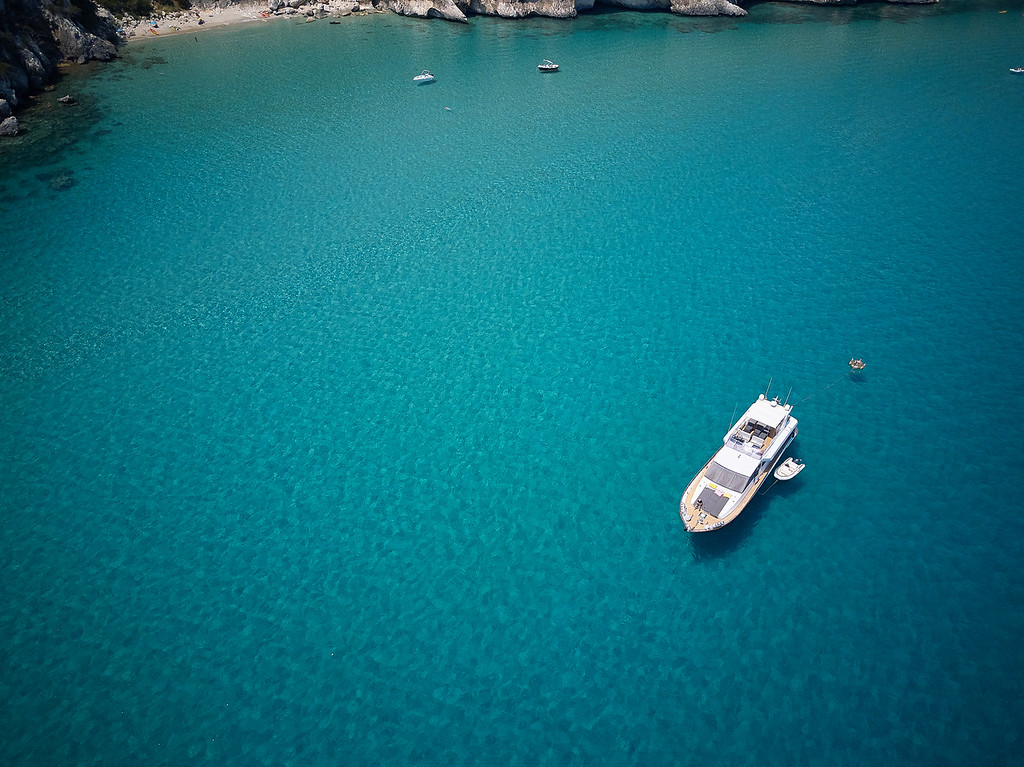

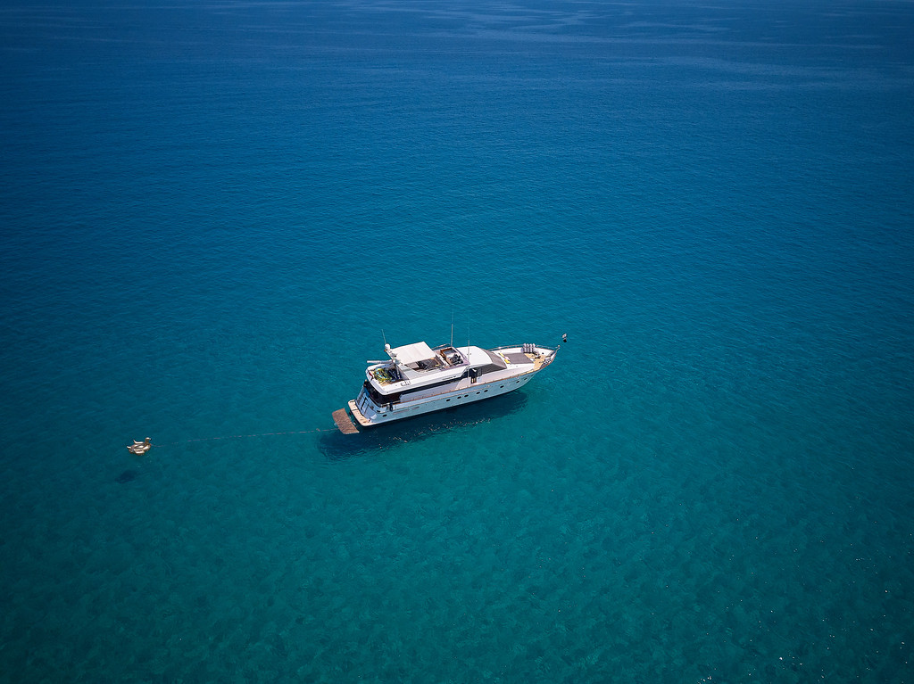
But we made a few nice pics while anchored close to cala di luna.

Well almost all anchorages have azur blue water, when you anker close to the beach, yesterday the carabiniery told us that we were too close to the beach ;-)
After having spend 2 weeks around costa smeralda and south corse,
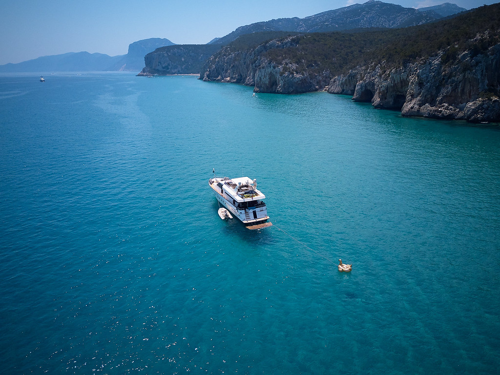
And another week sailing south along the east coast of Sardegna, we can can confirm that it is stunning discovery !
While Mapism repeatedly mentioned the clear water around here, I have to repeat this again,
The clear water in combi with the white sandy bottom, here I’ve never seen, and is so inviting for a swim....
The costa s’meralda is ticked on my bucketlist, but don”t fancy going there again, its nice, but its all articicial, there is little to no heritage over there, just everything is buld for the rich and famous.
From the “posh” marinas, Porto Cervo, P Rotondo and Poltu Quatu , the latter we liked the most.
But we prefer the old town marina’s such as Maddelena, Cannigione,
but ofcause Bonifacio remains the juwel in that region.
We used Mapism guide above for discovering the east coast, and visited a few nice marina’s,
And indeed the south part of the orosei gulf, is in my top list of nicest sailing regions ever.
Thanks P
We were unable to park Blue Angel in this spot: Spiaggia di su Achileddu, because she was occupied, and also it was very cloudy at that moment,
But we made a few nice pics while anchored close to cala di luna.
Atm we are around capa carbonara and marina vilassimus, (the most southerly point of sardegna)
Tomorrow dropping guests in Cagliari,
And hopefully later this week reach our final destination Mapism ‘s holiday hometown Carleforte !
My pleasure, B. Can't wait to catch up soon!We used Mapism guide above for discovering the east coast, and visited a few nice marina’s,
And indeed the south part of the orosei gulf, is in my top list of nicest sailing regions ever.
Thanks P
Those are lovely crisp photos - what is the drone?
We were stopped once off Arbatax by the carabinieri but they were only interested in arresting Mapism + S