Navionics SonarChart - no depths in drying areas

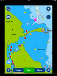
I should have said I'm using an iPad rather than a plotter. Maybe that's the reason but I can't see any logic for not showing the heights/depths if the data actually exists. It's exactly the sort of info I want from a chart.

The data is missing from both standard and sonar charts.
 
Weird. Maybe delete and reinstall the app? Here’s the standard chart on my iPhone via the app and it shows drying heights.

View attachment 66789

That's because you haven't pressed the wavy blue symbol at the bottom left of your app and selected 'Sonar Chart'. When you do you'll see the other version with the crowd-sourced bathymetry - and blanked-out drying heights!
 
This is what I see on standard setting for Bembridge. Could be a bit more useful!
 

Attachments

  • IMG_0066.PNG
    IMG_0066.PNG
    253.2 KB · Views: 2
Aye. And sail right over that drying spit to get out of the Bembridge channel West of St Helen's Fort. (See? - that's why it is unhelpful of them to blank out drying heights!)

You really don’t need to zoom in that far. Still visible from several cables away at this level.

A9E2ECCA-5E73-41A8-8191-C90D356F50A5.jpg
 
You really don’t need to zoom in that far. Still visible from several cables away at this level.

View attachment 66794

I'm sorry, I might not have been clear.

Take your pic of Navionics' regular charts: you can see that (and at what states of tide) you can sail over that drying spit, which is the channel out of Bembridge.

Now switch to their SonarCharts view (with the squiggly blue icon in the bottom-left corner). Lots of lovely up-to-date contours - but no clue as to the drying height of that bar, so no idea when you can pass over it.

IMG_0090.PNG
 
I'm sorry, I might not have been clear.

Take your pic of Navionics' regular charts: you can see that (and at what states of tide) you can sail over that drying spit, which is the channel out of Bembridge.

Now switch to their SonarCharts view (with the squiggly blue icon in the bottom-left corner). Lots of lovely up-to-date contours - but no clue as to the drying height of that bar, so no idea when you can pass over it.

View attachment 66795

Guys, just to pick up one obvious point......

The Navionics chart is showing that the water is deeper to the South of St Helen's Fort, rather than the conventional (and buoyed !) entrance which is from the North of the fort and over the bar. The existence of an entrance South of the fort is cobblers. There isn't one. If there was, I'm pretty sure that Bembridge Harbour would have relaid the channel markers. They aren't stupid.

If I remember correctly, this exact example came up on here a few months ago when someone asked about going into Bembridge from south of the fort.

(The Admiralty chart for Bembridge approaches has no such "below datum" approach south of the fort).
 
Last edited:
You realise that Sonarchart is a separate chart from standard Navionics, right? Their main chart uses the same surveys that anyone else uses. The Raymarine Lighthouse II plotters default to not using Sonarchart.

Yes, I do. It was more their denial that a problem could have existed that has turned me against them than the fact that some crowd sourced data on Sonarcharts may be rubbish. If they said "This info is from Jo public. Most of it should be good, some of it may be rubbish. Use with caution" then I would think "fair enough". But the instance I cited at SIBS was when I confronted them about the accuracy of data on Sonarcharts and the person I spoke to categorically denied that any of the data could be dodgy. That was evidently incorrect of him.
 
Now switch to their SonarCharts view (with the squiggly blue icon in the bottom-left corner). Lots of lovely up-to-date contours - but no clue as to the drying height of that bar, so no idea when you can pass over it.

Yes, we established that Sonarchart doesn’t do drying heights many, many posts ago and had moved on to trying to diagnose the problem NDG was having with the Navionics app on their iPad, where they couldn’t see drying heights on the non Sonarchart.

We know Sonarchart doesn’t have drying heights. It’s ok to stop telling us.
 
And I always thought it was mud ;)

Indeed it is. :D

Very soft mud, in fact. I was in Bembridge last month (for their Oktoberfest). I stepped off the boat at low water (springs). The normal motion of the boat when someone "dismounts" was distinctly deadened, by virtue of the tip of the keel sitting on mud. The assertion of the harbour guys that the whole of the outside of the pontoon is 2.5m below datum (or was that 2.5m below MLWS?) is not entirely true, given I draw 2.1m.
 
Yes, we established that Sonarchart doesn’t do drying heights many, many posts ago and had moved on to trying to diagnose the problem NDG was having with the Navionics app on their iPad, where they couldn’t see drying heights on the non Sonarchart.

We know Sonarchart doesn’t have drying heights. It’s ok to stop telling us.

OK, OK! I'm sorry - that's not how I read your post; I'm sorry to have misunderstood you.

It's such a long way to see from here to the front of the class.

Did you know that SonarChart doesn't show drying heights?
 
Top