salar
Well-Known Member
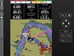
I have a Garmin GPSMap4008 that I am very happy with. However I would like the option of displaying sonar, charts and/or radar on a second screen. Is there an alternative approach to using a second Garmin unit (GPSMap4008 now no longer manufactured anyway)? I am using NMEA2000 as well as Garmin Network. Thanks for any advice.
")