Crossing the Thames Estuary

Chris_d

Well-known member
Joined
15 Jun 2001
Messages
4,677
Location
Oxfordshire
Visit site
See, I knew I would get sound advice. Working on the assumption that baked beans are cheaper than diesel that should do the trick nicely 😁
A wrong assumption I fear, a 415g can of Heinz premium beans is £1.40 and the actual wind content is not clear, 415g of red diesel would be about 70p.

A more reliable source of wind would be to keep asking random questions on this forum.
 

Sea Hustler

New member
Joined
18 Jan 2023
Messages
28
Visit site
A wrong assumption I fear, a 415g can of Heinz premium beans is £1.40 and the actual wind content is not clear, 415g of red diesel would be about 70p.

A more reliable source of wind would be to keep asking random questions on this forum.
Point 1. Shoot, I didn't realise this sailing lark was quite so complicated, My boat is 54 years old with a BMC Captain 1500 engine of similar vintage, I have heard that it can run on Dolphin shite and seaweed.
Point 2. Does that mean I could get away with Lidl Baked Beans as they retail at about 30p a tin or do you recommend I stick to the more premium barns for a cleaner burn..
 

Sea Hustler

New member
Joined
18 Jan 2023
Messages
28
Visit site
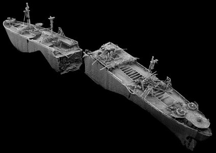
View attachment 173974
Try not to run into this .................at least not not before lunchtime anyway.
I noticed that lying about when I sailed passed that way back in 1944. nearly hit the damn thing, pretty careless of someone to leave an unmarked wreck there for so long, Was considering throwing a line around one of the masts and towing it out into deeper water just to make it safe.
 
Last edited:

prestomg27

Active member
Joined
24 May 2023
Messages
126
Visit site
My boat Presto is also based in Essex Marina and I have sailed to Ramsgate quite a lot from the Crouch., including a couple of times last year.

The easiest route is probably the SW Sunk, through fisherman's gat dropping straight down past North Foreland. It logs about 37 NM from the Inner Crouch to just of the marked channel to Ramsgate, so probably 40nm.
I used roger's book, crossing the Thames estaury to help with the passage planing and that manages to get tide assistance pretty much all the way other than the drop down to the SW Sunk. I haven't got my books with me so working from memory here I think the best time to leave essex marina is an hour or so past HW and aim to get to the SW Sunk around lowish water so you get the SW flood pulling you down.

Going through Havengore is a viable option but you can't go straight across or you will be walking. You could drop down to the kent side and then hug the kent coast through the gore channel. However, the bridge only operates in daylight hours and when the range is not being used, which generally means weekends. The tides don't work as well either.

A couple of observations for you, that I think are helpful:

1) Do not rely on charts for the SW Sunk. It has moved North East to the extent that there is a thread on here describing the grounding of a couple of yachts following what they thought was the correct route based on old data. Download Roger's survey updates from his 'crossing the thames estuary website'. If you do that you should probably do the decent thing and buy the book. I understand that Navionics has been updated with the latest survey (2022?)
2) I'm guessing from your description that yours is a colvic watson or Fisher type motor sailer with the 2 foot 6 draft. It is not a huge advantage on the east coast. You are either generally in a channel or walking. I would also think 5 knots is optimistic unless you motor the whole trip. They don't really sail to windward and are pretty slow with the wind. I would passage plan at 4 knots.
3) Don't go in a blow. It can get a really nasty sharp chop out there as the water goes from deepish to shallow in a few feet and the tidal streams go in different directions through the swatchways. Bear in mind the SW Sunk is not buoyed and you have to go through a chanel, out of sight of land, that is maybe 200Mish wide with a steep vertical side on the West side to crash into if you get it wrong. Alll at low water. Benign conditions a must.


Hope this helps. All that said, it is a really easy voyage to do with a bit of prep and a light westerly.
 

PeterWright

Well-known member
Joined
23 Aug 2006
Messages
1,096
Location
Burnham-on-Crouch, UK
Visit site
Hi,

Great that you have chosen Daydream's advice and leave the Crouch by the conventional route. I've not done the sums, but it seems to me that the Haven gore bridge is disfunction Al for about 30% of the days in a year, rather like all other equipment procured under a MoD contract.

Sticking to the main channels can be interpreted two ways, the first is to stick to shipping channels, which I would say is unnecessary, and the second is to use the shallower channels and swatch ways, I all of which are well surveyed and documented by Roger Gaspar, eminent author of the much recommended book. I do have a copy but must admit to rarely using it, but I do use both his associated website and his excellent weekly summary of E Coast notices to mariners published on the E Coast Forum of ybw. Com.

Using those to check current conditions, I would head from Essex marina, which is across the river from my house, down the river and on reaching the sea make straight for the Barrow no. 2 swatch way (chartlet on Roger's website) then make up the Black Deep for Foulger's gat to cross Long Sand through the London Array wind farm. This gat is buoyed, one at each end and one near the S end where you are expected to make a totally unnecessary dog's leg, I tend to head straight on to clear water, ignoring the last buoy. Once clear of the windmills, you can set course for N. Foreland from where Ramsgate is close, if you got your tides right.
As to tides, much of this passage is cross tide, but the first bit down the Crouch to the Barrow no. 2 swatchway needs the ebb, while the last bit from N. Foreland to Ramsgit needs the flood. The leg up Black Deep benefits from a flood tide, but to satisfy that and an ebb tide down to the Barrow no. 2 swatch way means crossing this swatch at low water. Drawing 6 foot, I prefer to arrive at the swatch way after the first hour of the flood has gone. Drawing 2'6",you needn't worry about this, if you cross at the right point, using Barrow no. 2 PHB to check your position and any tidal set.

Peter.
 
Last edited:

DoubleEnder

Well-known member
Joined
27 Apr 2002
Messages
1,329
Location
N Hemisphere
Visit site
Hi,

Great that you have chosen Daydream's advice and leave the Crouch by the conventional route. I've not done the sums, but it seems to me that the Haven gore bridge is disfunction Al for about 30% of the days in a year, rather like all other equipment procured under a MoD contract.

Sticking to the main channels can be interpreted two ways, the first is to stick to shipping channels, which I would say is unnecessary, and the second is to use the shallower channels and swatch ways, I all of which are well surveyed and documented by Roger Gaspar, eminent author of the much recommended book. I do have a copy but must admit to rarely using it, but I do use both his associated website and his excellent weekly summary of E Coast notices to mariners published on the E Coast Forum of ybw. Com.

Using those to check current conditions, I would head from Essex marina, which is across the river from my house, down the river and on reaching the sea make straight for the Barrow no. 2 swatch way (chartlet on Roger's website) then make up the Black Deep for Foulger's gat to cross Long Sand through the London Array wind farm. This gat is buoyed, one at each end and one near the S end where you are expected to make a totally unnecessary dog's leg, I tend to head straight on to clear water, ignoring the last buoy. Once clear of the windmills, you can set course for N. Foreland from where Ramsgate is close, if you got your tides right.
As to tides, much of this passage is cross tide, but the first bit down the Crouch to the Barrow no. 2 swatchway needs the ebb, while the last bit from N. Foreland to Ramsgit needs the flood. The leg up Black Deep benefits from a flood tide, but to satisfy that and an ebb tide down to the Barrow no. 2 swatch way means crossing this swatch at low water. Drawing 6 foot, I prefer to arrive at the swatch way after the first hour of the flood has gone. Drawing 2'6",you needn't worry about this, if you cross at the right point, using Barrow no. 2 PHB to check your position and any tidal set.

Peter.
Thats all excellent advice and a very do able plan. The only thing I'd add is that the little stretch between N Foreland and Ramsgate can, for some reason, be surprisingly bouncy when wind is against tide. I don't think it is anything particularly to worry about, just be aware. I came round once heading north, and got a bit chucked about. At one point the tiller went totally light and I thought "aargh the rudder has dropped off". In fact the boat was picked up on a wave and the whole back end was in the air....
 
Top