simonjk
Well-Known Member
Hi all,
Do you want me to start posting the Sailing weekend Weather Forecasts again, as per below?
I do send them by email as well. They are free, you need to send a blank email to sailingweather-subscribe@weatherweb.net to receive them each Friday.
Simon
WEEKEND WEATHER FORECAST
==========================
Issued: 1500hrs, Friday 31st March 2023
SATURDAY
=========
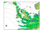
Low pressure remains east of the UK on Saturday. An occluded front affecting eastern coasts with a slow moving occluded front lying through Ireland, Wales and southern England, slowly weakening during the day.
Plenty of cloud for many during the day with rain on and off through Ireland, Wales, southwest and southern England as well as parts of the Midlands. Low cloud shrouding hills.
Eastern England and eastern Scotland stay cloudy and damp with some showery bursts of rain, these may become more persistent in the afternoon.
Many western areas of England and Scotland should fair better with the cloud being more broken, although some showers can't be ruled out.
Winds will be N-NE 18-25kt (F5-F6) in the east, N-NW 15-20kt (F4-F5) in the west and E-NE 12-15kt (F4) in eastern Scotland.

SUNDAY
=======
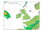
Pressure tending to build through Sunday. There will still be plenty of cloud, especially in western areas of the country at first, a few spots of rain or drizzle on hills. Eastern areas should be brighter and dry although always a chance of some cloud over eastern coasts.
The afternoon sees the cloud breaking further, although staying fairl cloudy in northwest Scotland where there could be some drizzle.
Winds variable mainly N-NE 8-12kt (F3-F4) but NE 20kt (F5) in southeast England.

**ends**
Do you want me to start posting the Sailing weekend Weather Forecasts again, as per below?
I do send them by email as well. They are free, you need to send a blank email to sailingweather-subscribe@weatherweb.net to receive them each Friday.
Simon
WEEKEND WEATHER FORECAST
==========================
Issued: 1500hrs, Friday 31st March 2023
SATURDAY
=========
Low pressure remains east of the UK on Saturday. An occluded front affecting eastern coasts with a slow moving occluded front lying through Ireland, Wales and southern England, slowly weakening during the day.
Plenty of cloud for many during the day with rain on and off through Ireland, Wales, southwest and southern England as well as parts of the Midlands. Low cloud shrouding hills.
Eastern England and eastern Scotland stay cloudy and damp with some showery bursts of rain, these may become more persistent in the afternoon.
Many western areas of England and Scotland should fair better with the cloud being more broken, although some showers can't be ruled out.
Winds will be N-NE 18-25kt (F5-F6) in the east, N-NW 15-20kt (F4-F5) in the west and E-NE 12-15kt (F4) in eastern Scotland.

SUNDAY
=======
Pressure tending to build through Sunday. There will still be plenty of cloud, especially in western areas of the country at first, a few spots of rain or drizzle on hills. Eastern areas should be brighter and dry although always a chance of some cloud over eastern coasts.
The afternoon sees the cloud breaking further, although staying fairl cloudy in northwest Scotland where there could be some drizzle.
Winds variable mainly N-NE 8-12kt (F3-F4) but NE 20kt (F5) in southeast England.

**ends**
